I’m going to leave photos and logs for the various things I go to this summer that don’t necessarily deserve their own topic.
Mt. Washington Hike, 5/14/2016
This is the first time ever that I went on a hike with people where I was the only one in the party who had ever done it. Laura went on it with me back in March of 2010 but there was too much snow.
Here is my GPS track:
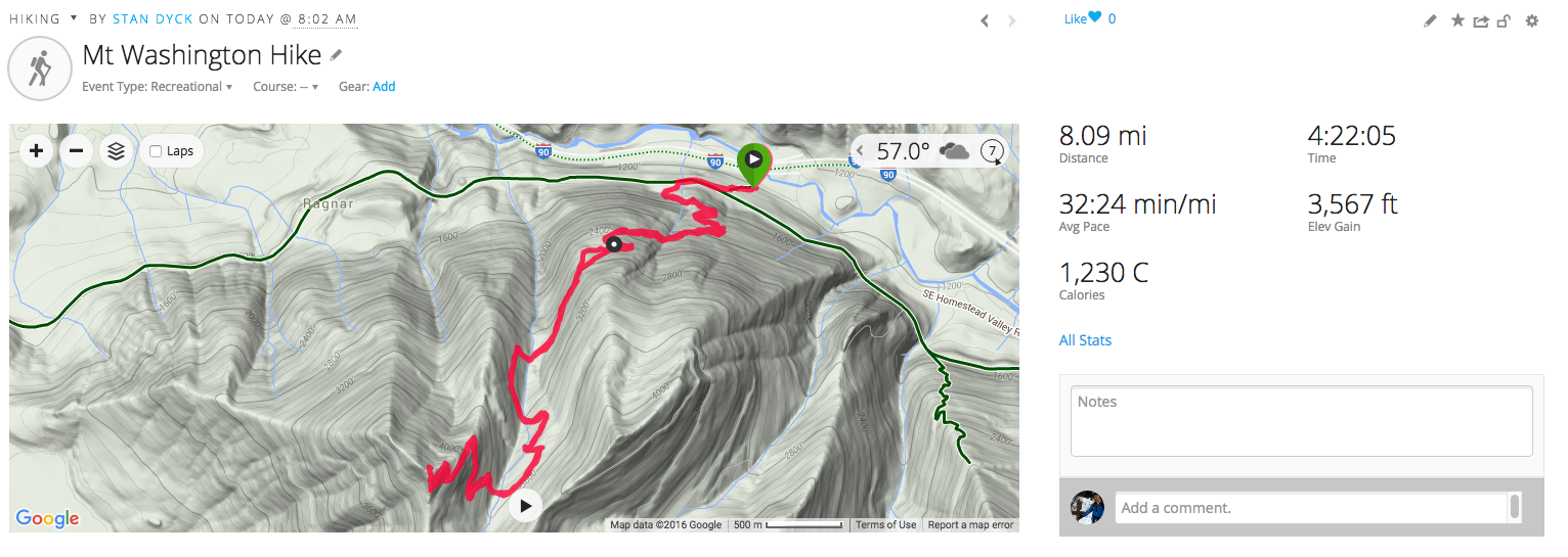
I call this hike the “anti-Si”. It has about the same dimensions (length, elevation) and it’s in the same general location but it’s on the other side of I-90. It’s a little hard to find the trailhead and there is usually more snow since it is a north facing slope. Perhaps this is why the number of people on it is something like a 10th of what you’d see going up Mt. Si on any given day.
It starts steep and in the trees but at about 1.6 miles up is a clearing known as “Owl Hike Spot” (click any photo to make it bigger)
It’s got a nice rock bench to hang out on. This shot almost looks like it was taken inside but it’s natural light. It’s just an enclosed area.
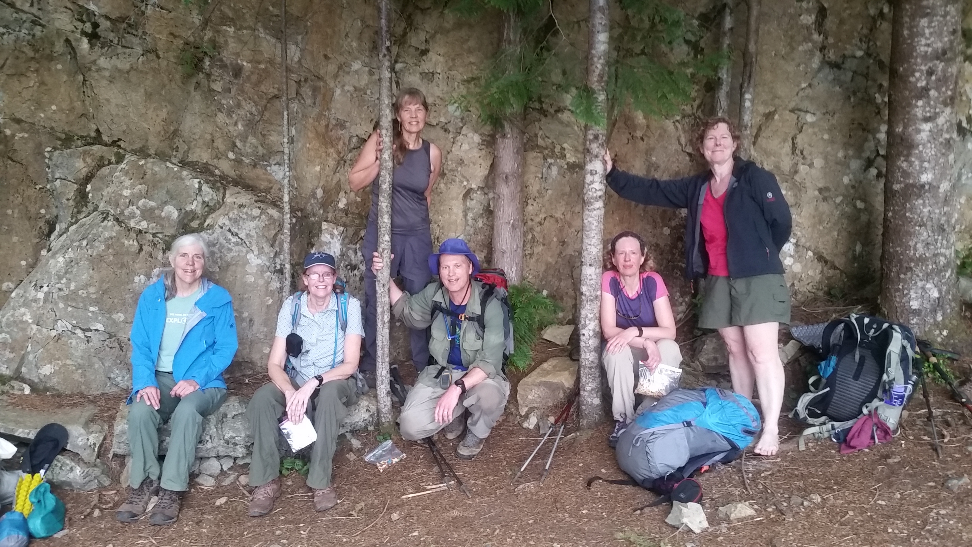
The photographer had a dog and I think that is what I was looking at instead of looking at the camera.
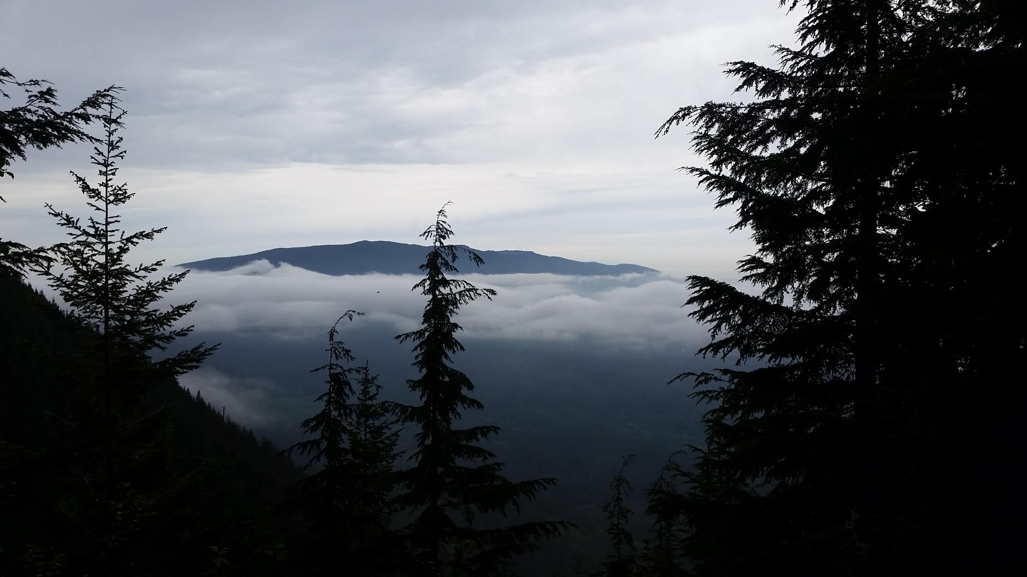
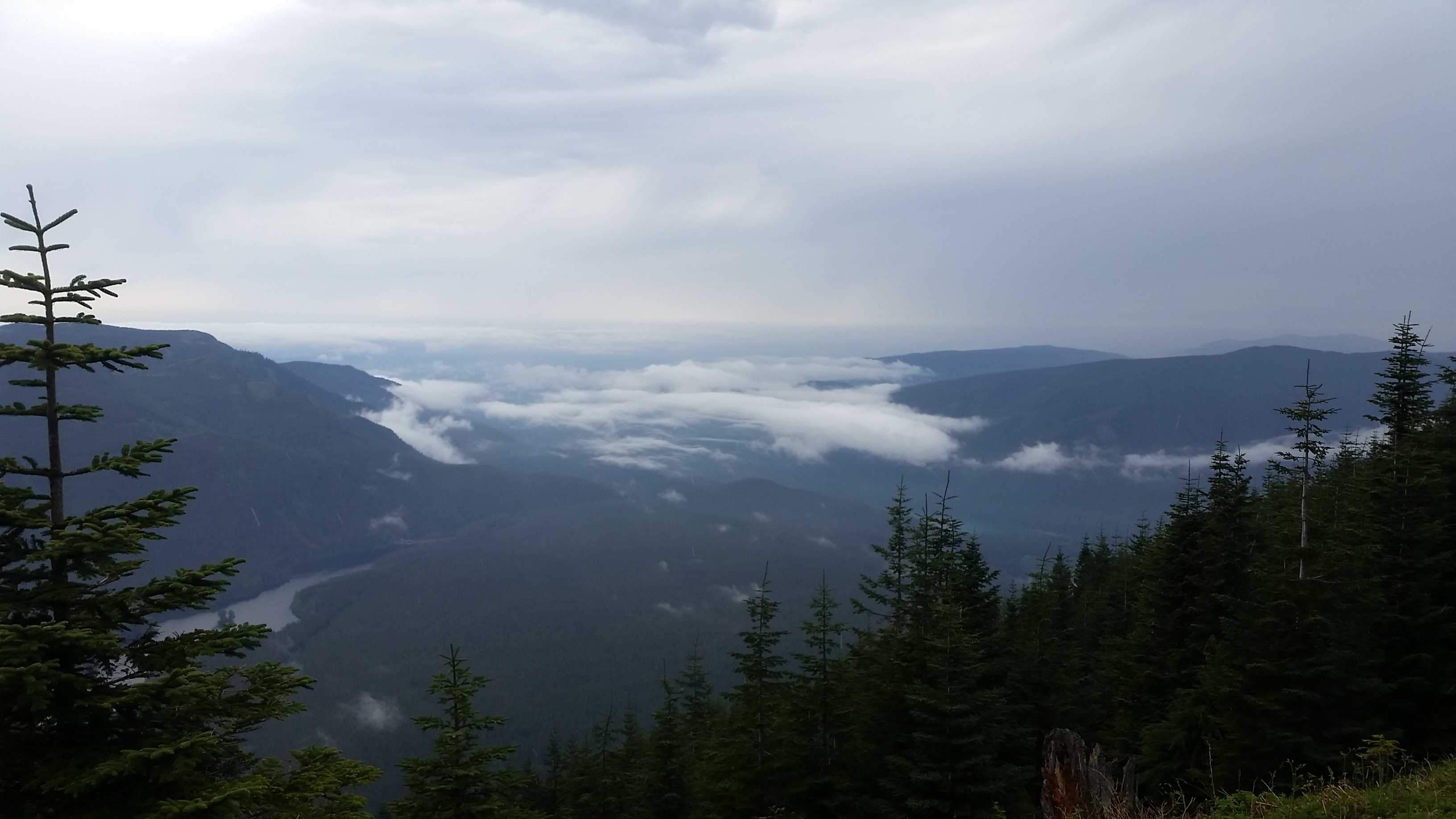
The weather was cloudy and it dripped on us the whole day but it wasn’t too bad and it made for dramatic skies
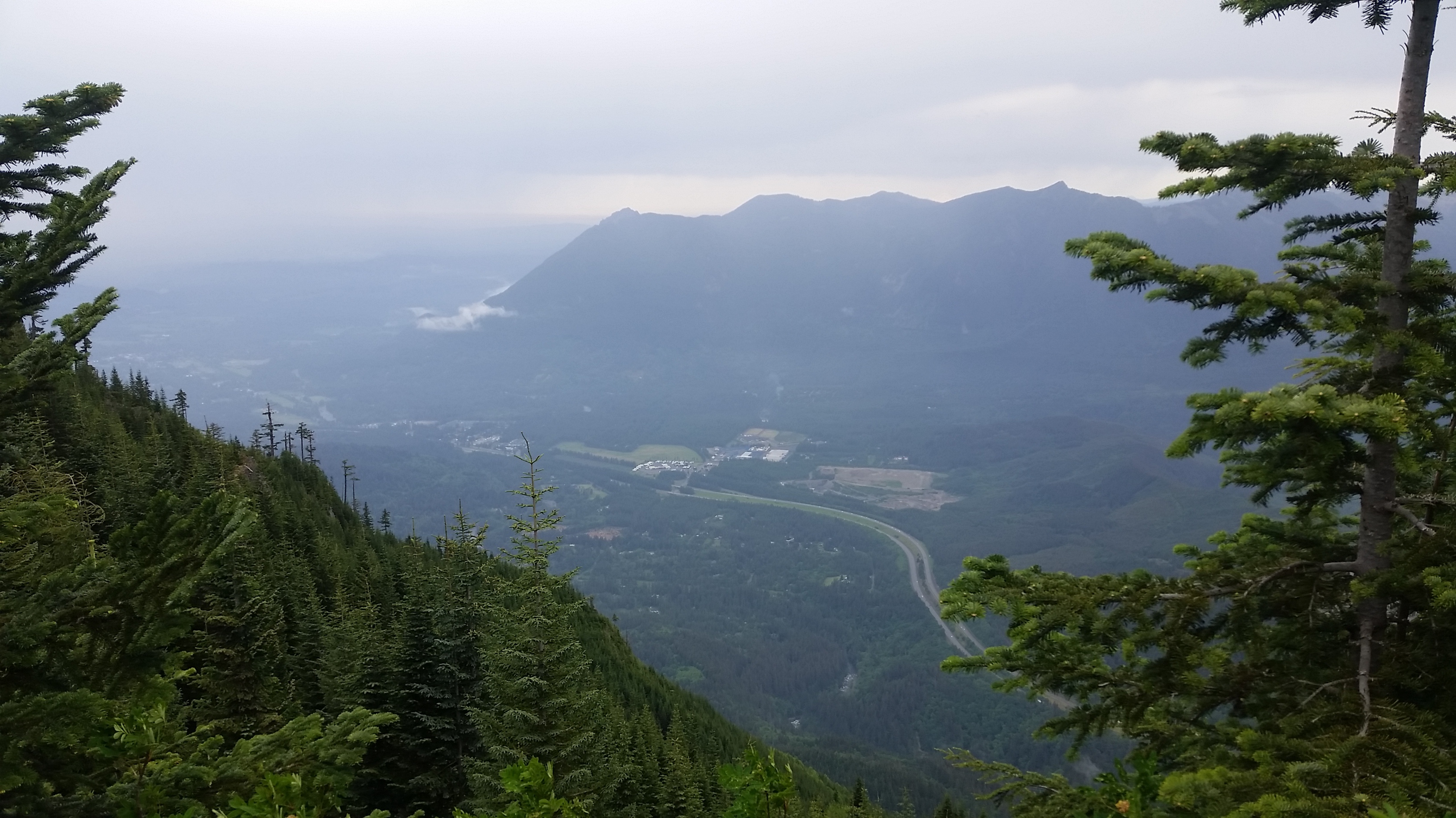
Here’s our group coming up over the ridge on the final push to the summit.

Behind us there is Chester Morse Lake, the reservoir the supplies much of Seattle’s water. You can see the dam in this shot on the far right.

To the north you can see Interstate 90 and beyond it Mt Si.
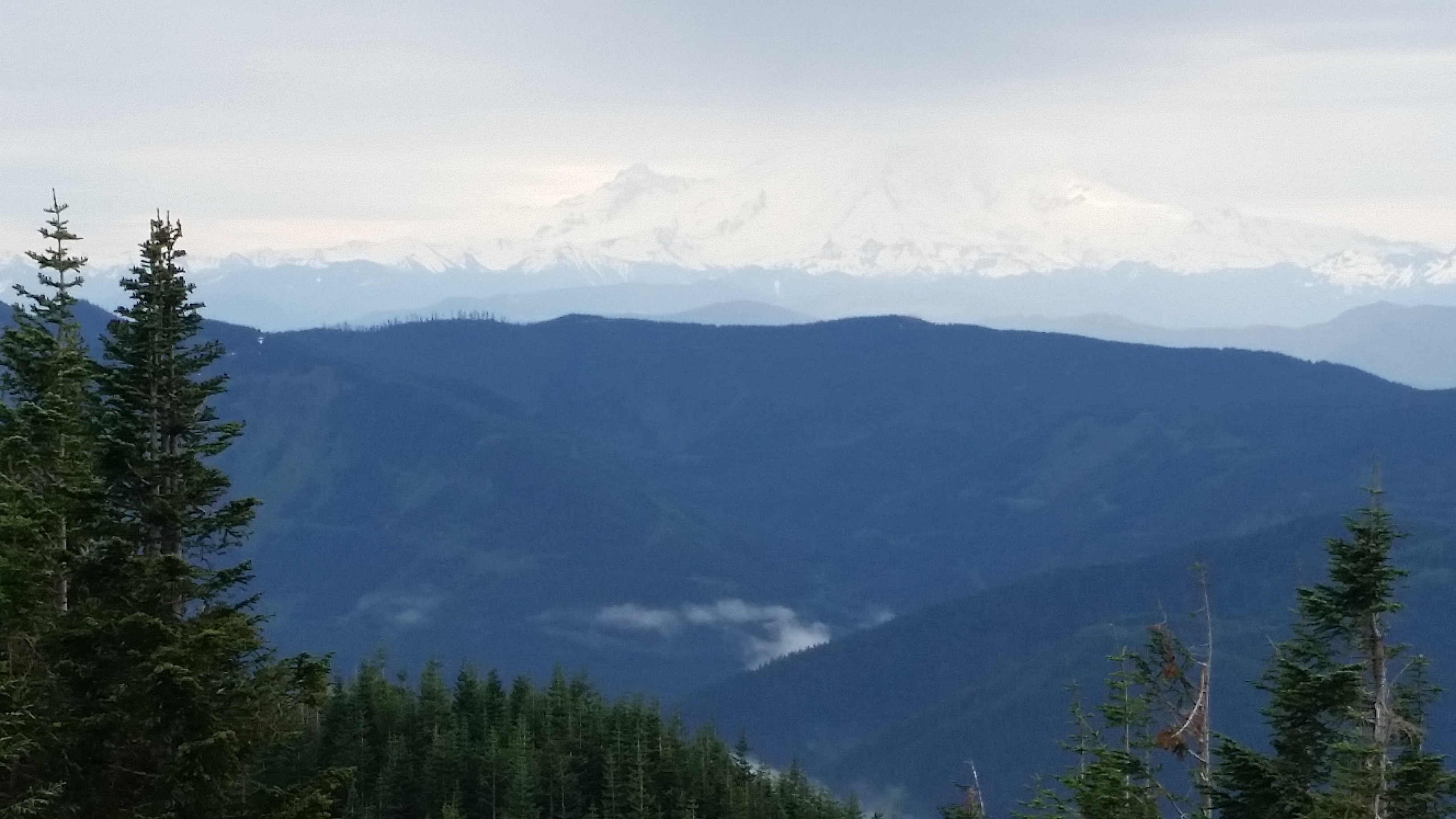
To the south we even got a peek at Mt. Rainier
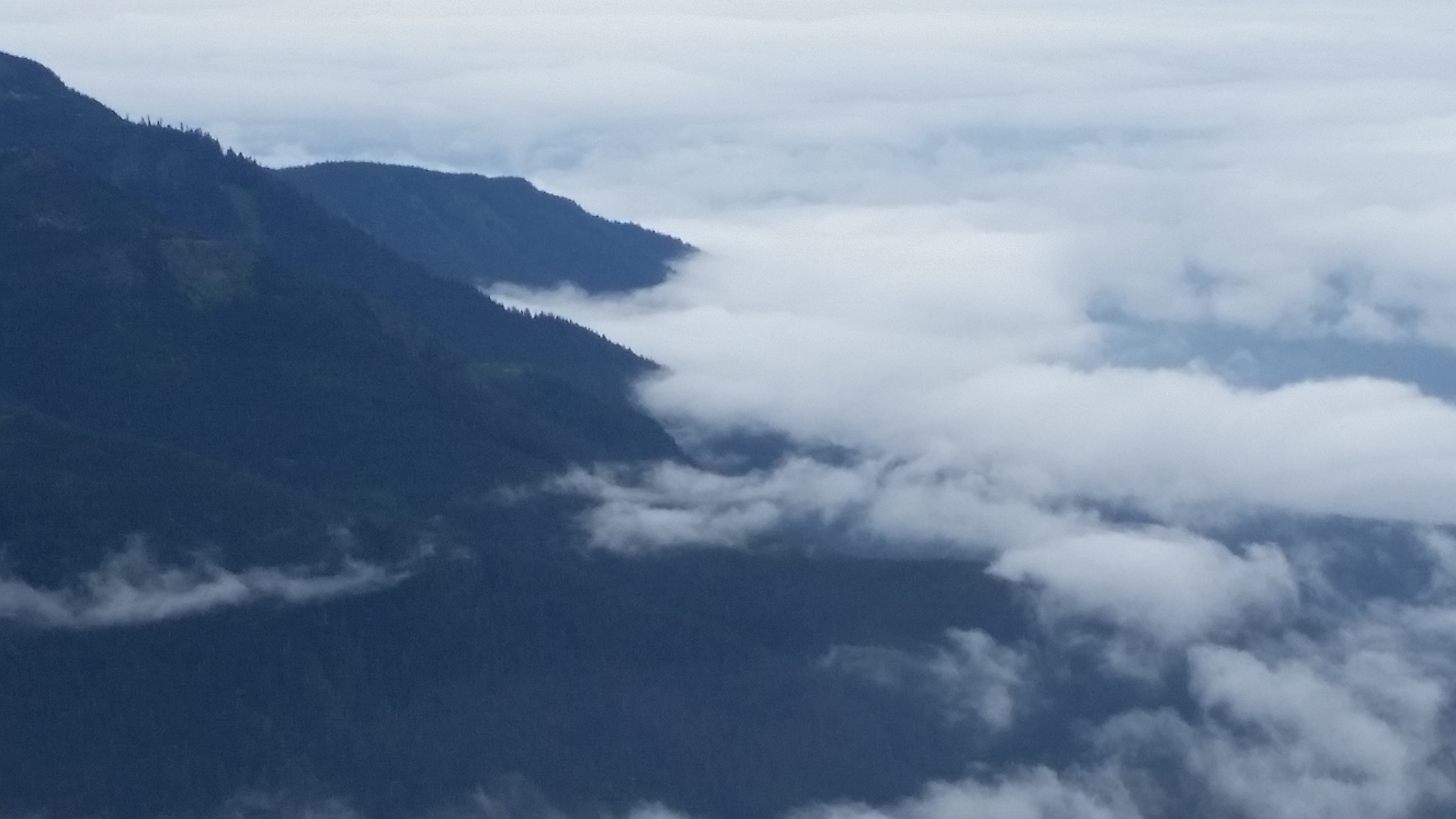
How about a dramatic cloud shot?
I was told that this is “Hike like a Girl” day. I don’t know if I was hiking like a girl but I was available with a camera to commemorate the occasion.

The rain picked up as we got to the bottom and the clouds dropped down. By the time we were back at the car it was pretty gloomy. I think we picked the right time to go.
John Wayne Trail/Iron Horse State Park
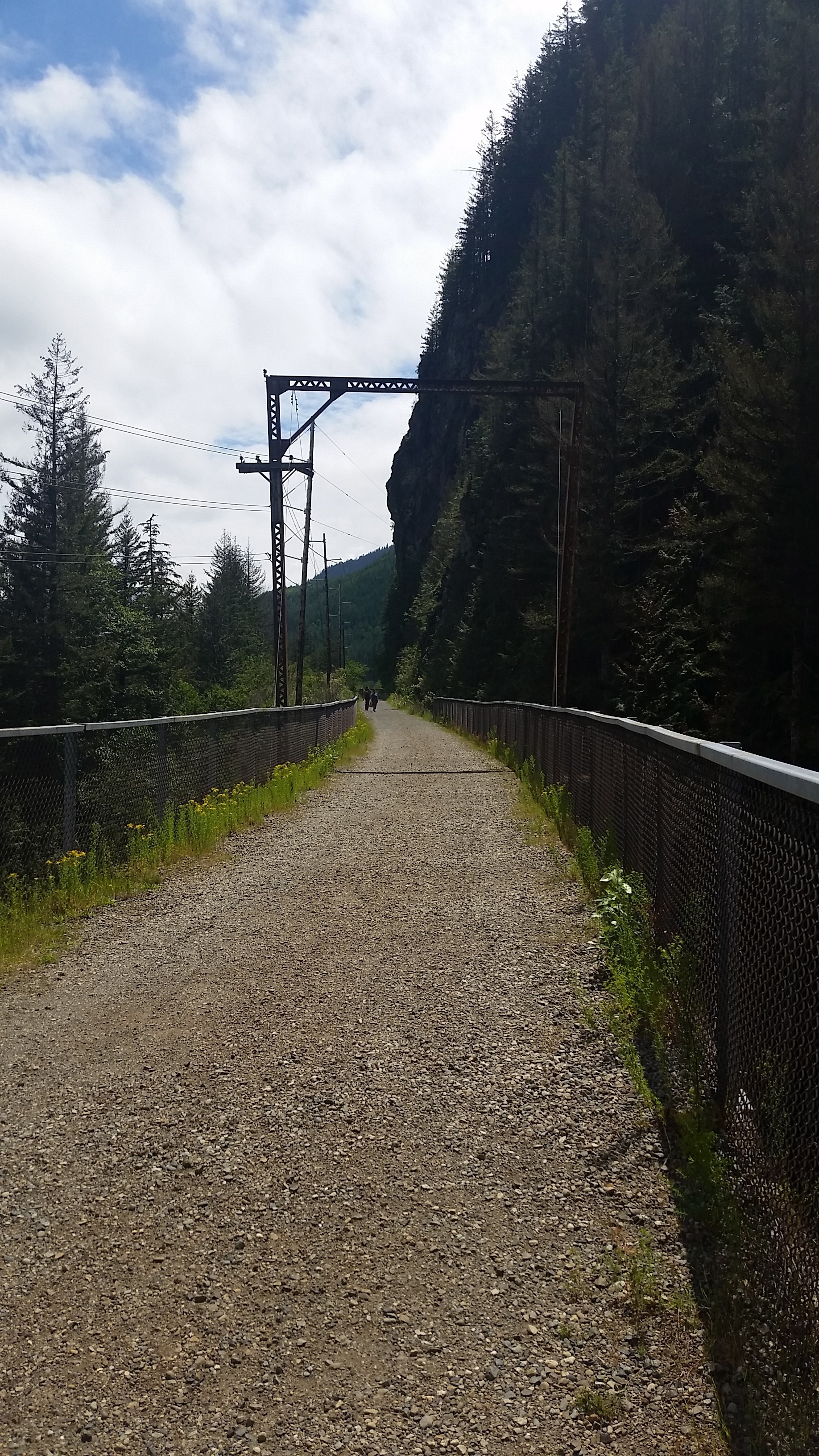
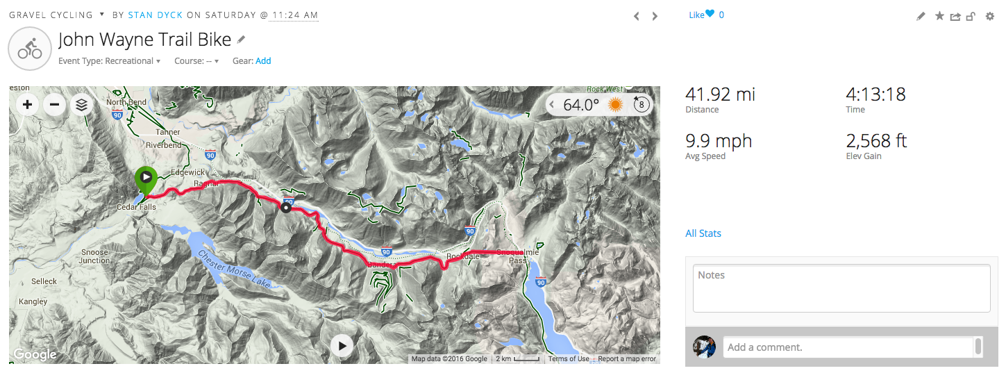
I took a little bike ride this weekend to the Iron Horse State Park. There is a bike trail there called the John Wayne trail. As you might guess from the name, it is a converted rail line. It parallels Interstate 90 across a good portion of the state. I did a 20 mile section from Rattlesnake Lake up to Snoqualmie pass.
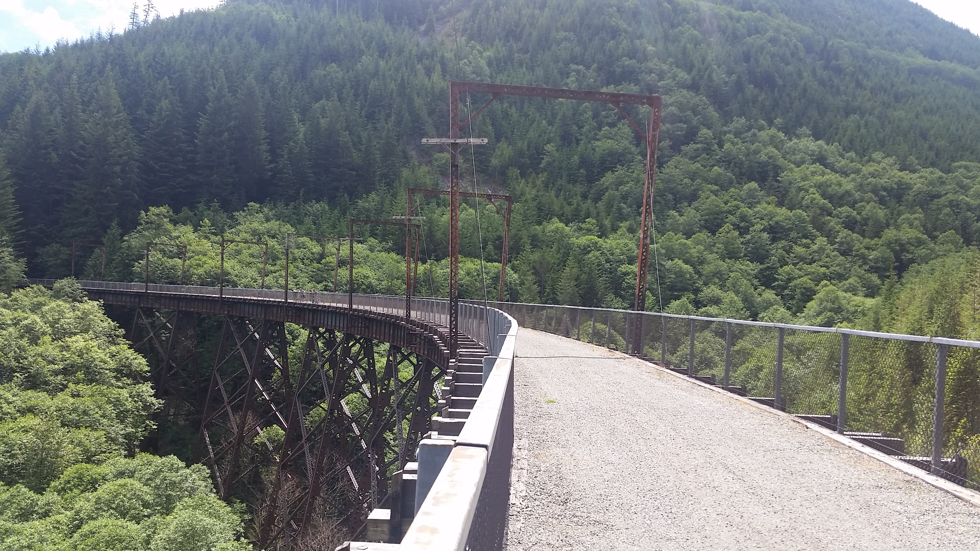
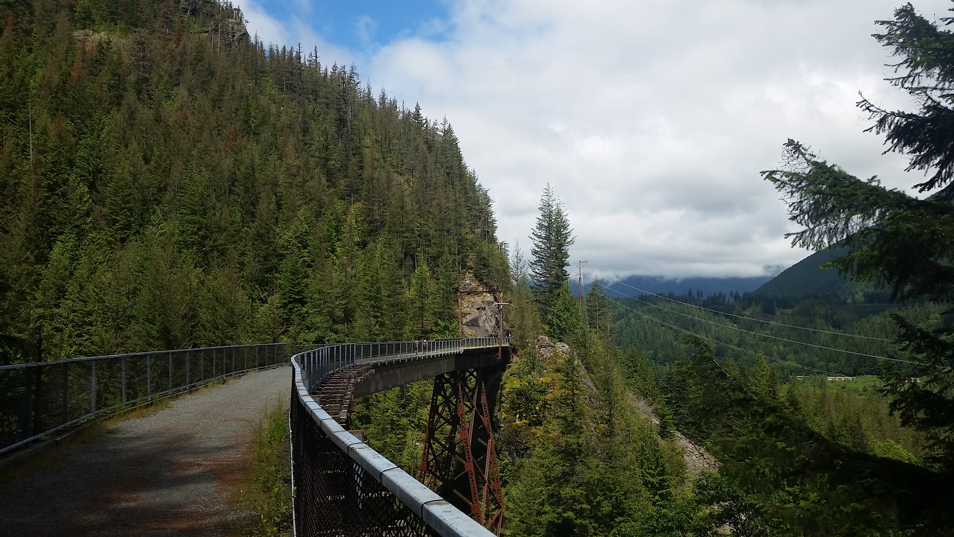
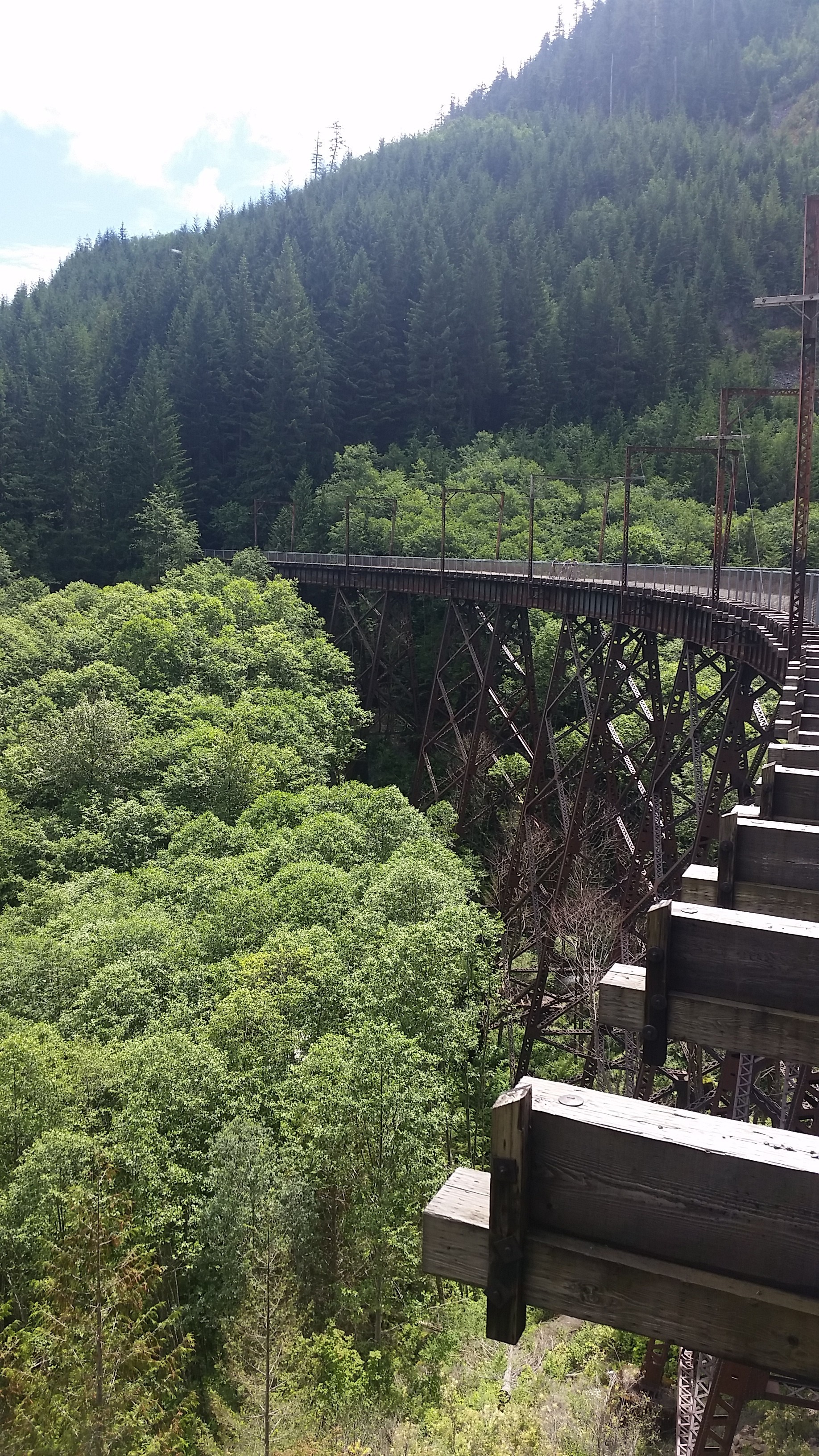
It was a long climb but since it is a rail line the grade is quite gradual. You wouldn’t really even notice it was going uphill. The trail has amazing views and about half a dozen trestle bridges which are worth the price of admission.
Yeah, wow!
The trail is hard packed gravel so you need a mountain bike. I could have used shock absorbers too.
It’s a bone shaker :
As I said, lots of great views
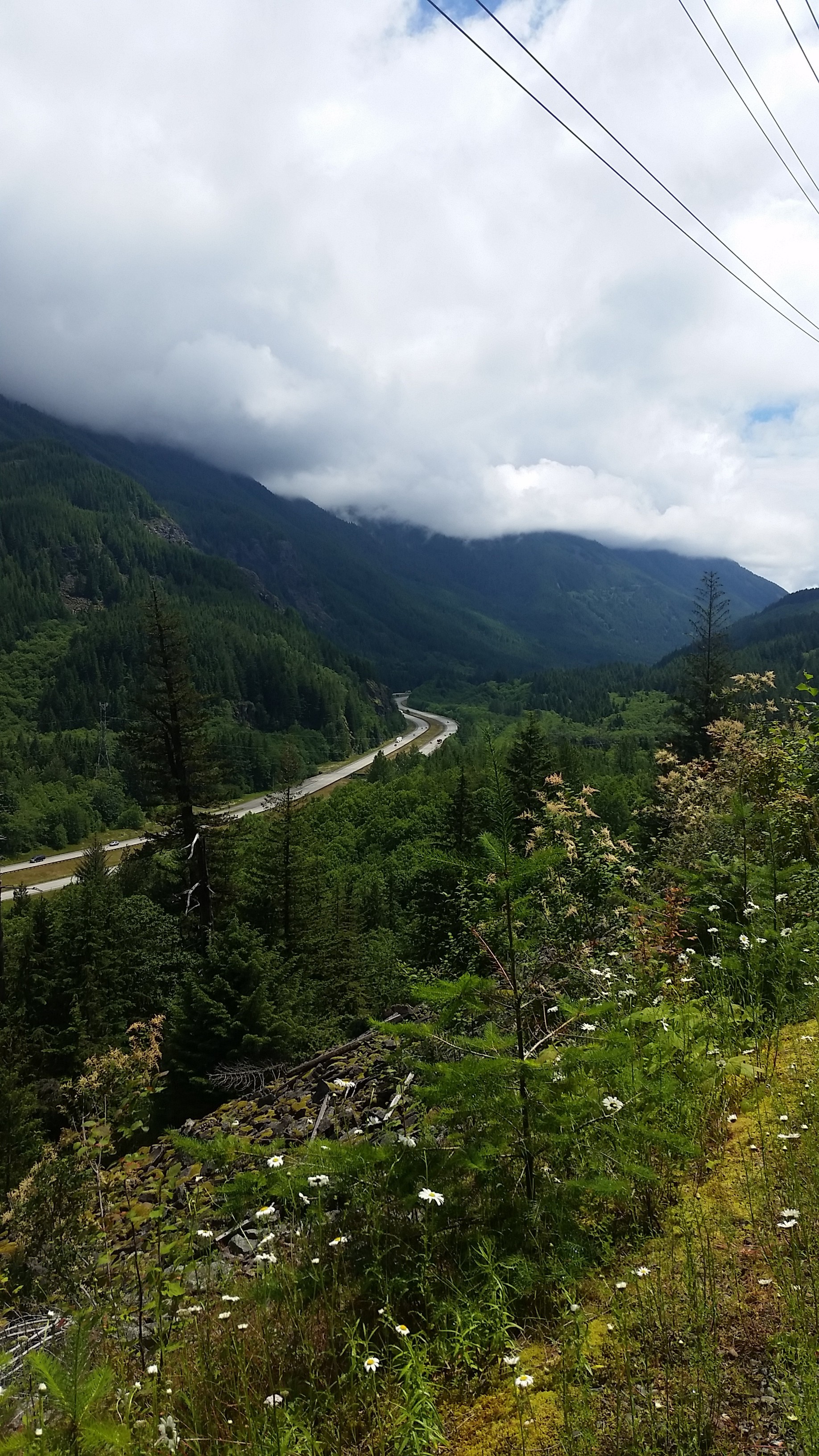
Ever present views of I-90
But the bridges…
The best part though was at the top of the pass you run into this
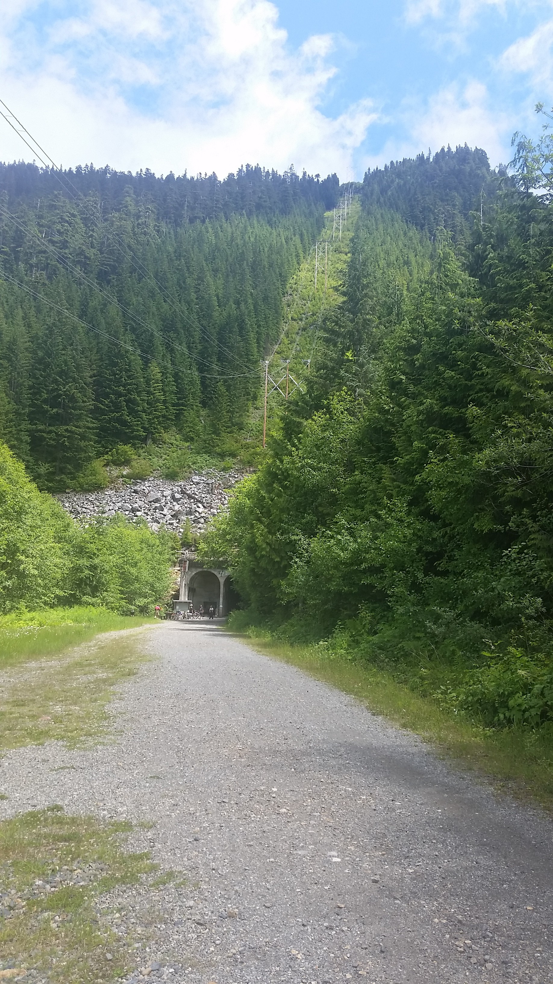
What’s this now?
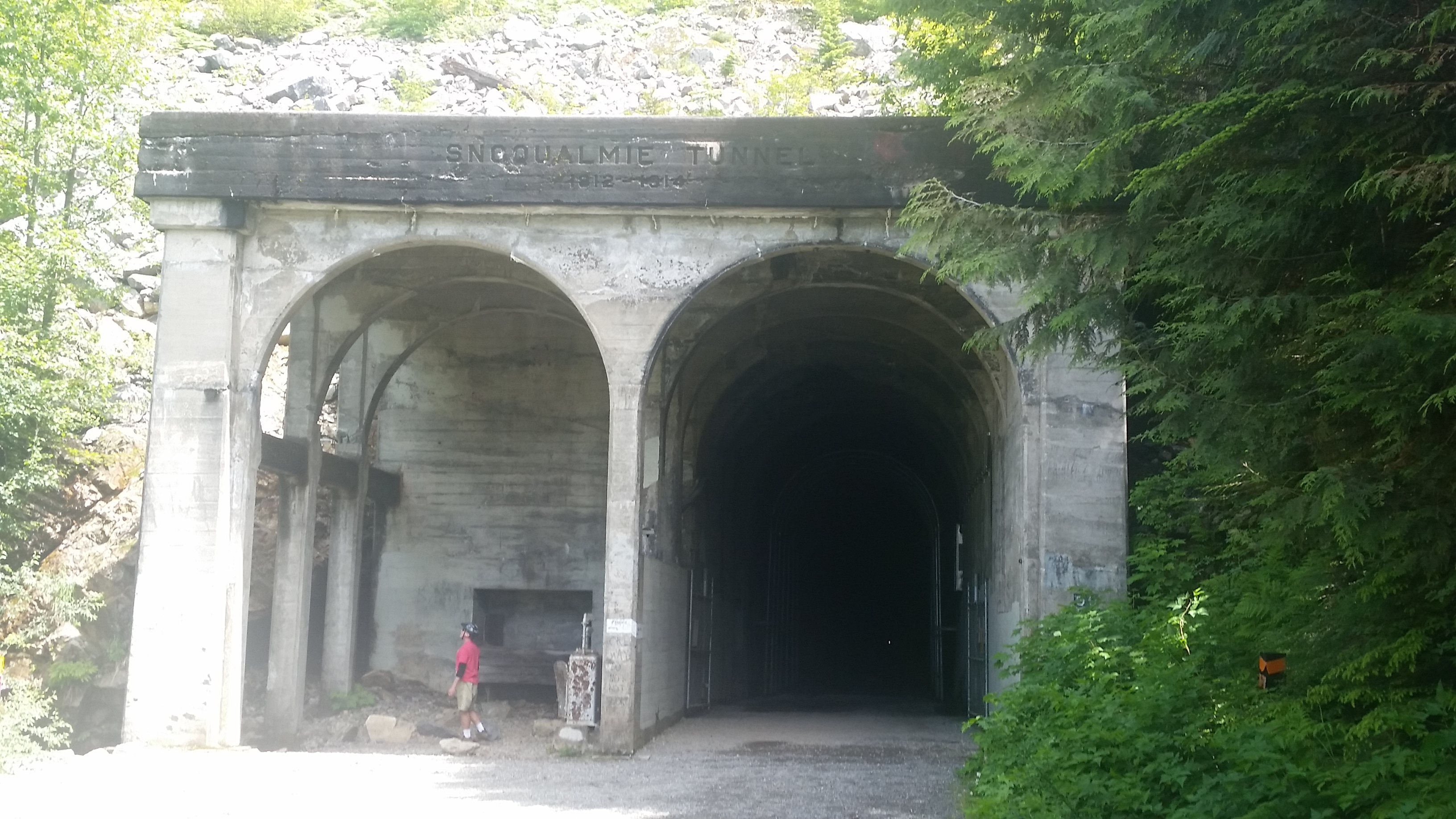
The Snoqualmie Tunnel. Can you see the light at the end of it? Its one pixel
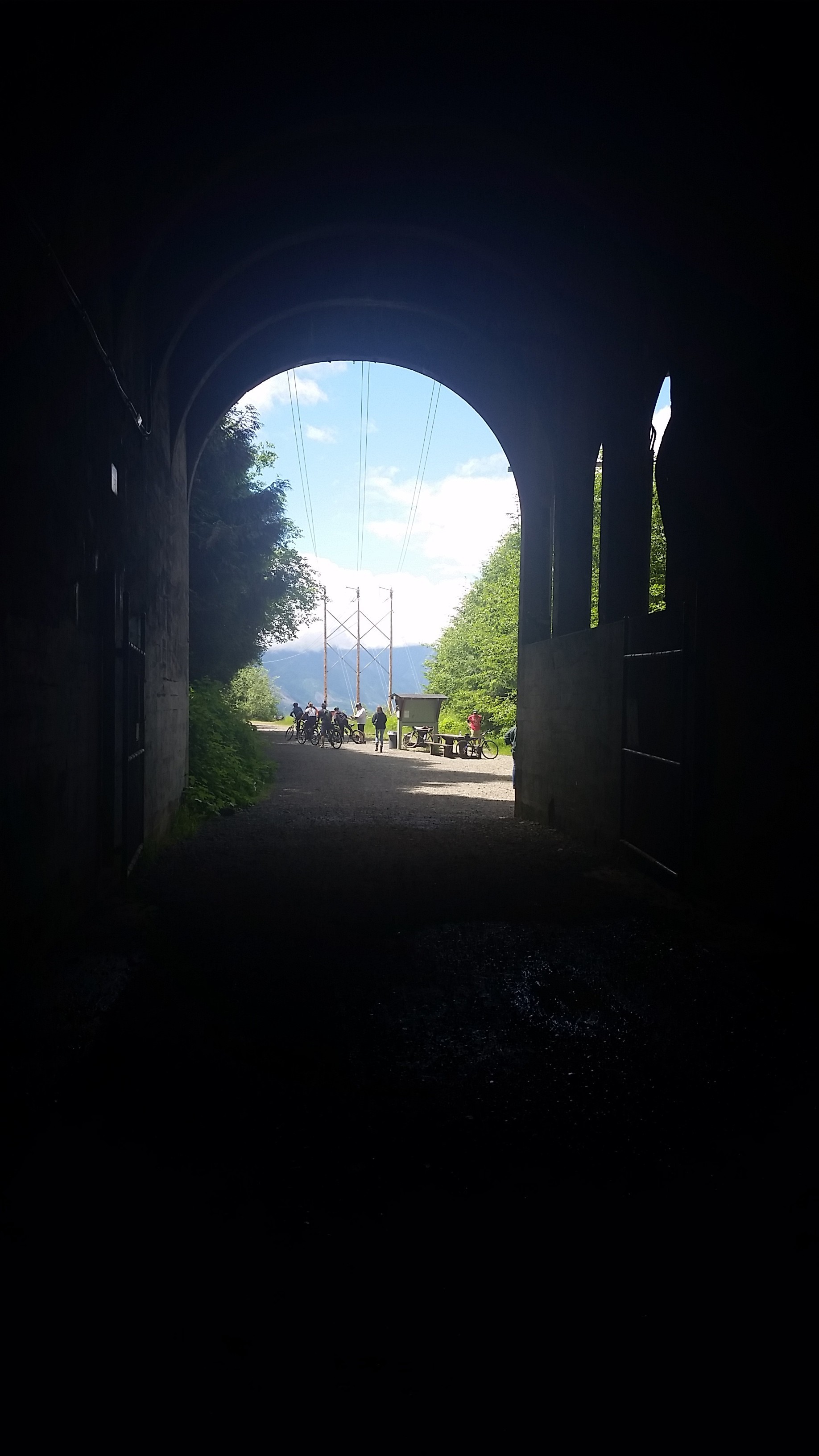
And from the inside
The tunnel is over two miles long and it is dark (and haunted  , (just kidding about the haunted part (I think))) . I had a head lamp and brought a flashlight as a backup. As soon as I got in there I took out the flashlight and used both.
I said you don’t really notice the uphill on the way but once I turned around I was amazed at how much faster I was going so that was cool. Didn’t stop me from being worn out at the end. It was a great adventure though! Much recommended. 
[Added: Here is the Garmin track for that ride. I inexplicably didn’t have my watch charged up so I had to use my backup GPS device  ]
]
Shriner Peak Hike
Shriner Peak is on the east side of Mt. Rainier National Park. We hiked up it on July 2nd. It’s a real cardio workout.
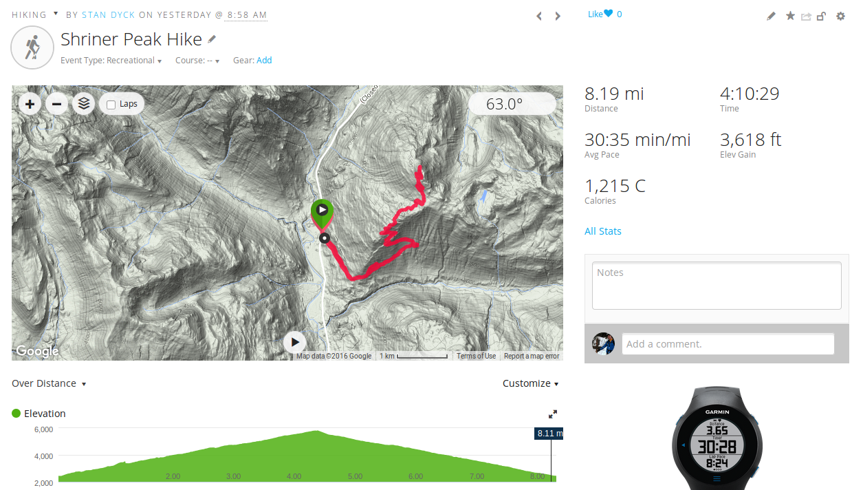
Check out the elevation profile
Laura and I did this one many years ago, around 2003. You can see from the track that this hike is southern exposed for a good portion of the trail so it gets a lot of sun. That is the only thing I remembered from our earlier hike. It was really hot.
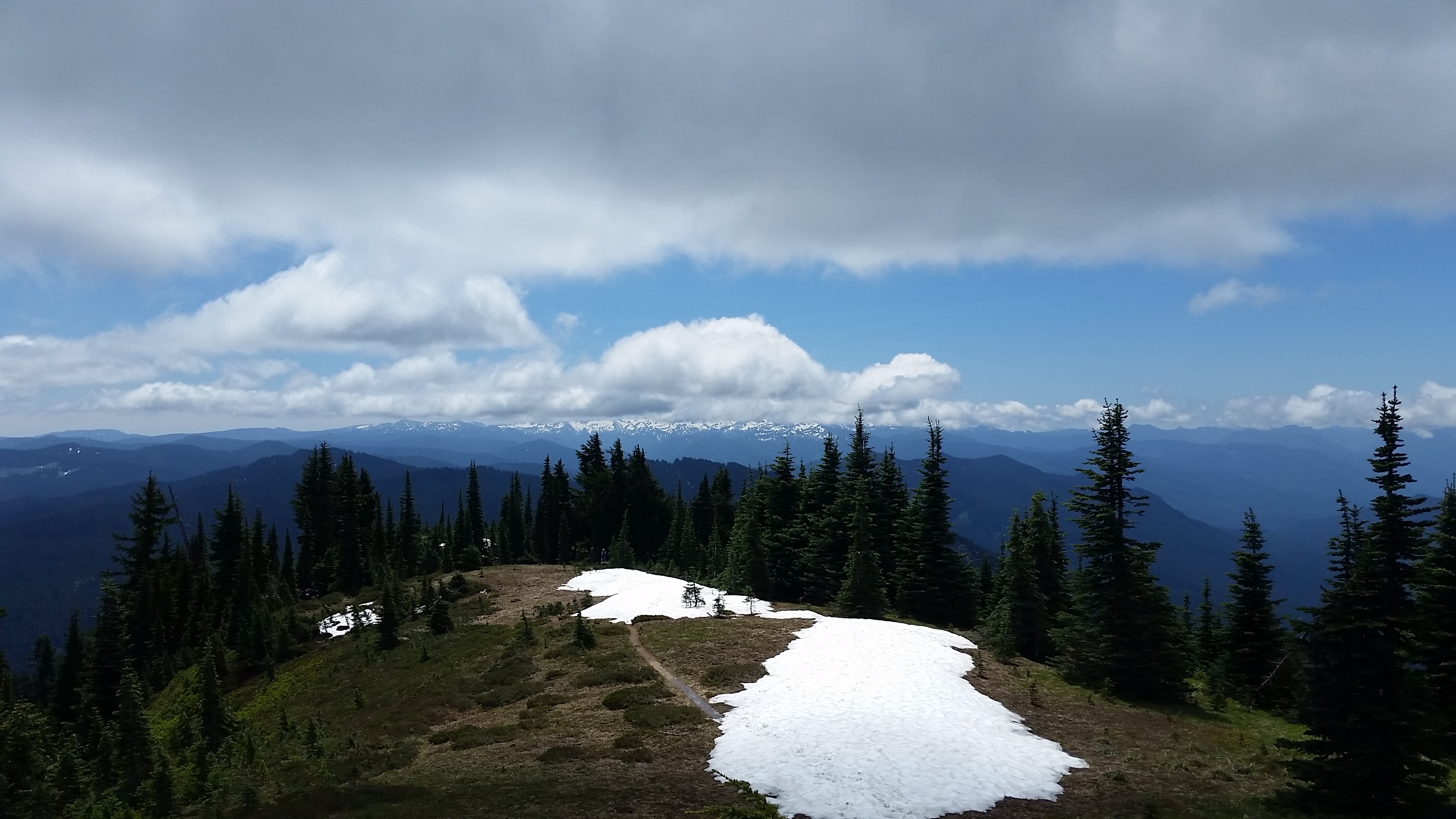
Luckily, it was much nicer this time around. It was partly cloudy and a pleasant 60-70 degrees.
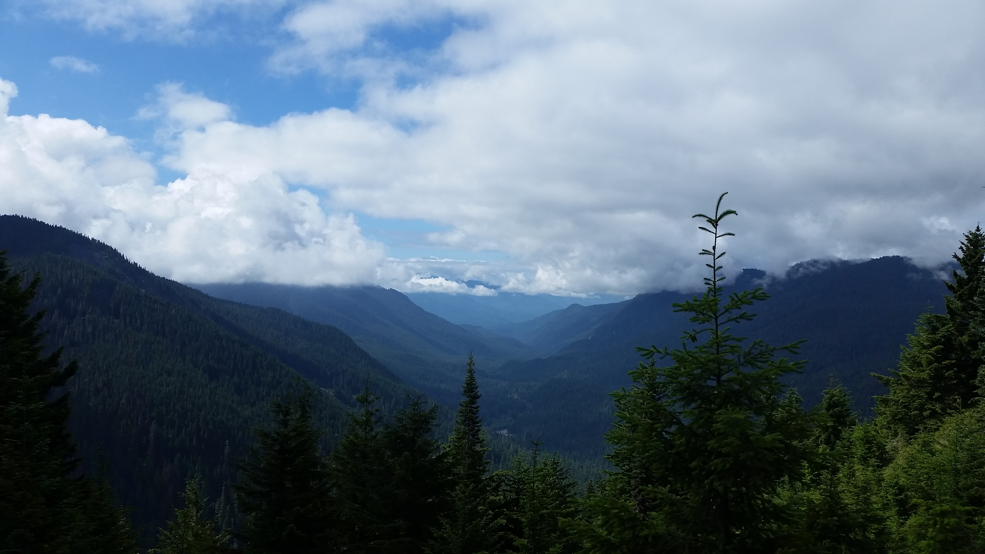
View to the Southwest
When you get to the top there is a lookout tower
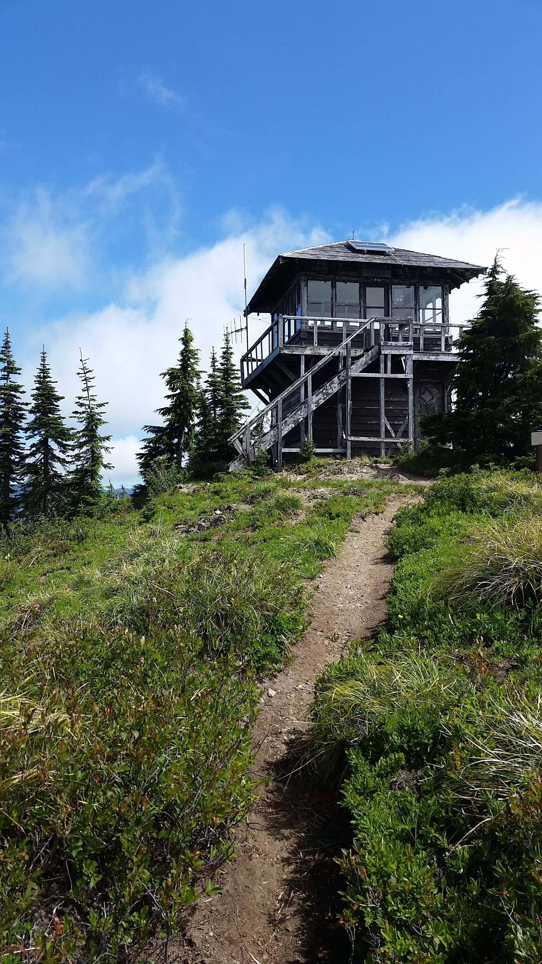
Nice views from here
See?
Directly to our west was Mt. Rainier, though it was a little reluctant to show itself for most of the time we were up there.
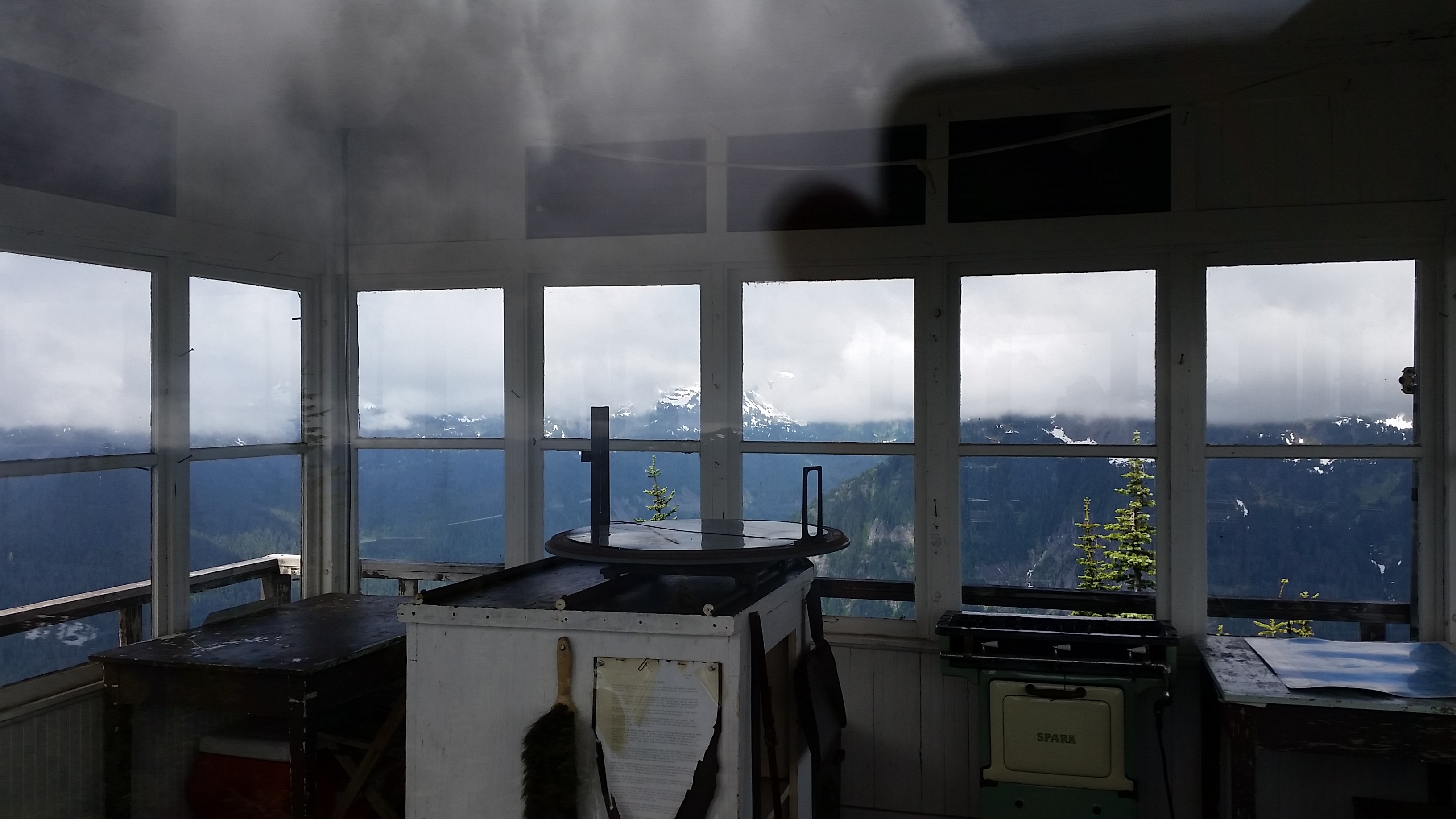
Mt. Rainier from the lookout tower

Laura makes the final push to the top
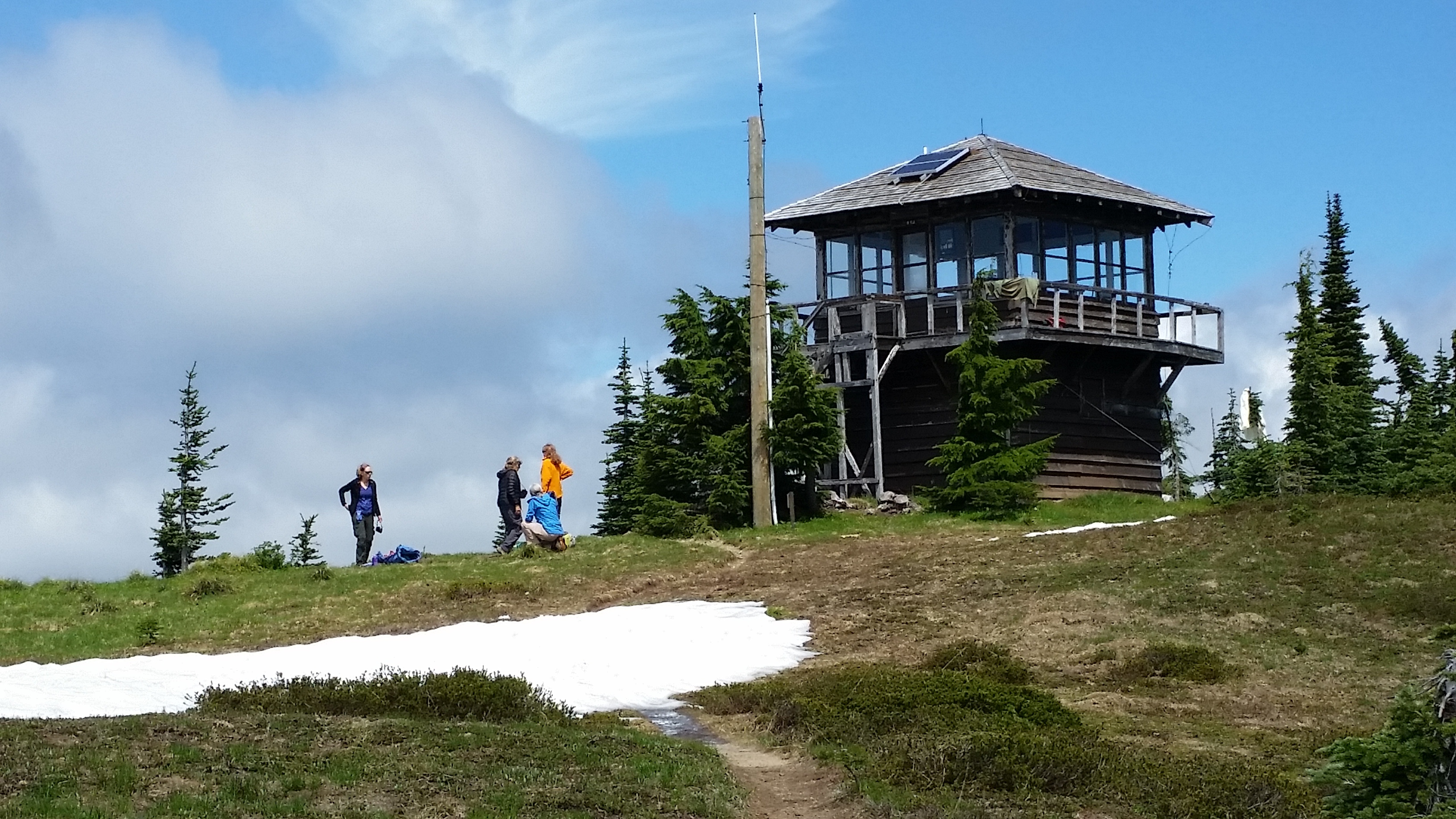
Lunch at the tower
As we sat up there eating our lunch, the clouds started to break up and we got some peak-a-boo views of the Rainier summit.
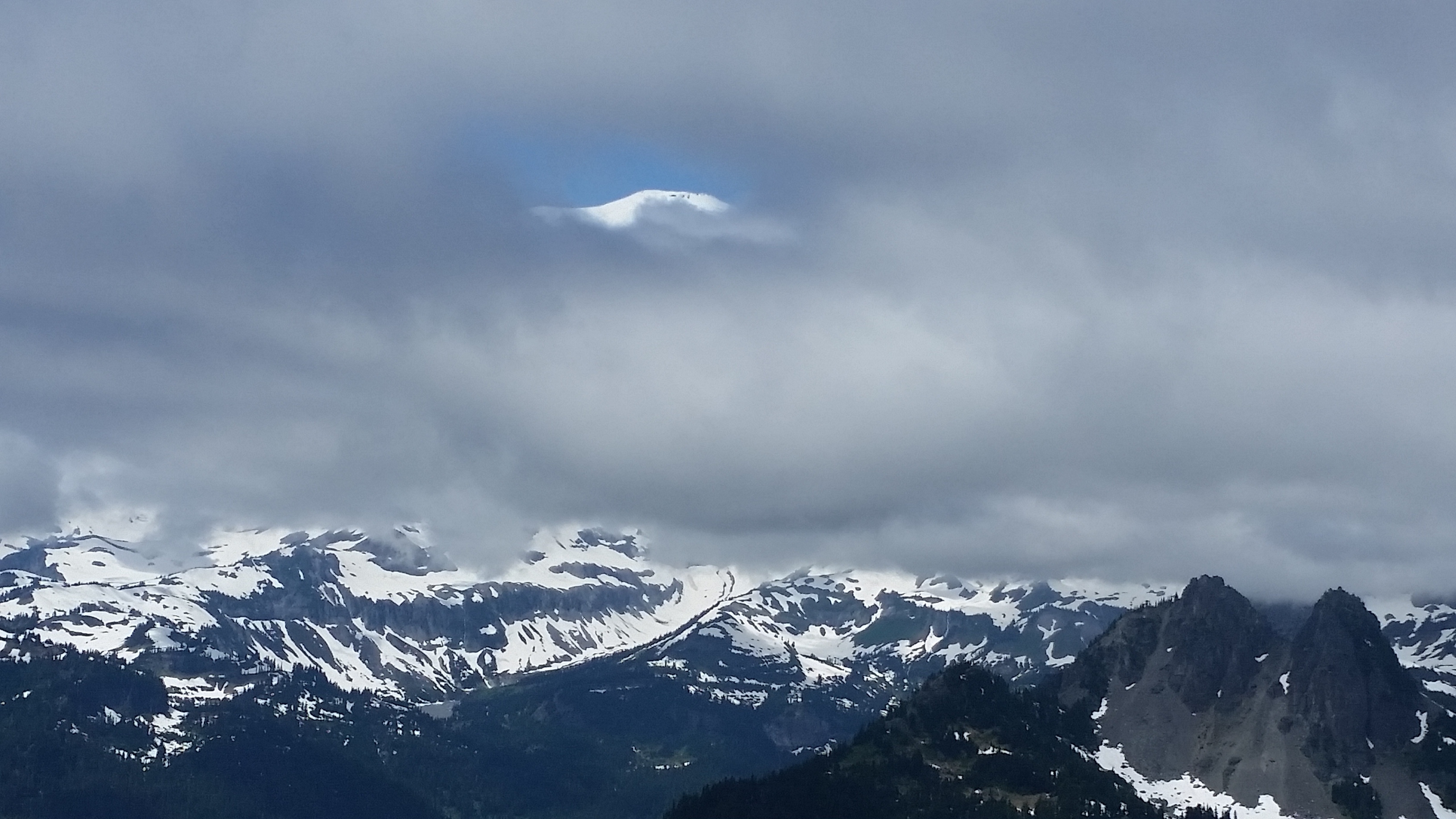
There she is!
Mt. Adams was also shrouded in clouds to the south
Also a pair of campsites over there
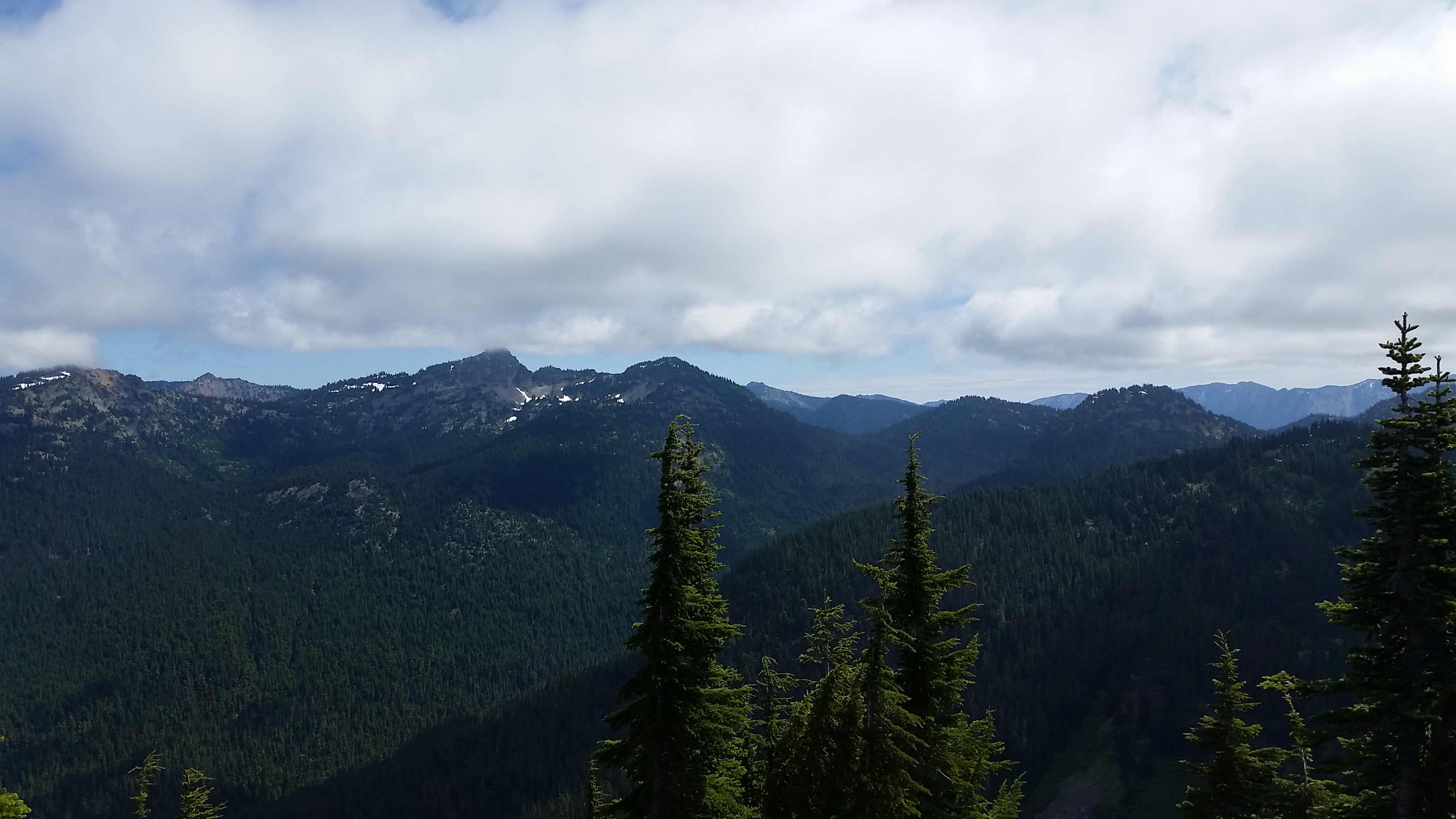
On the way down we got even better views of the mountains

There’s Adams
And Rainier
All in all, a great trip finished off with some ice cream at Wapiti Woolies in Greenwater.
cc: @laura, @seattlenvj
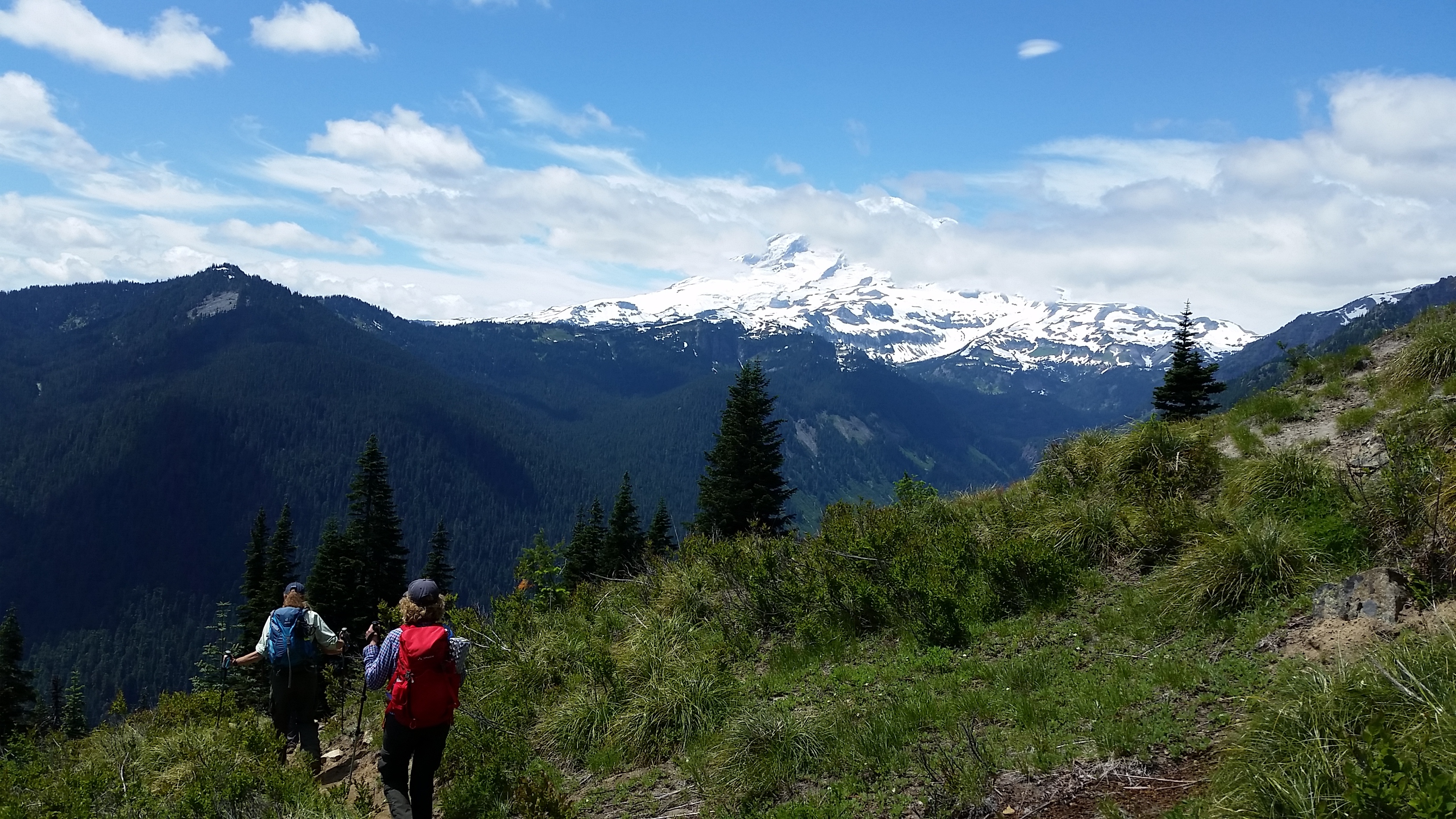
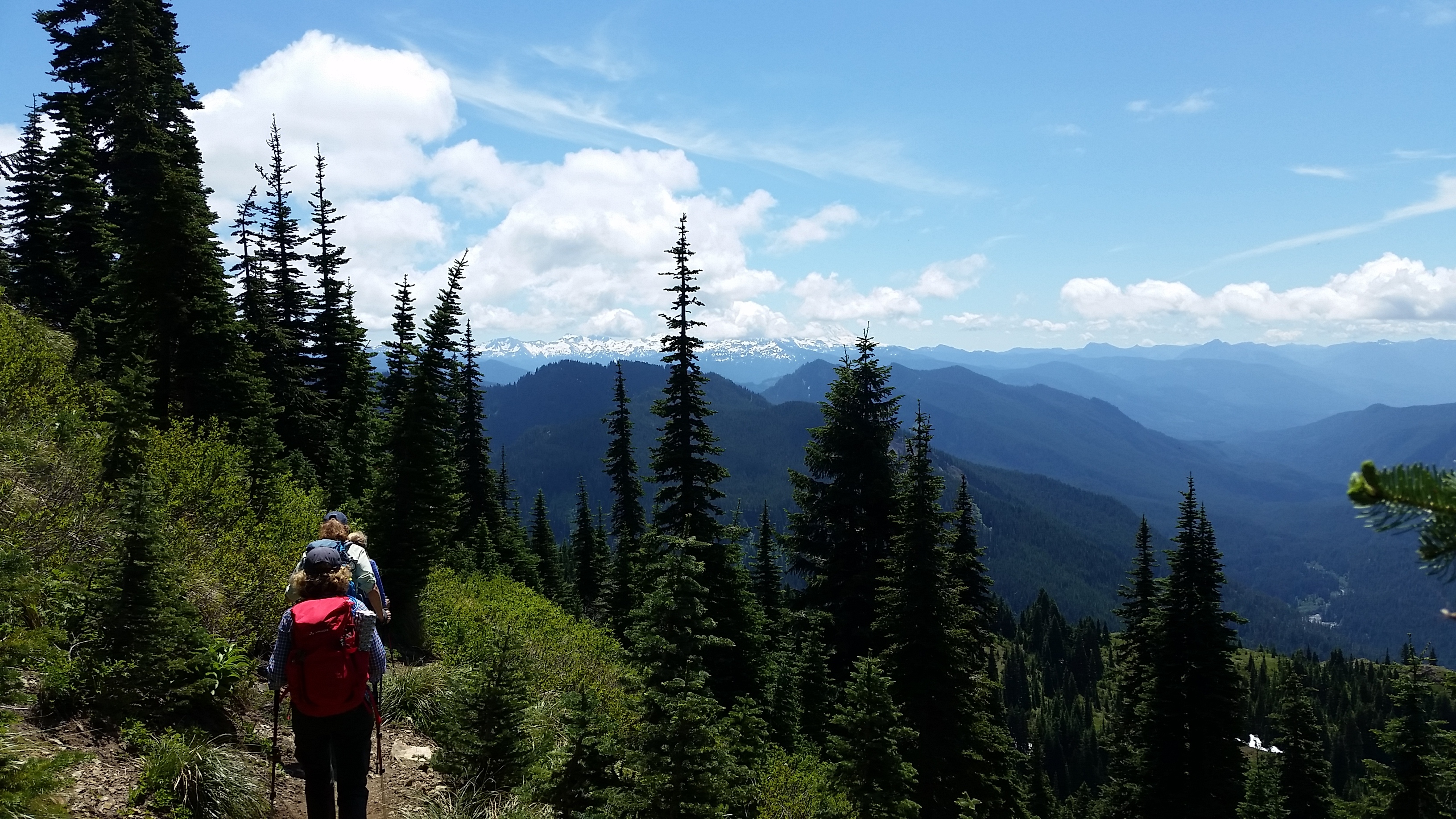
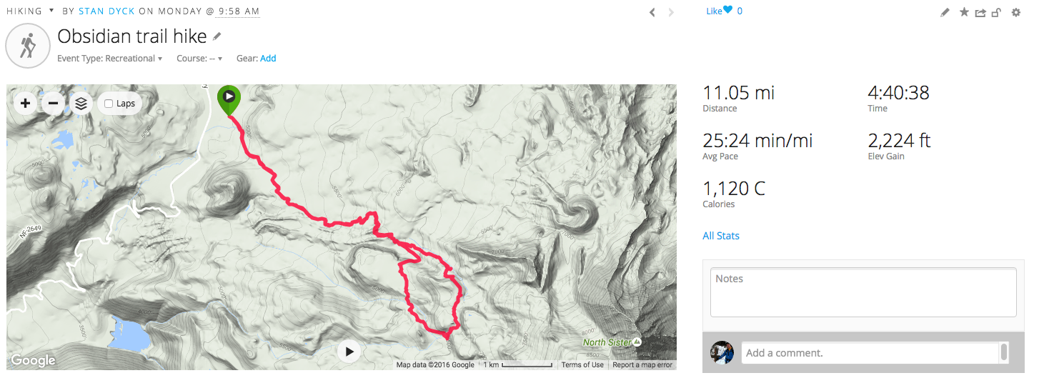
Obsidian Trail Hike in Oregon
This was a hike we took on our trip to Bend Oregon for the Cascade Lakes Relay in July/August. The hike is restricted so you need to get a pass. It’s an out and back with a loop at the end. Here is my track:
The area is geologically active (i.e. there are lots of volcanoes around). The drive up included a stop at the Dee Wright Observatory.

Mountains all 'round in the lava fields
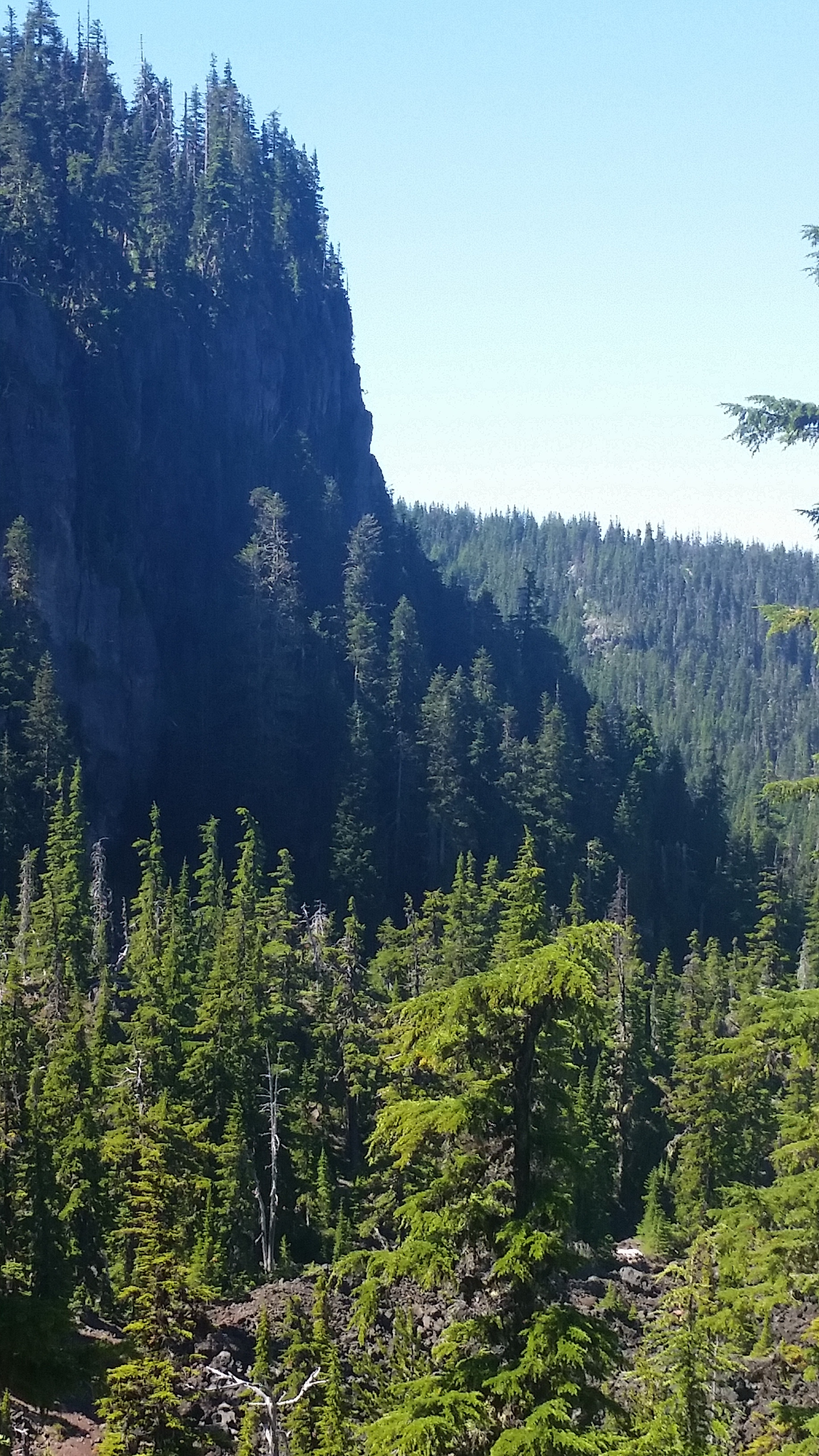
The hike is nothing unusual for about the first three miles or so. Lots of nice views
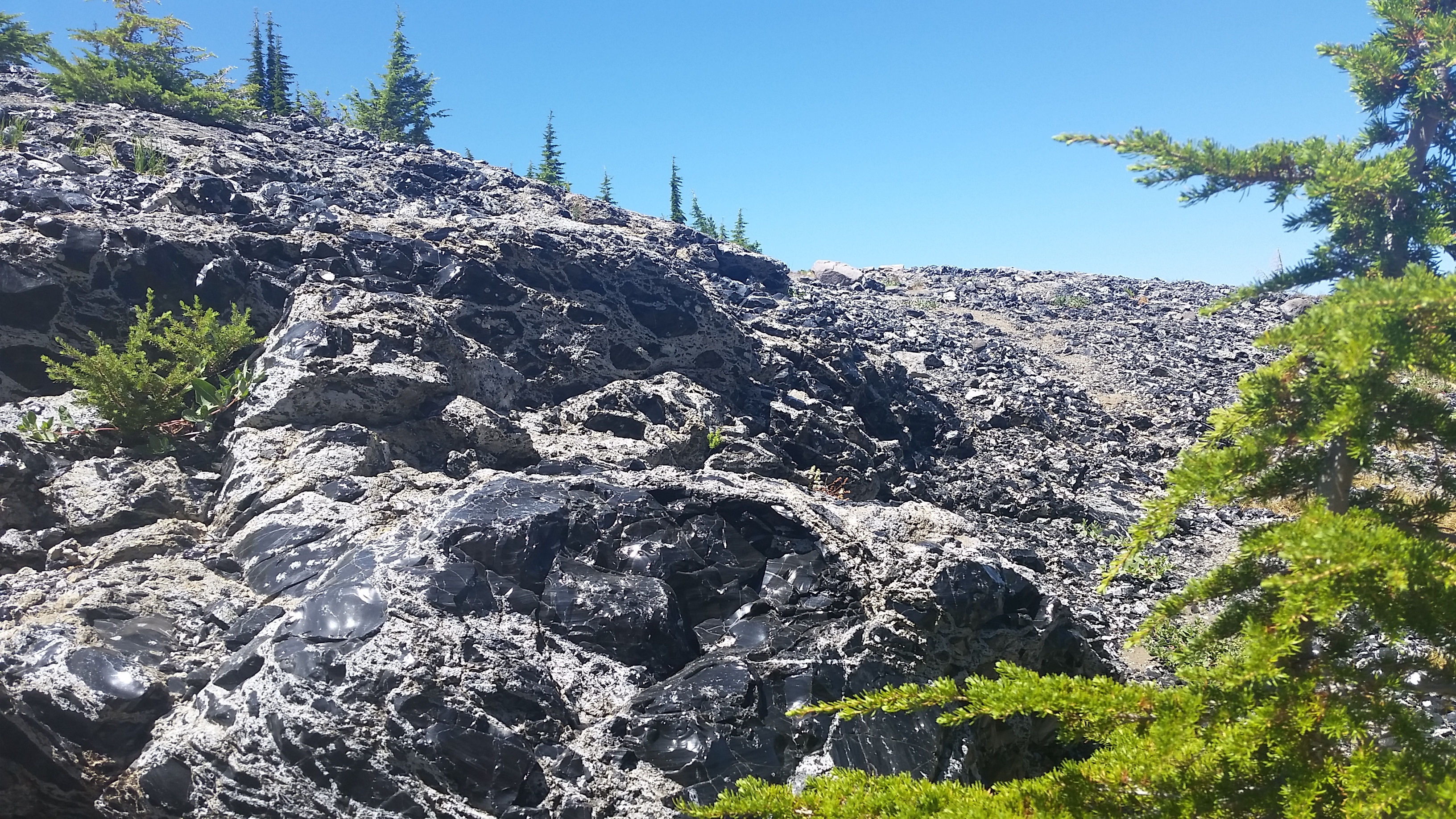
Then you start to hit the lava fields…
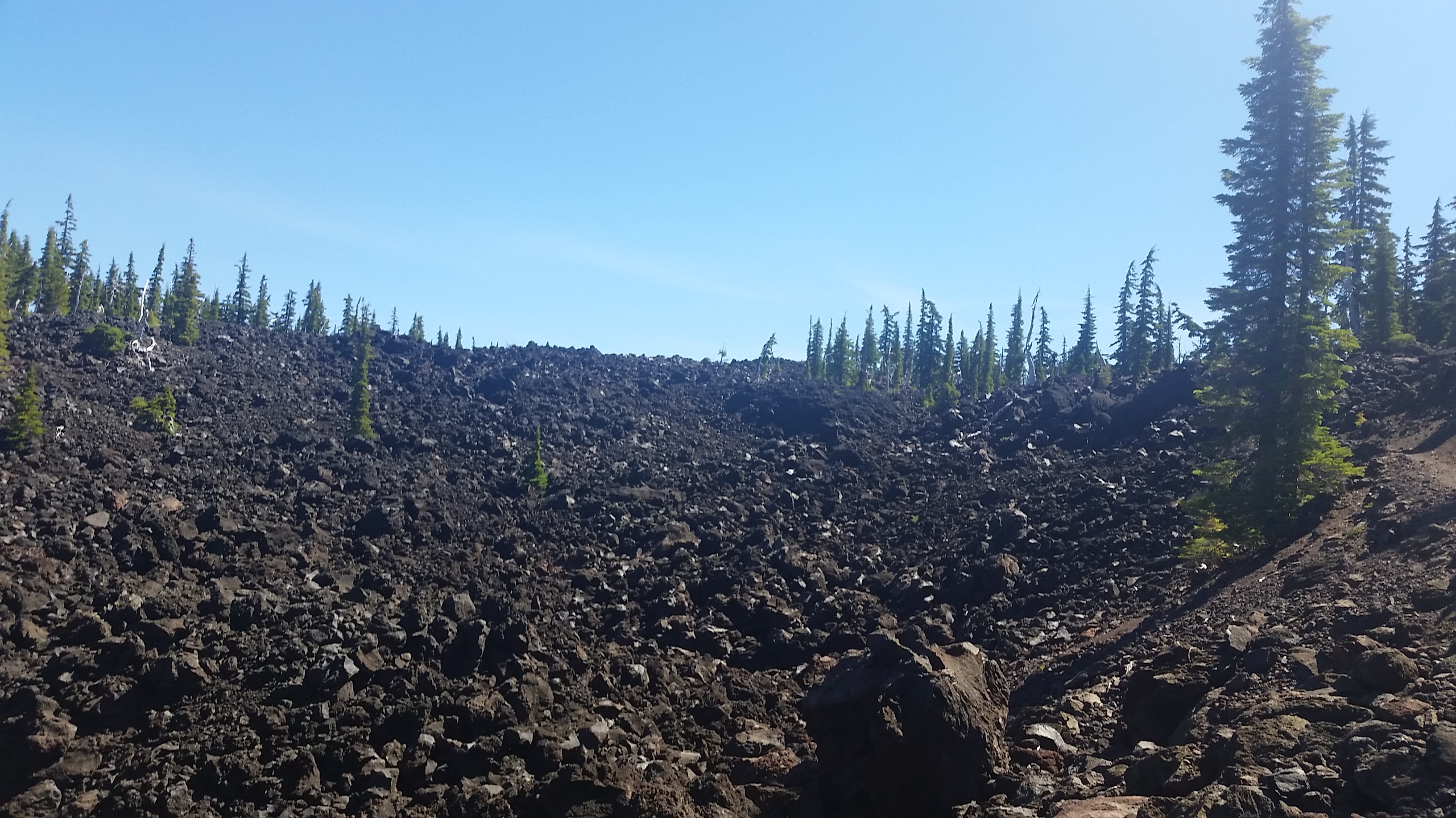
Igneous
…and then you hit the obsidian fields…
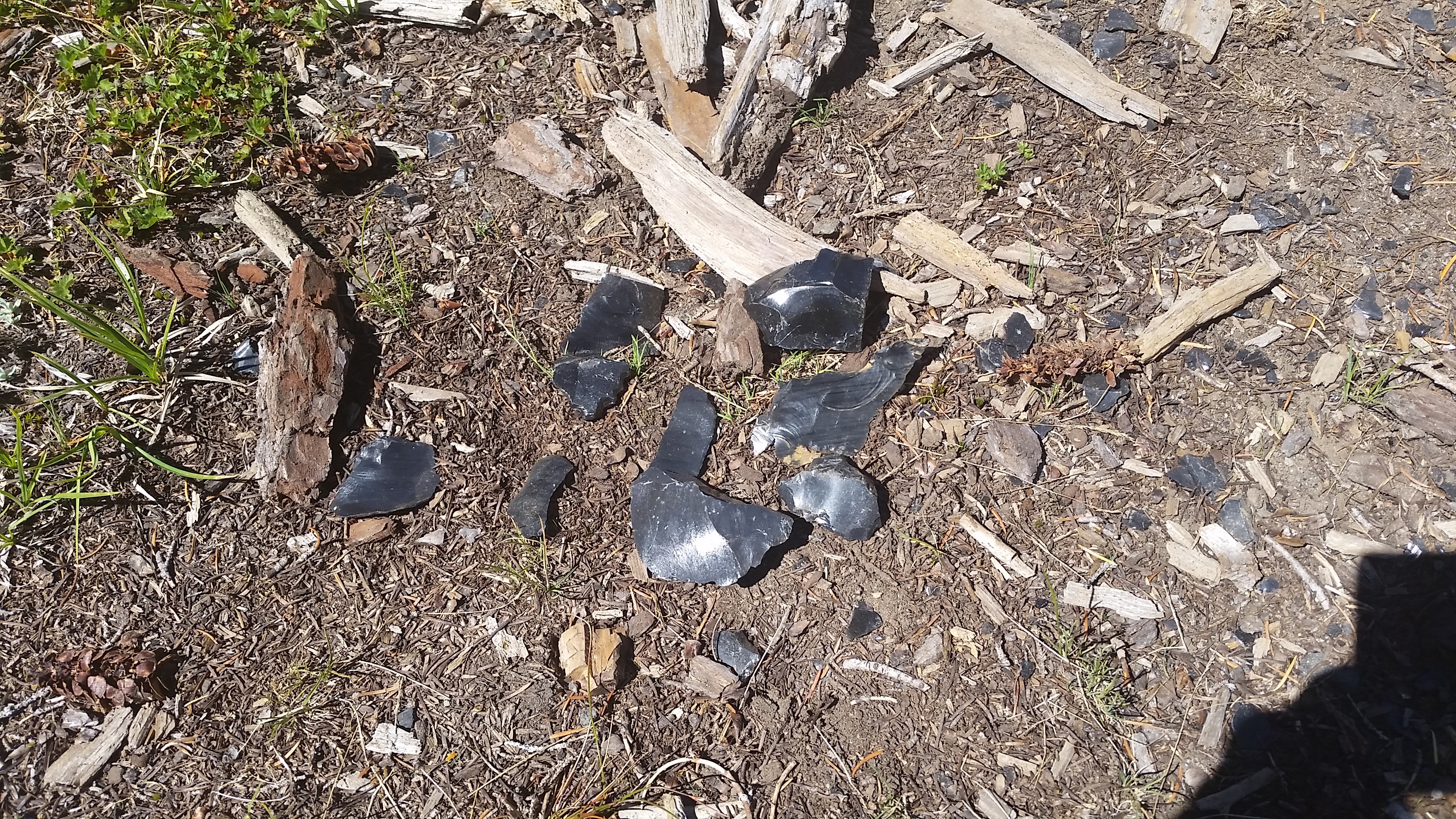
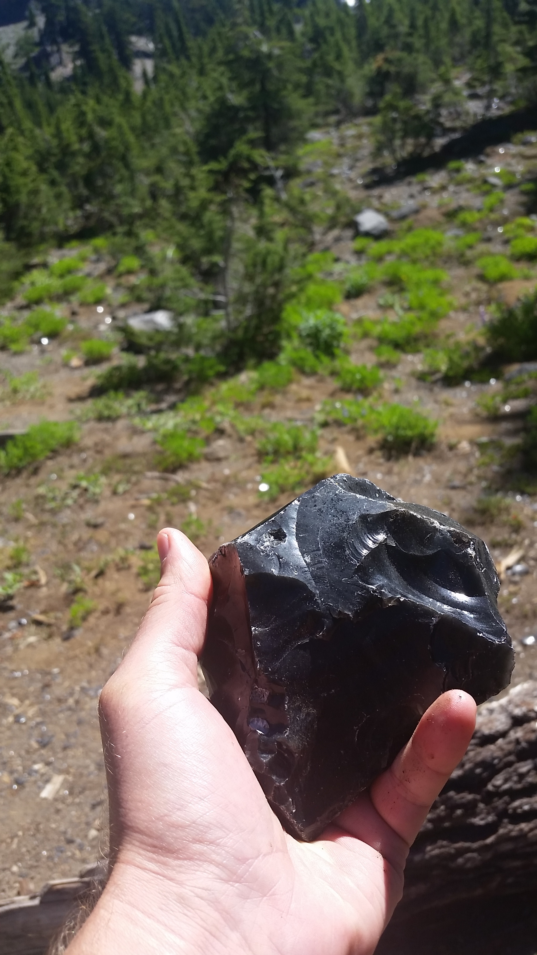
A big chunk of Dragon Glass
The stuff is lying around everywhere. It’s quite beautiful. Make sure to click on each photo to see a full view.
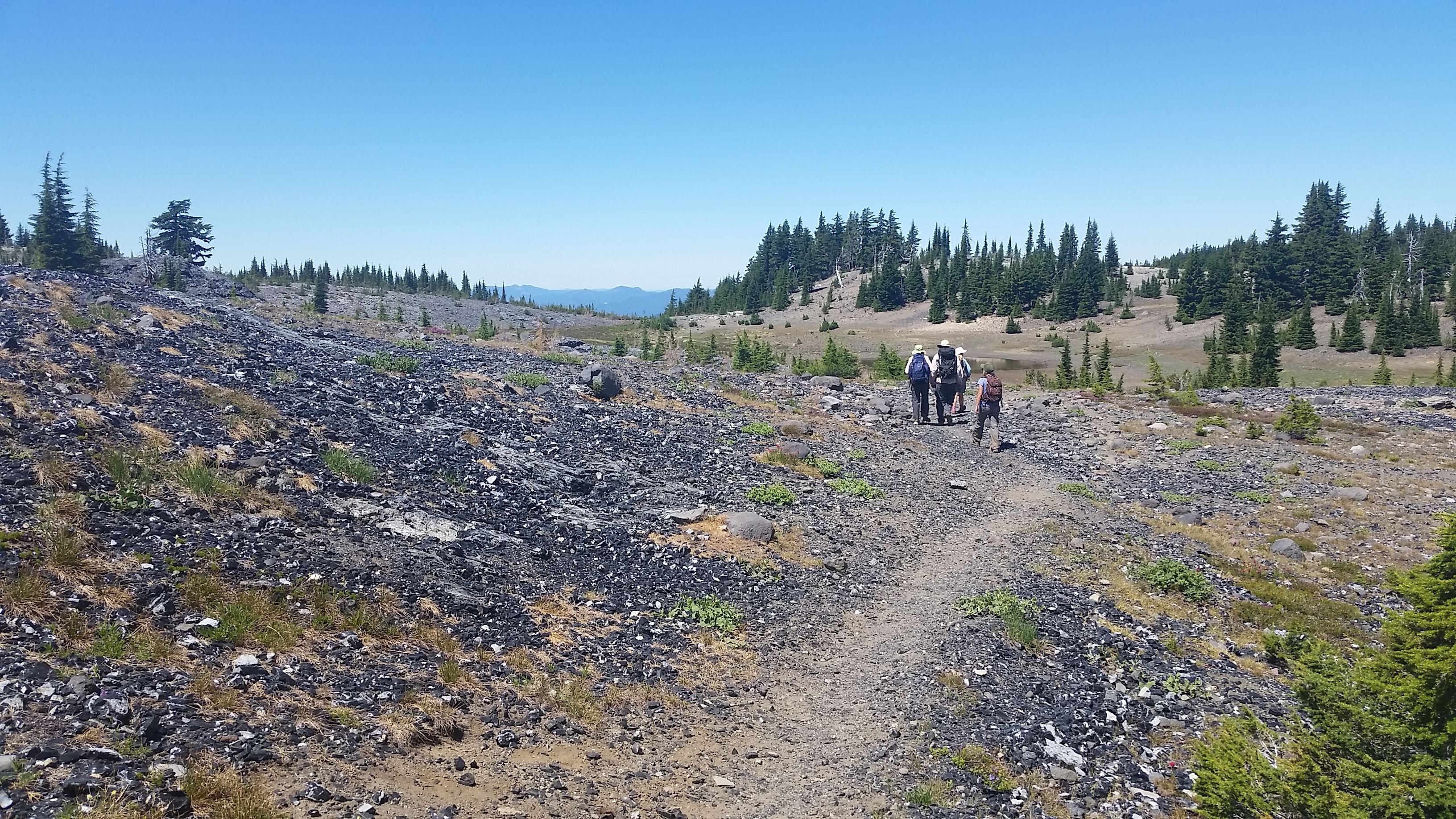

Walkin’ on broken glass
Shouldn’t forget to look up either. The sights are nice
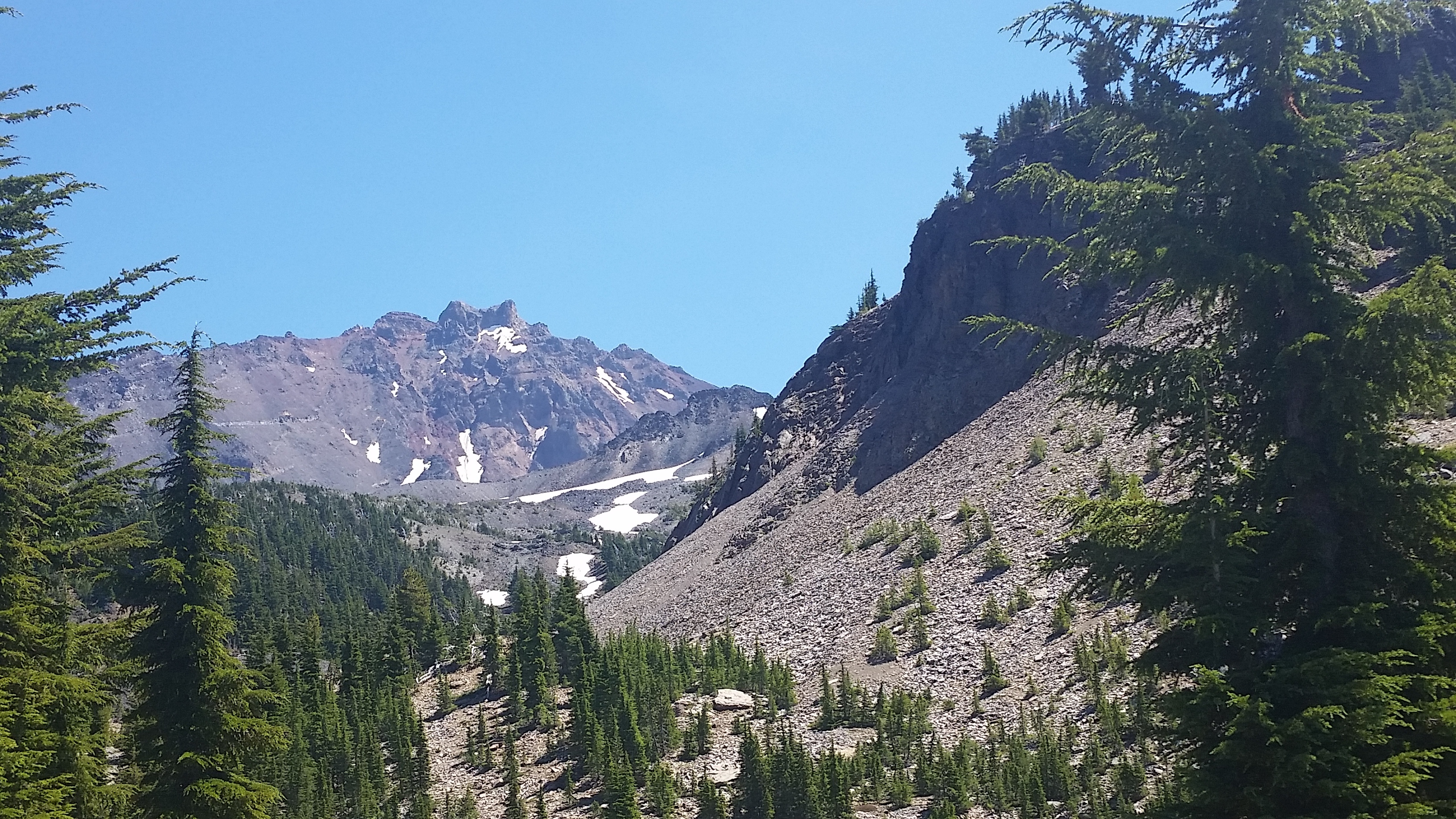
The North Sister from whence came the glass

Lined up volcanoes
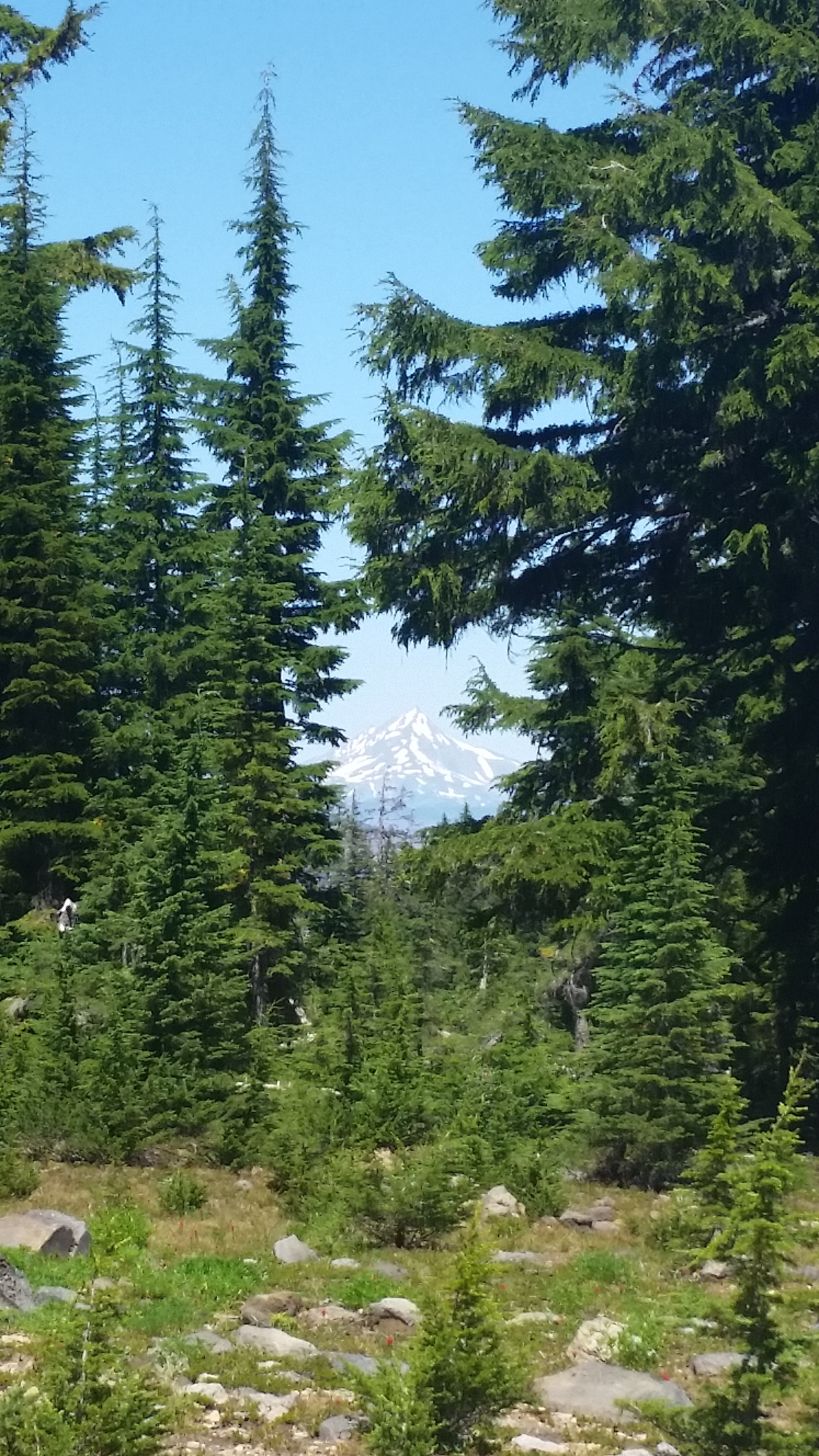
Mt. Jefferson
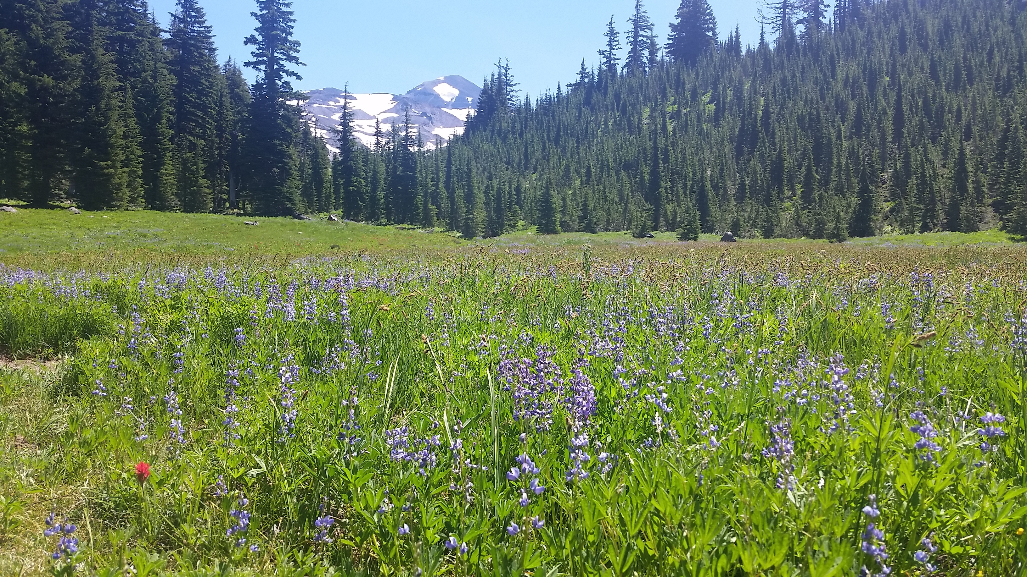
Fields of flowers
cc: @masterhiker, @laura
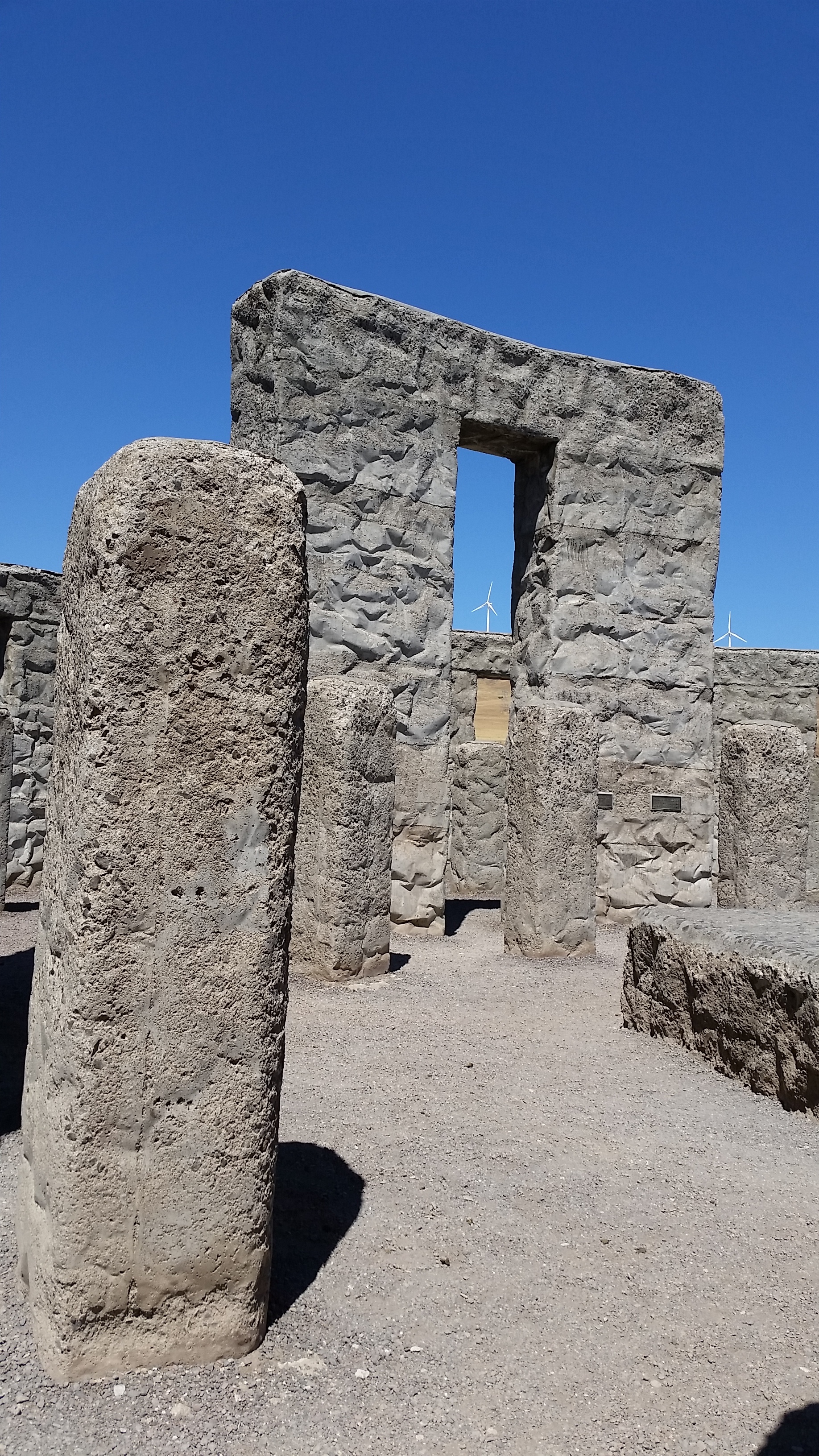
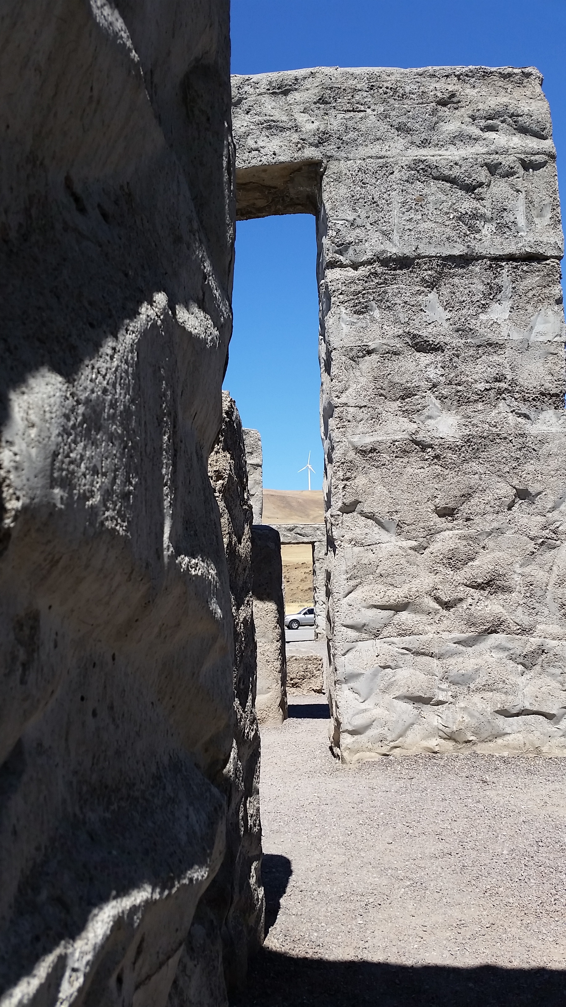
Sam Hill Stonehenge
On our trip back from Bend in August we took the route through Yakima. When you get to the Columbia river you run into Sam Hill’s World War I memorial which was meant to model Stonehenge. It’s worth a stop
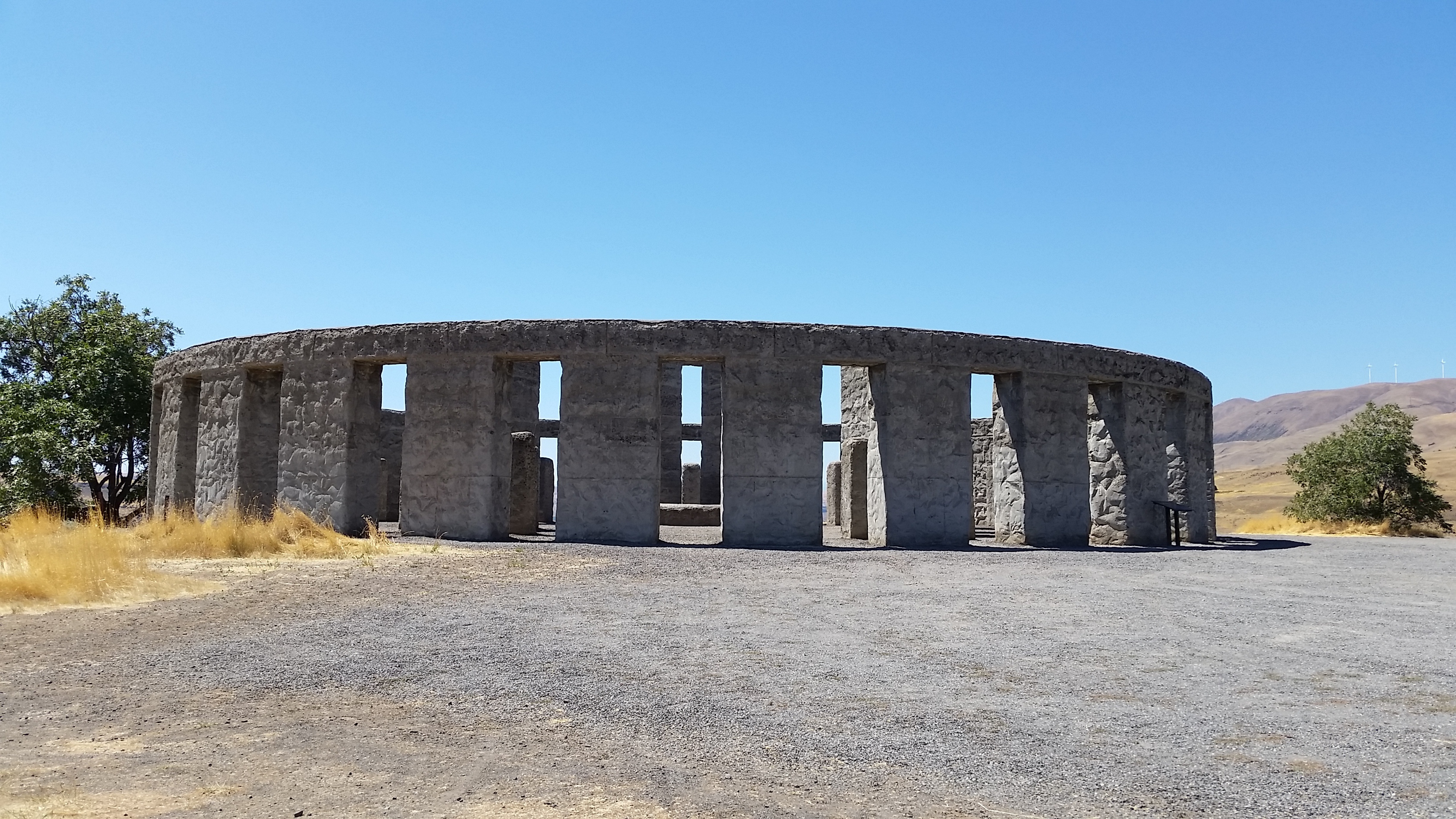
No druids to be found
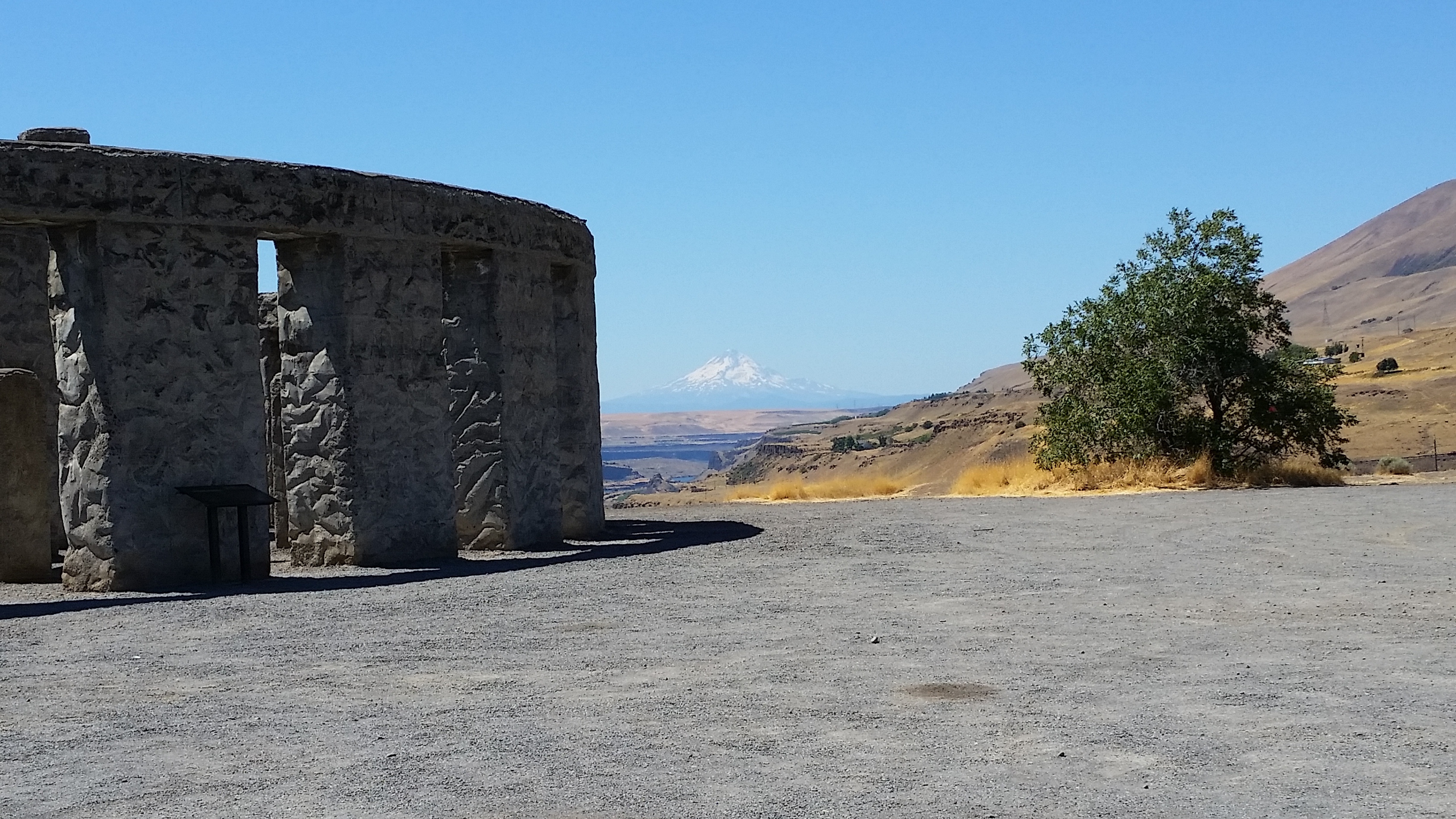
Mt. Hood

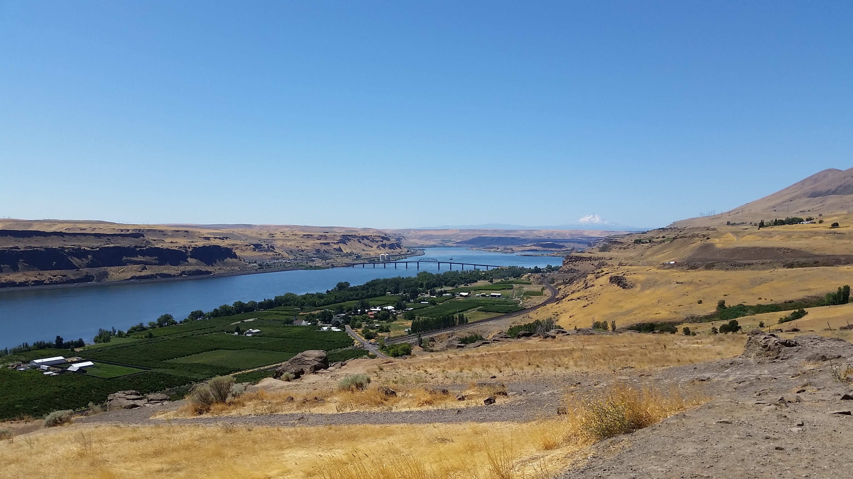
Columbia River
Hidden Lake Lookout, North Cascades
This hike out of Marblemount Washington is best saved for nice weather conditions. When it’s nice, and you don’t mind crowded peaks, the payoff is big.
Stunning
We did this hike last year and it wasn’t so nice. Here’s a comparision:
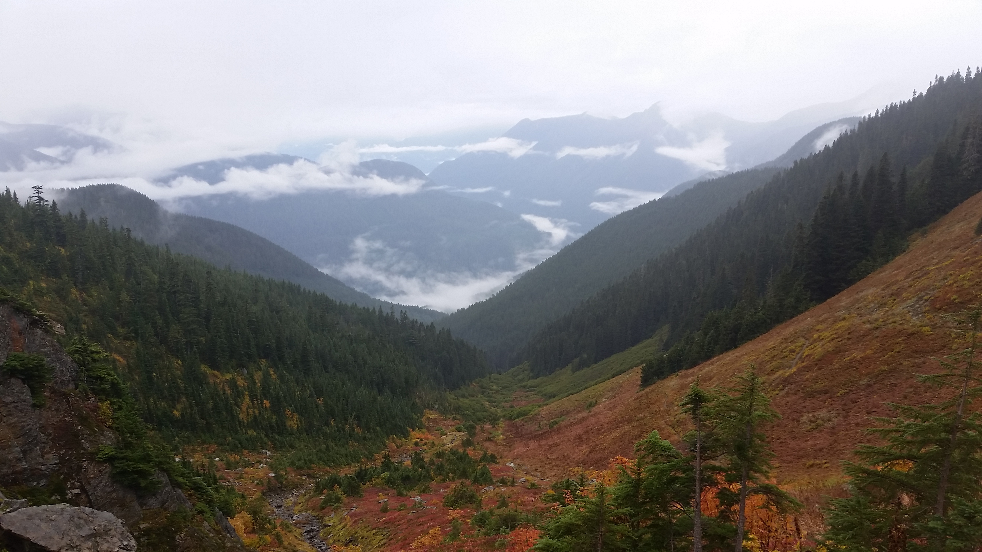
Last year (September)…
And that was the nice part of the day. We didn’t end up getting up to the lake because the clouds descended and visibility dropped.
This year was much better
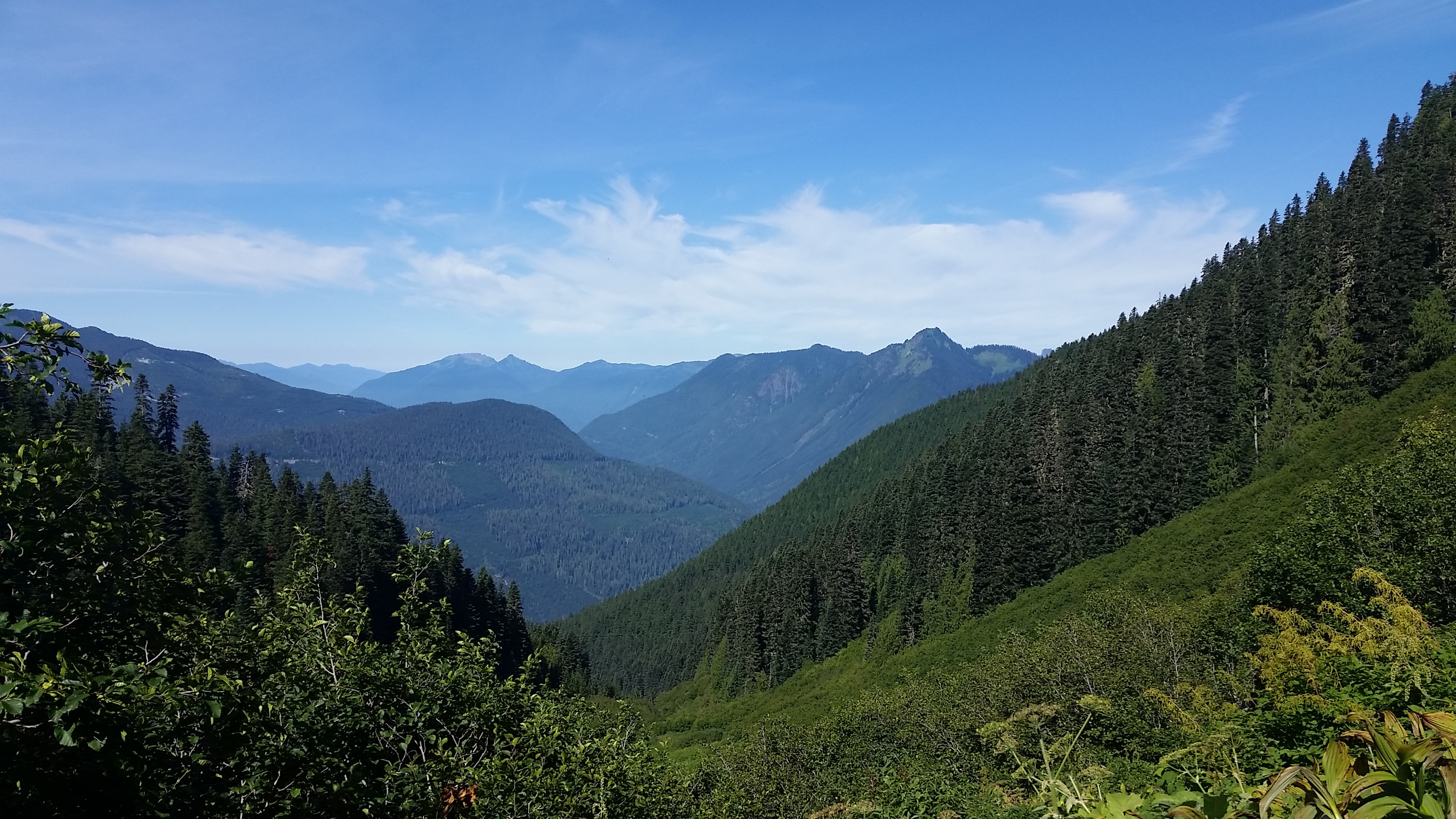
…This year (August)

This is about where we turned around last year

Not so hidden lake
Once you get in view of the lake you are in the North Cascades National Park with 360 degree views.

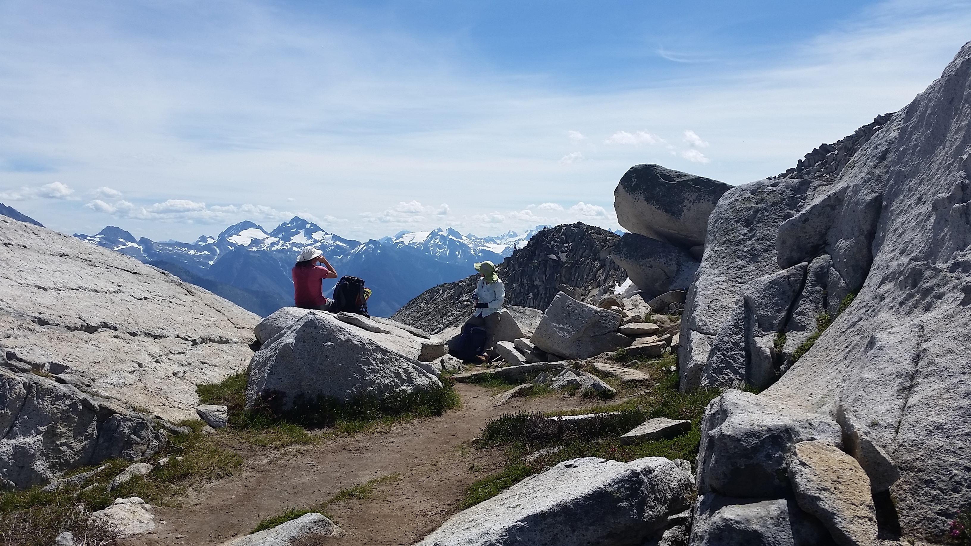
Kelly and Anthea at a lunch spot
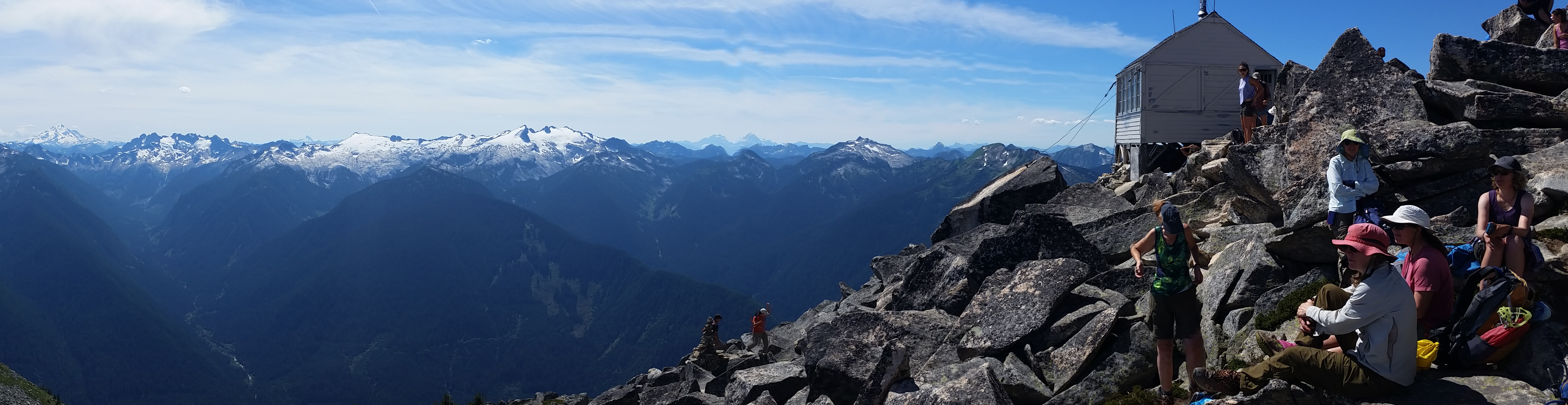
But that’s just a saddle point. Then you climb up to the lookout and it’s even better.
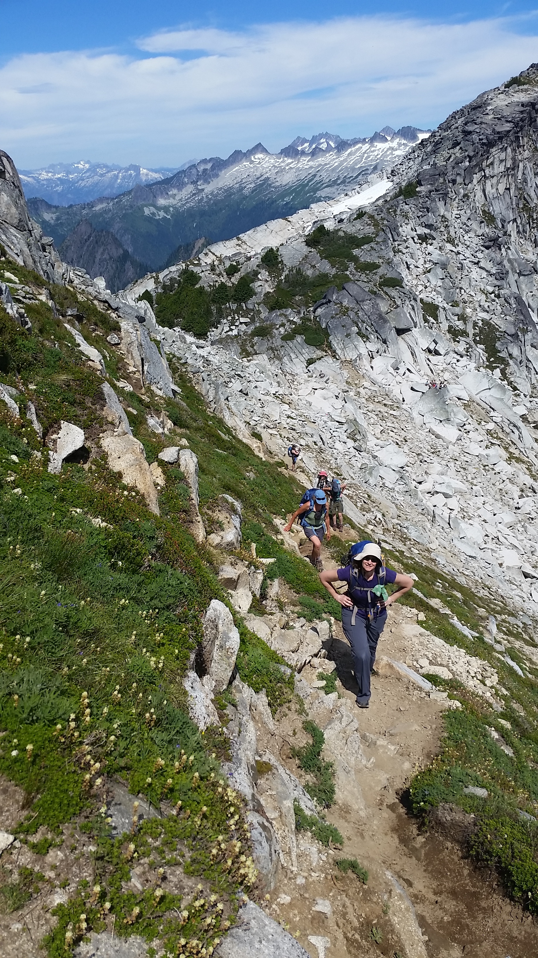
On the way up to the lookout
What should I photograph first?
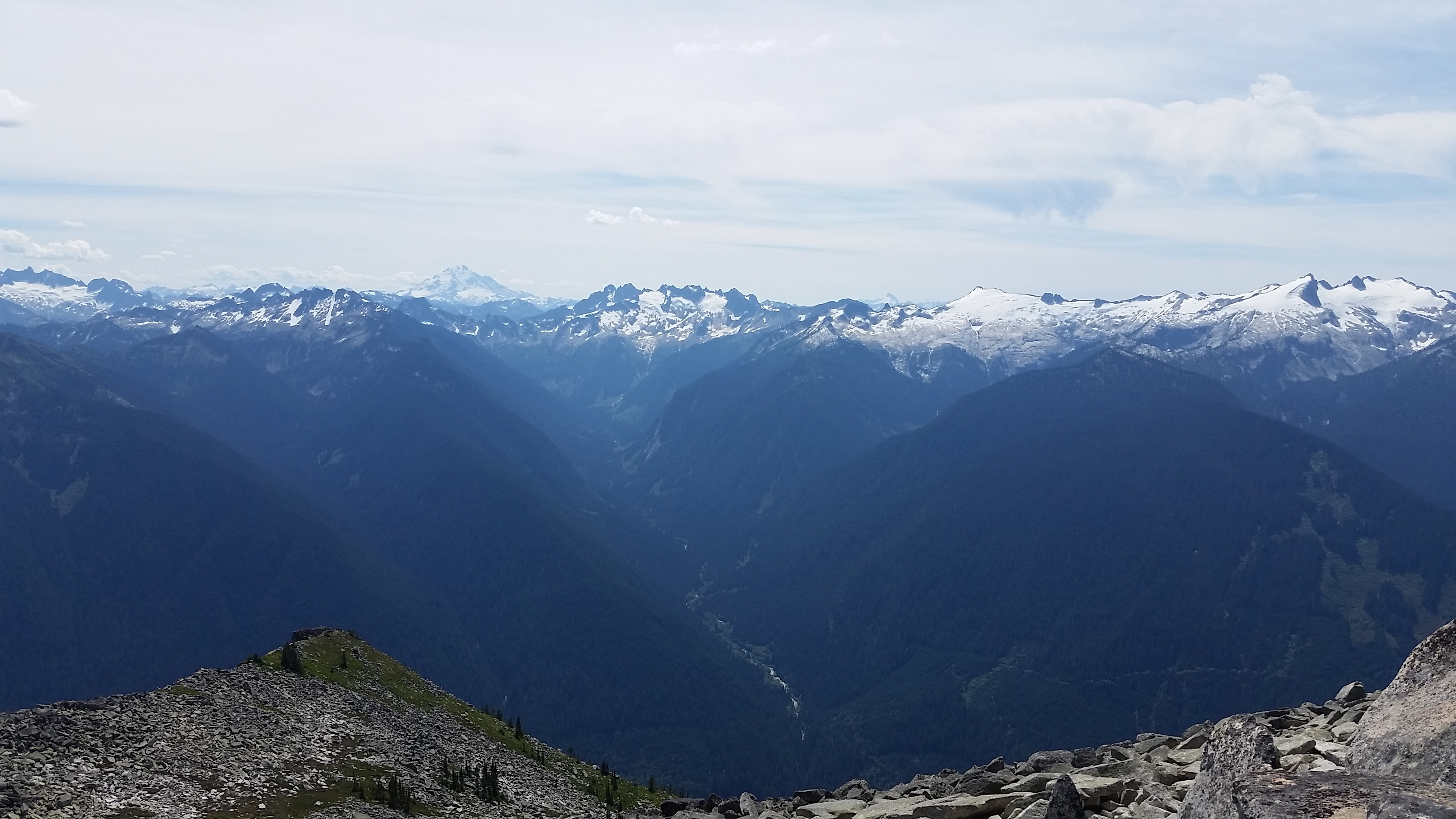
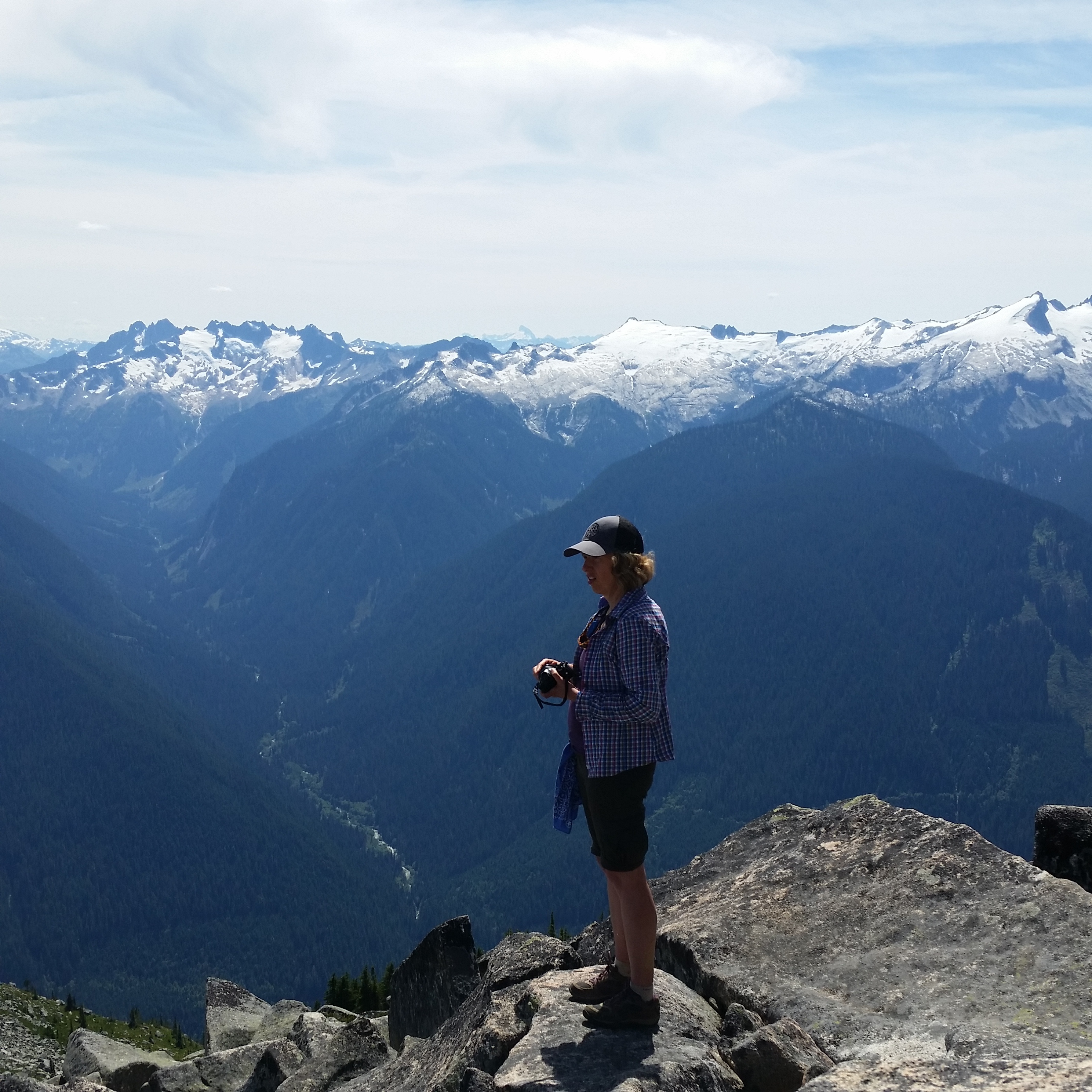
View to the South
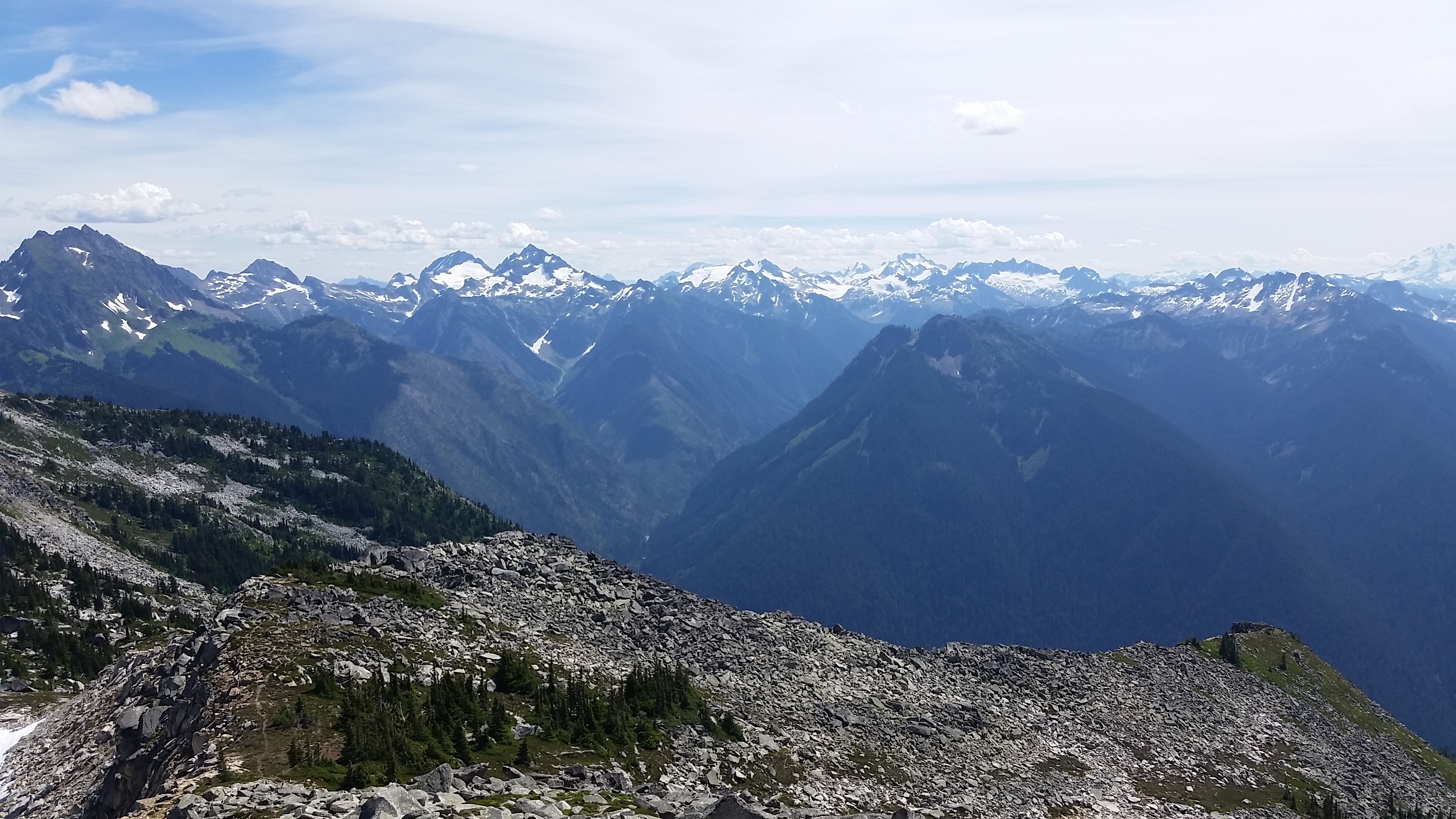
View to the Northwest

View to the East

The aforementioned crowds
Eventually, you have to leave though

Coming down a small snow field
Maybe take a selfie
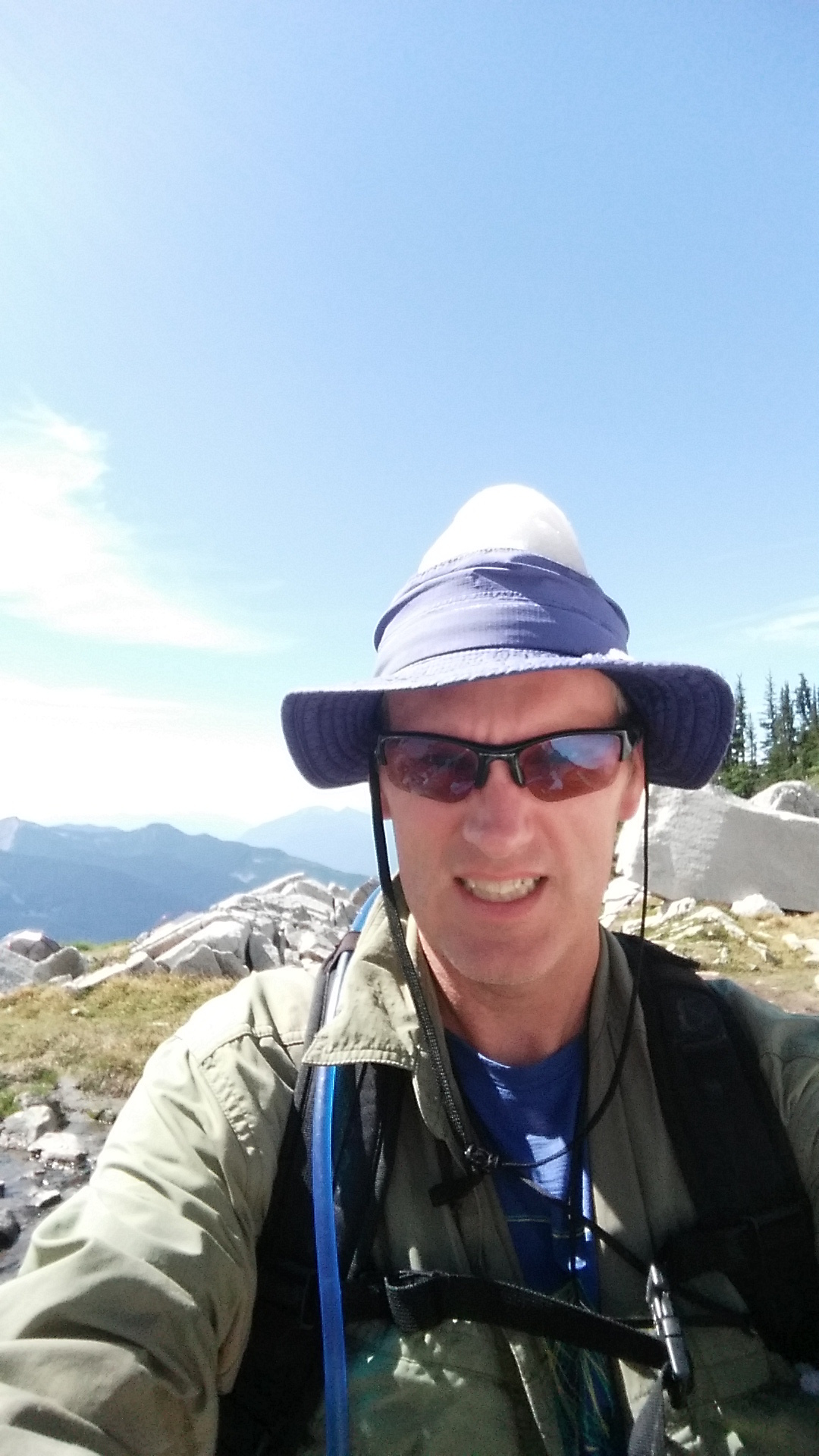
Enough snow for a cool hat
cc: @laura, @masterhiker, @seattlenvj, @kwesterhof