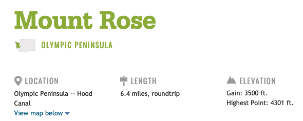
From its lofty perch above Lake Cushman and the southeastern corner of the Olympic Mountains, Mount Rose lures a steady stream of hikers May through October. That’s because, as Brian Pope from the Hood Canal Ranger District puts it, “Most of the trail is south-facing, which means late-fall and early-spring access in a typical year.” Indeed, while Mount Ellinor and other nearby peaks are still buried under a blanket of snow well into summer, Rose typically grants safe passage much earlier. Even after a cold spring, hikers can usually count on snow-free conditions all the way to Horse Camp at the junction with the summit loop at 3,050 feet. Of course, you’ll want to verify this by checking trip reports before you go.
Southern exposure. It’s going to be a hot one!
Directions
From Hoodsport, head inland on State Route 119. After 9.3 miles, you’ll reach a T. Take a sharp left on Forest Road 24. The pavement runs out 1.7 miles later, but you’ve only got one more mile to go to the trailhead, which is on your right. Parking is free at the small parking lot. One privy is available at the trailhead.
This was a 2.5 hour drive so we got an early start at around 5:30. The forecast told us this was going to be the hottest day of the year so far so we didn’t want to start too late.
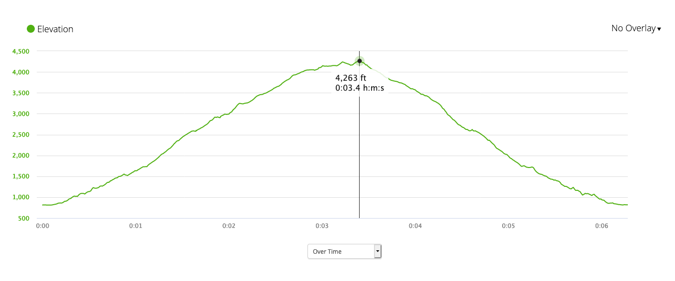
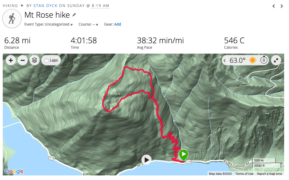
The story of this hike is the elevation gain so let’s show that first.
It starts going up almost immediately and never really stops. One of our hikers turned back before the first mile (wasn’t feeling well).
No views to speak of for most of the trip. At about 1.85 miles you get to a junction that starts the lollipop loop. The clockwise direction is steeper and shorter going up. There were a few kids at the junction with us who went up the clockwise direction so we decided to go the counter-clockwise way.
There were many reports of bees swarming in that part of the trail so I was prepared to bail if there were too many but I never heard more than one at a time and they mostly left me alone.
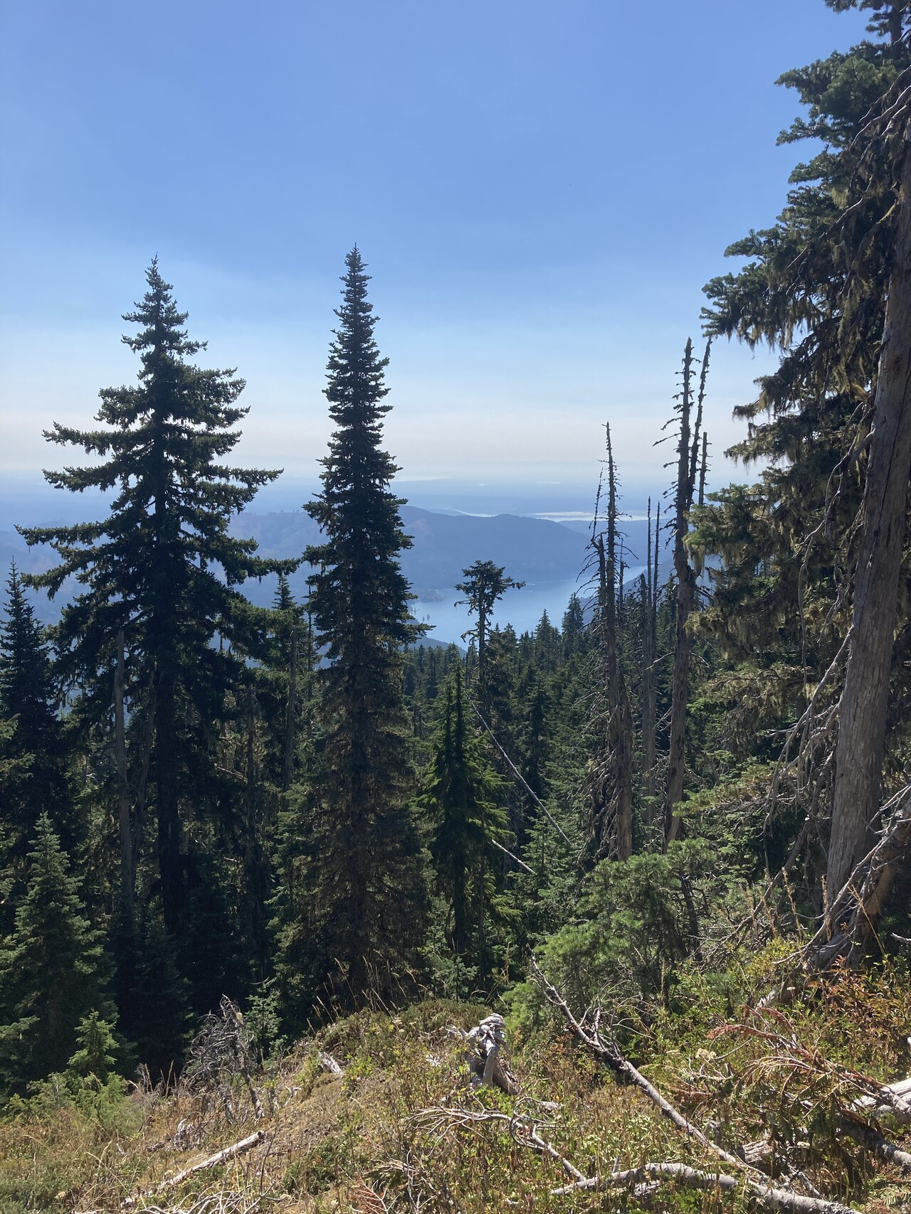
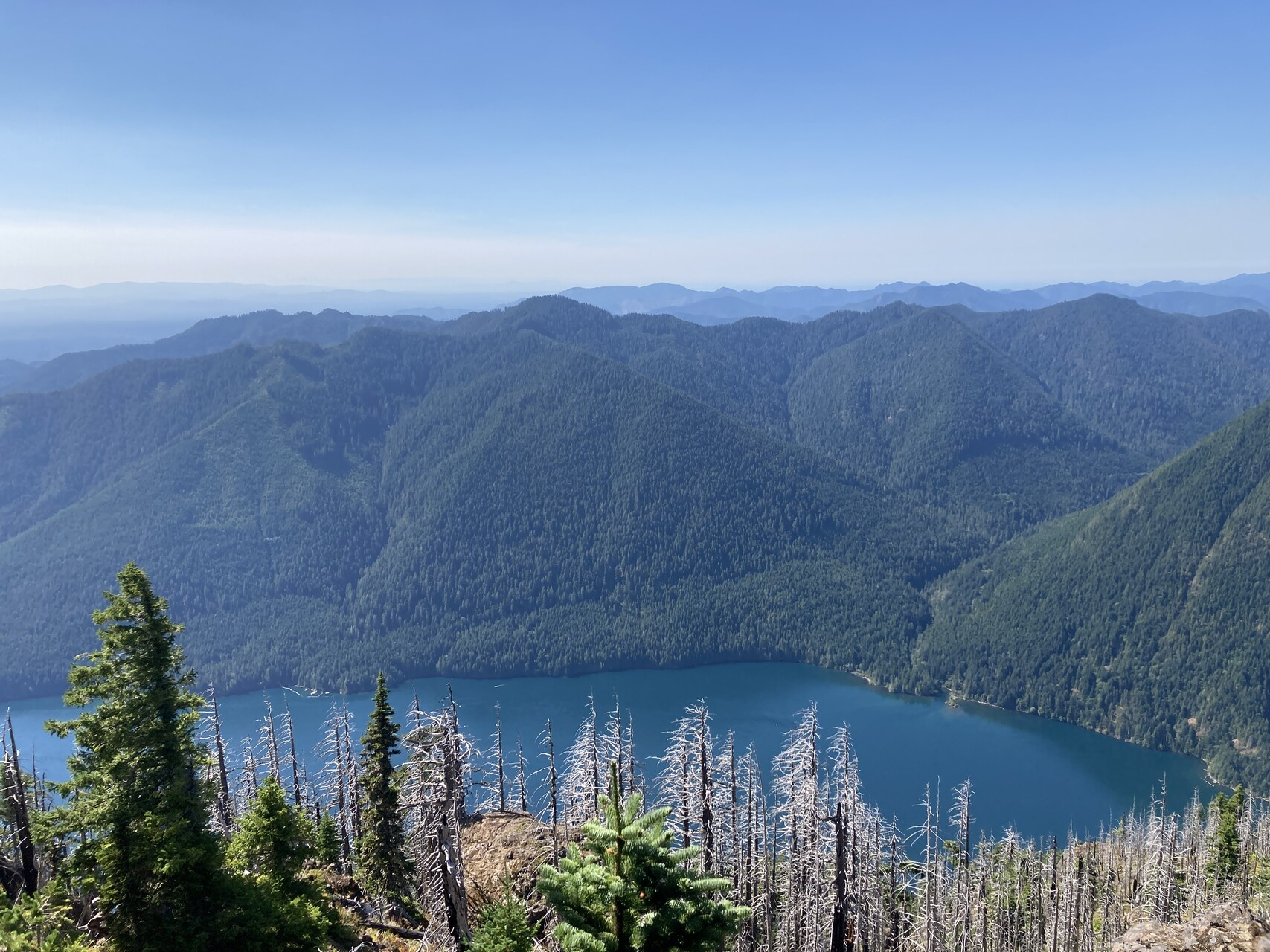
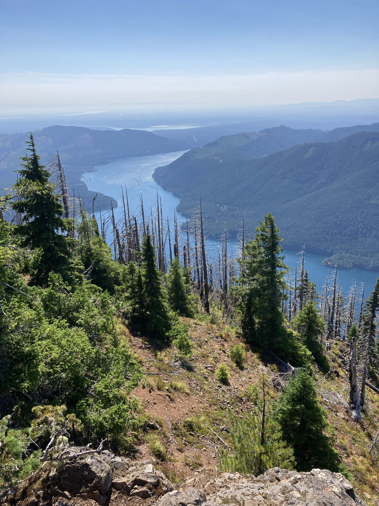
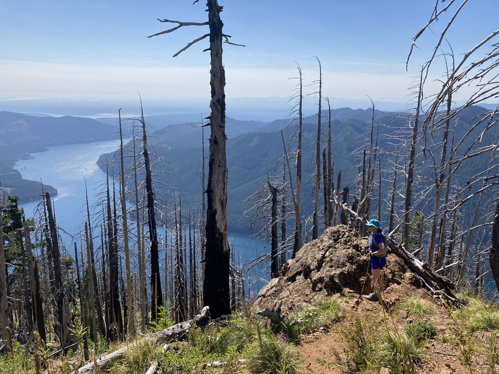
The counter-clockwise path is longer and less steep. It gains a ridge at about 4000 feet so it levels out a bit in the last 2 thirds of a mile. You finally get some views when you get to the ridge.
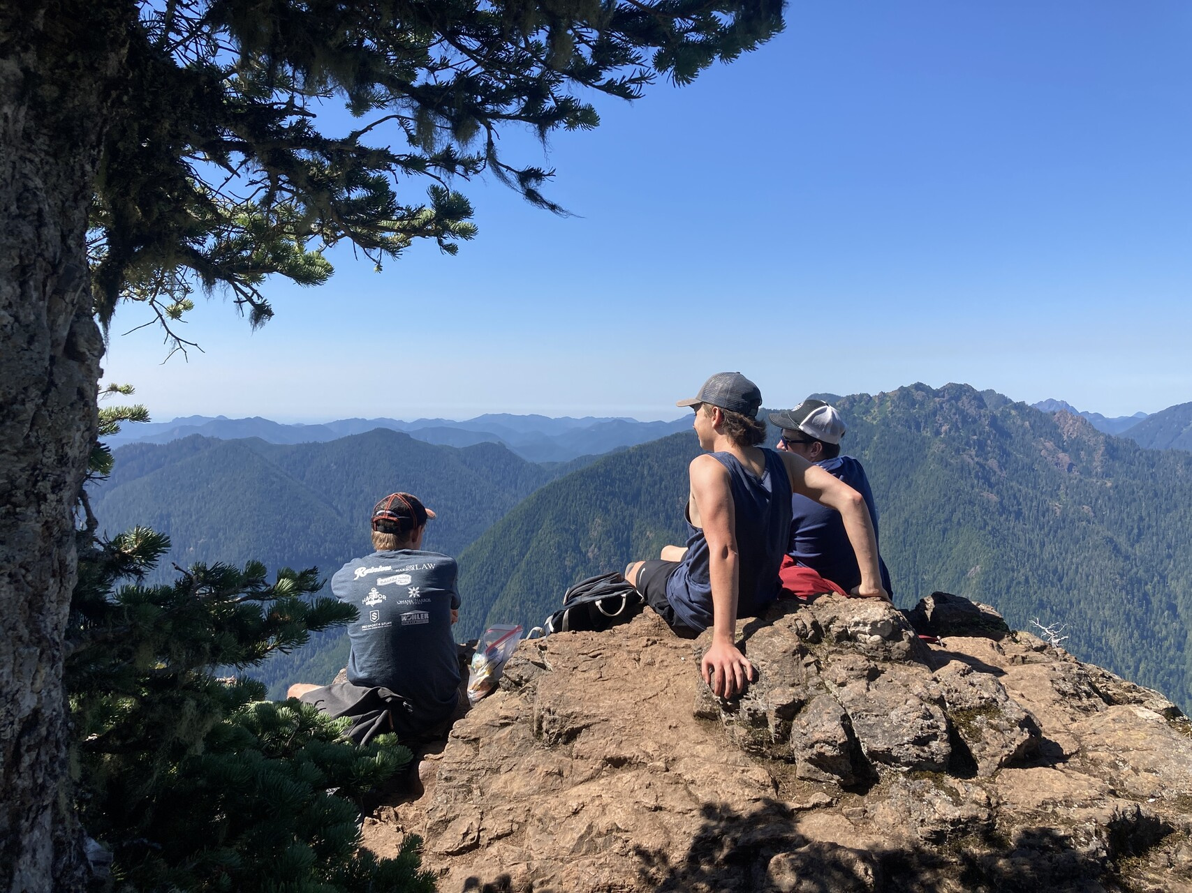
By the time I reached the summit I had lost everyone except Mary. Such was the day. There was a rock outcropping that overlooked Lake Cashmere to the south so we took advantage for lunch.
We rejoined the rest of the party just below the lollipop junction and headed back down. It was hot and I was pretty worn down by the end.
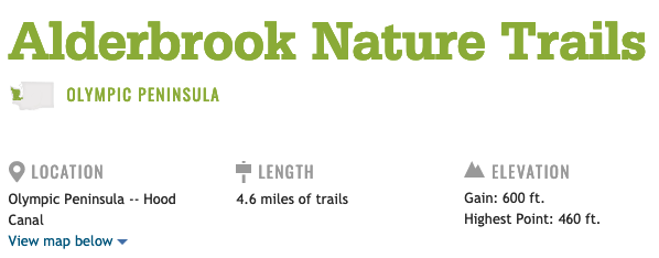
We were planning on some nature trail hiking at Alderbrook but we bailed on that and spent a few hours on Steve & Rhea’s deck with some cold beverages and salty snacks. Much appreciated.