I’ve been lucky to visit a lot of magnificent places over the years but one place I had never been to until this year is the Grand Canyon in Arizona.
We got an opportunity to do some backpacking there with some friends. It was a fantastic trip.
I’ve been lucky to visit a lot of magnificent places over the years but one place I had never been to until this year is the Grand Canyon in Arizona.
We got an opportunity to do some backpacking there with some friends. It was a fantastic trip.
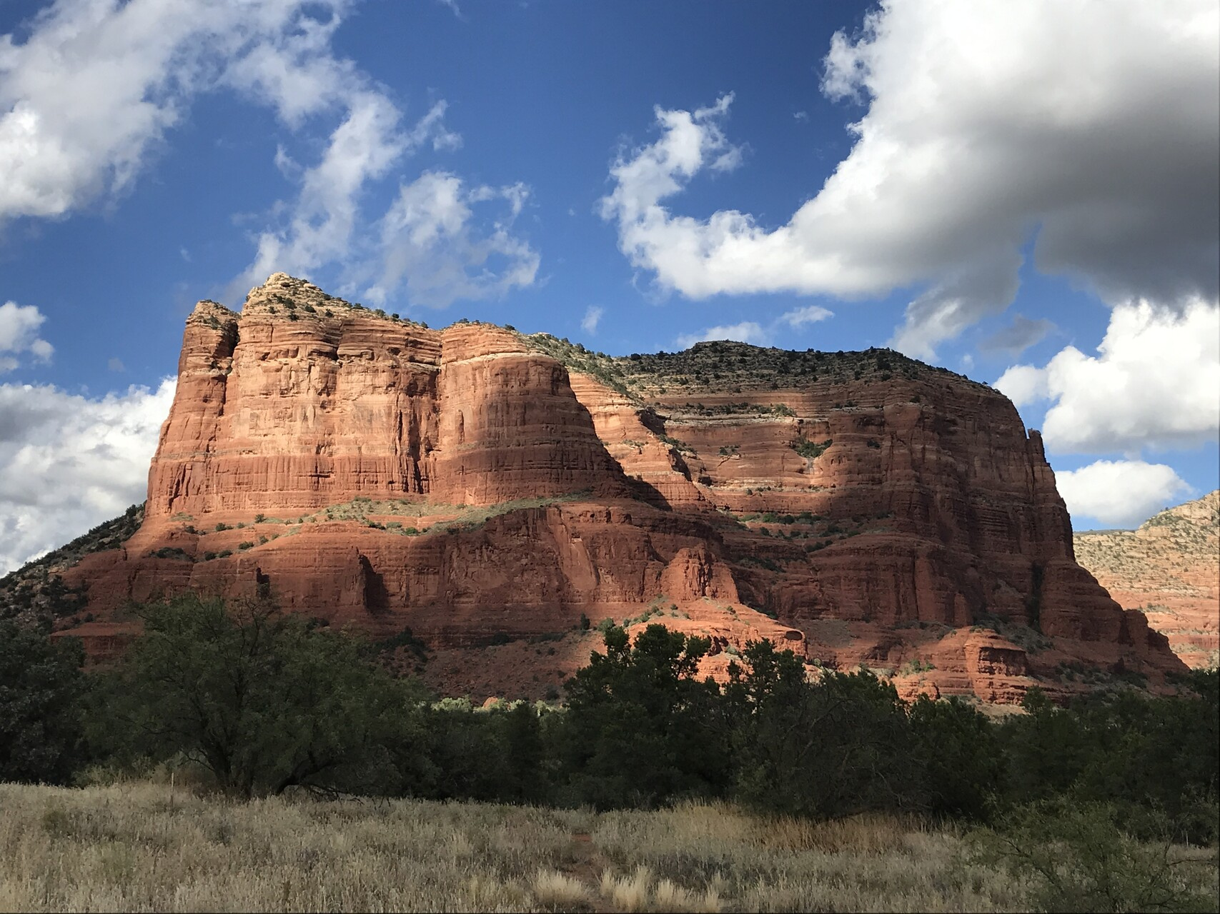
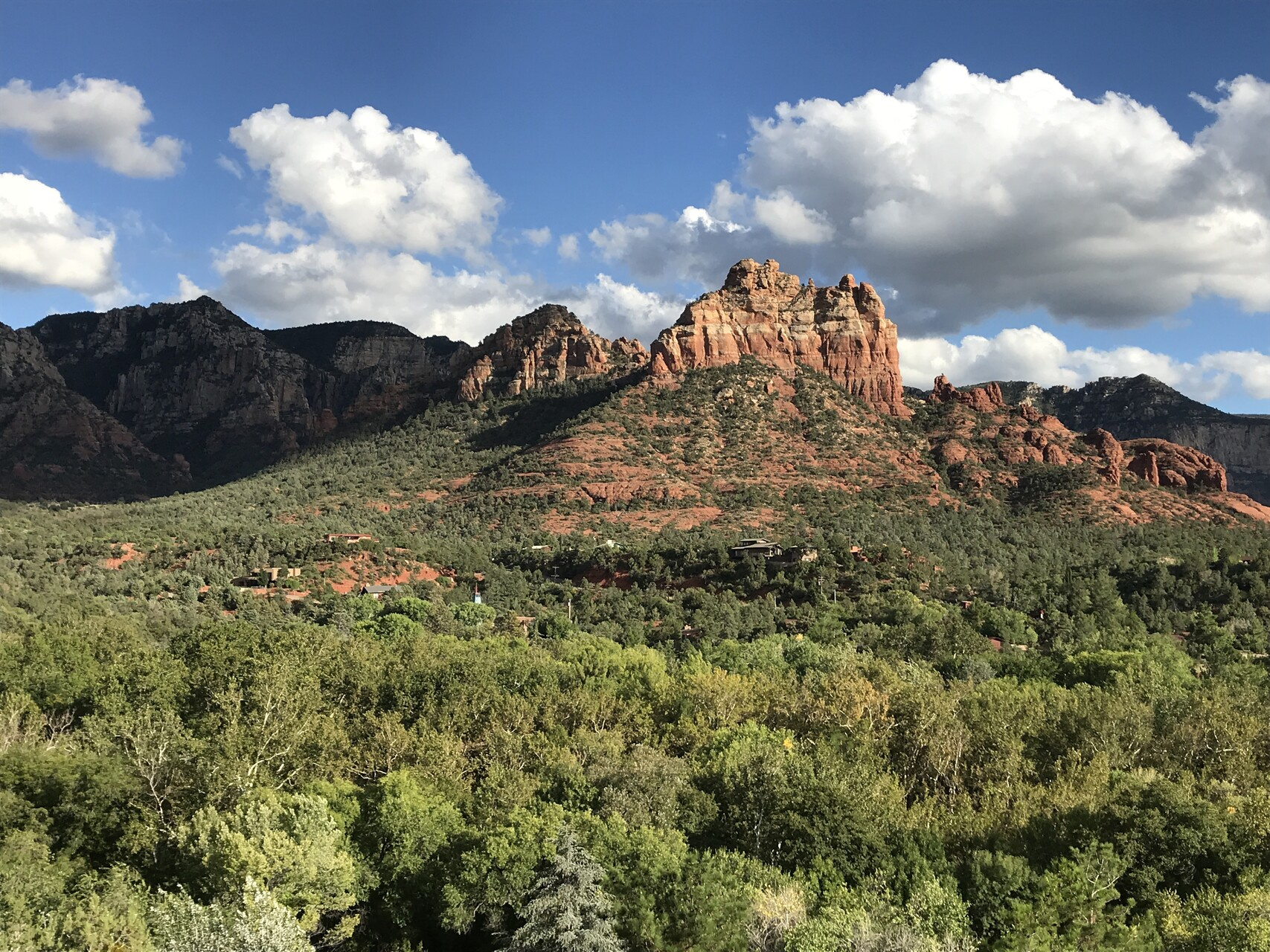
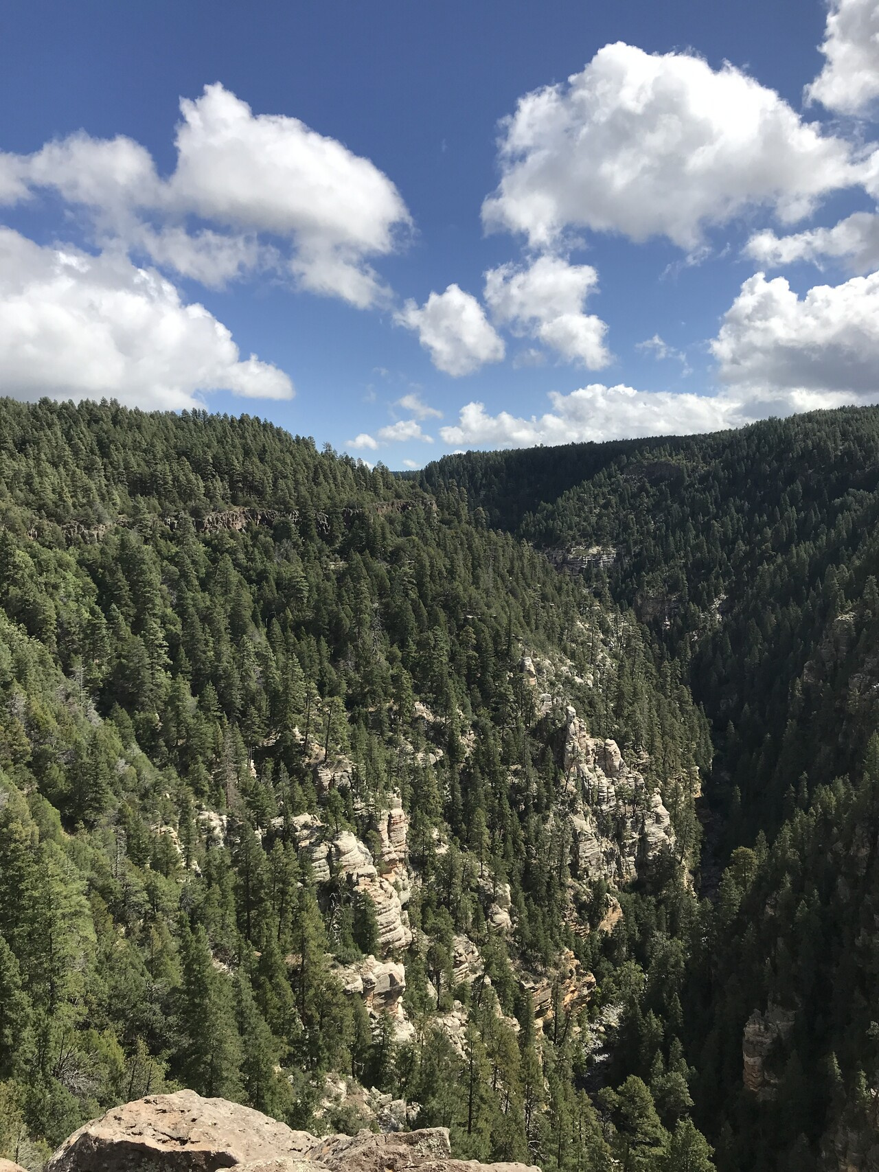
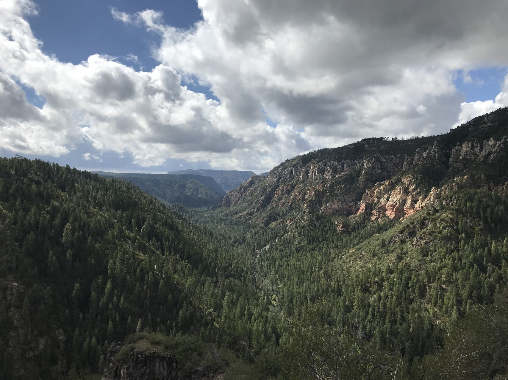
We flew in to Phoenix on Saturday the 28th and drove up to Sedona for the night. Sedona is a nice town in a beautiful setting. The best part though were the dramatic skies when we were there.
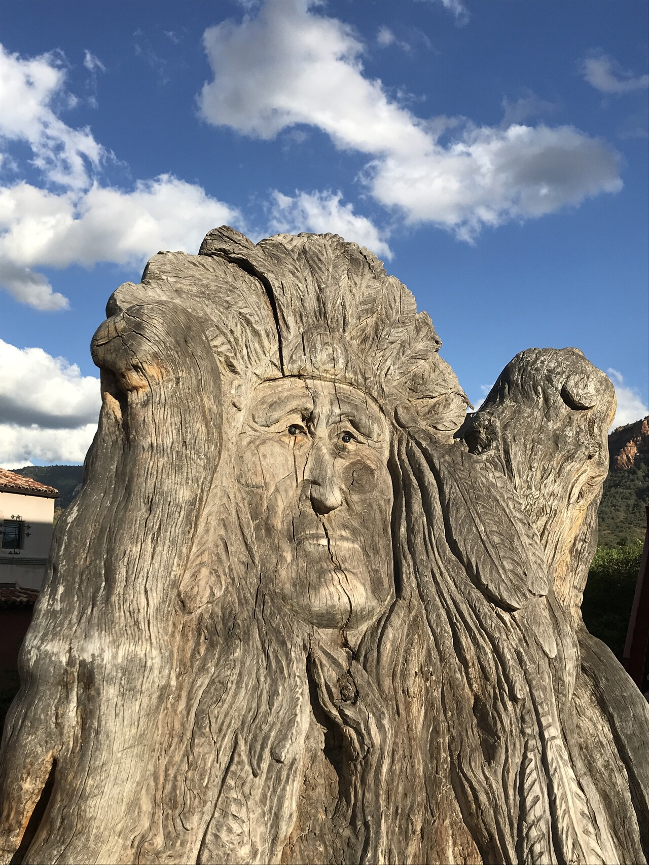
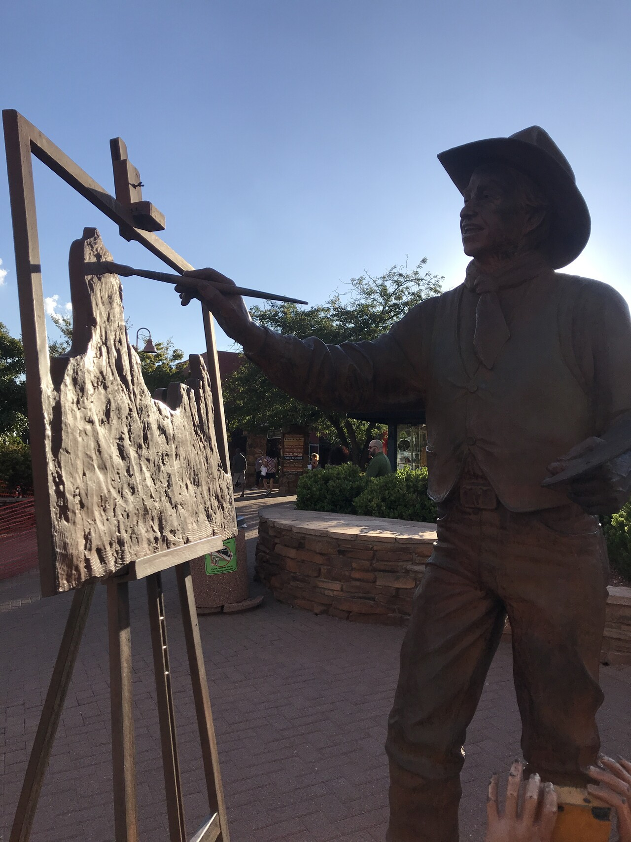
After taking in the Vortex  we went into town for some dinner and sight seeing.
The next day we drove up to Flagstaff to get provisions for the trip
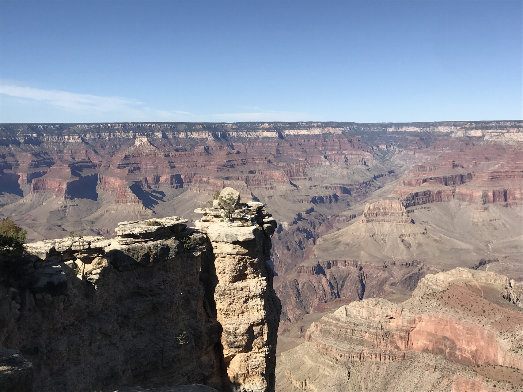
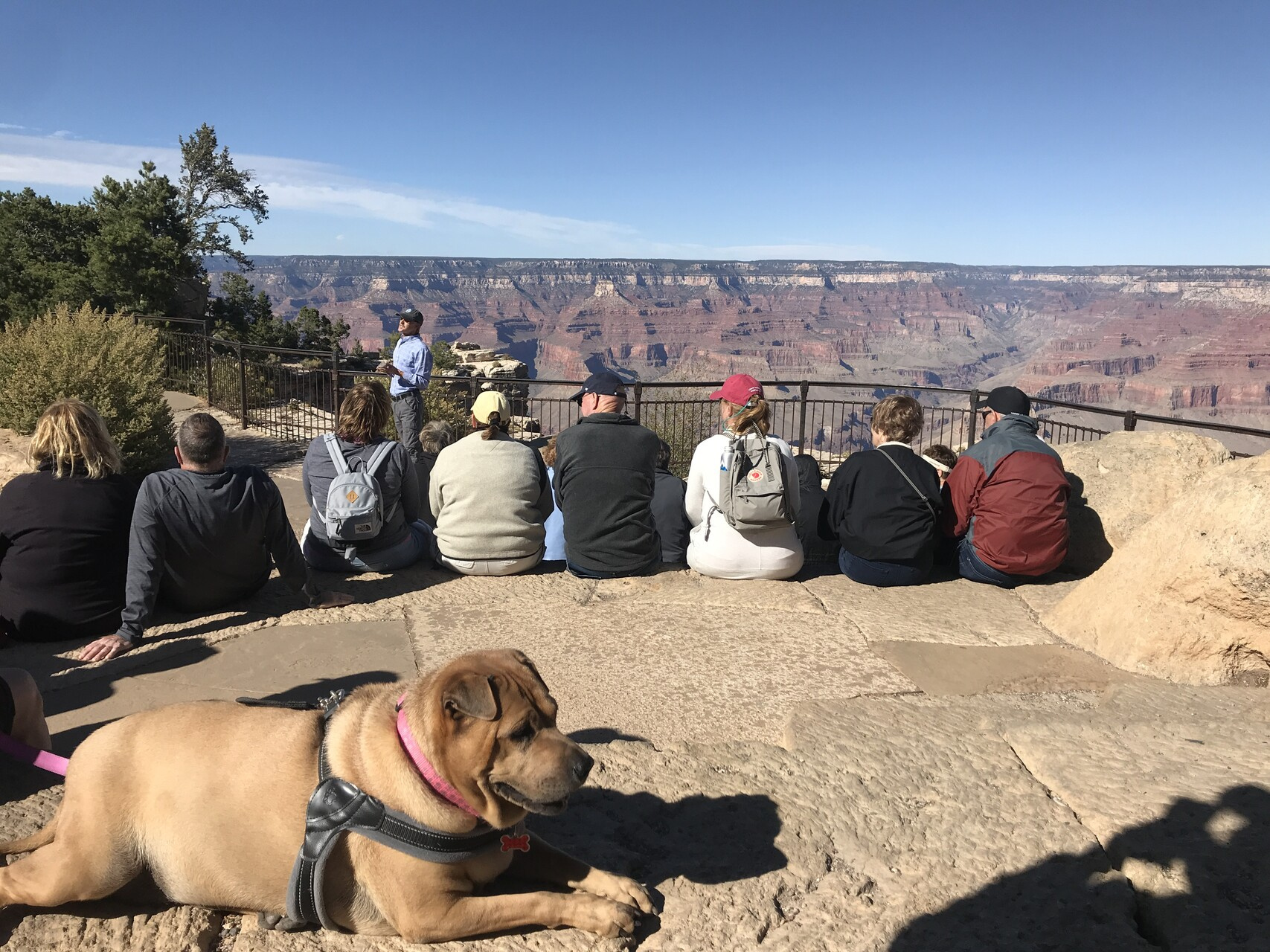
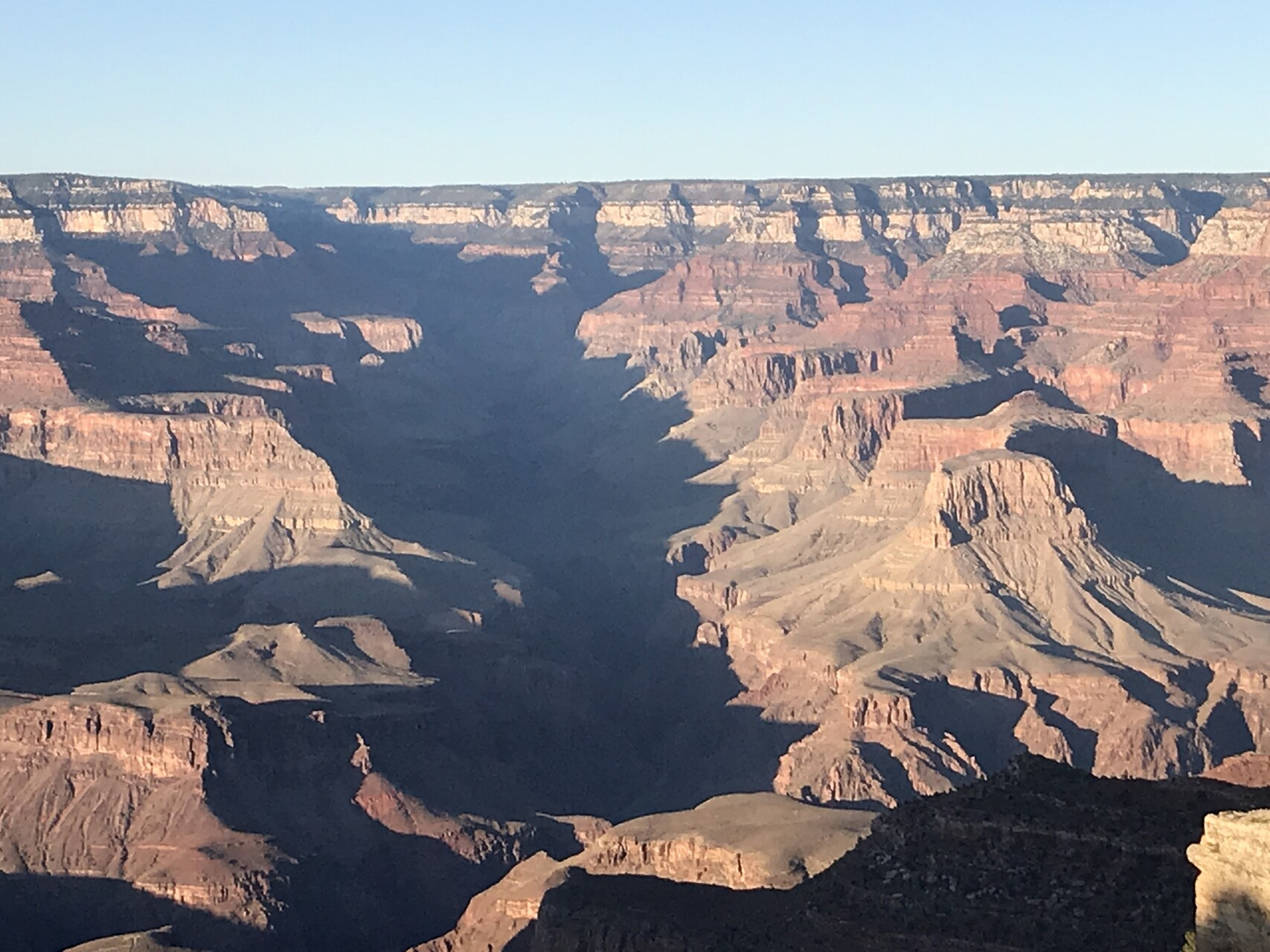
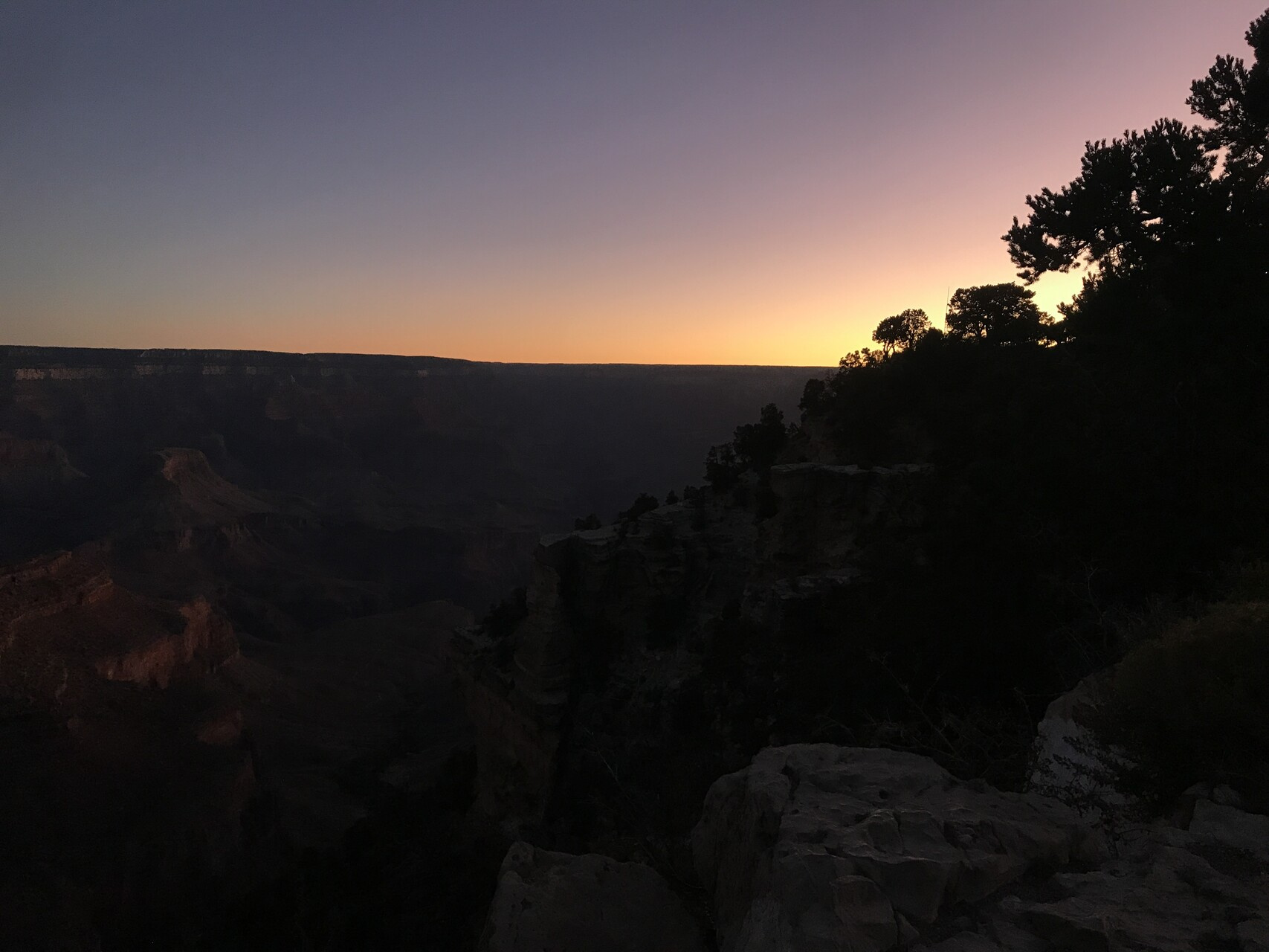
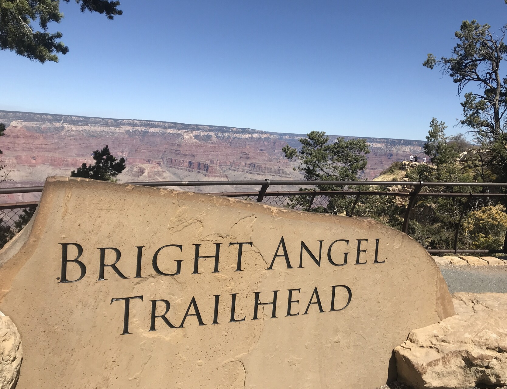
and then up to the Grand Canyon National Park. I got my first look
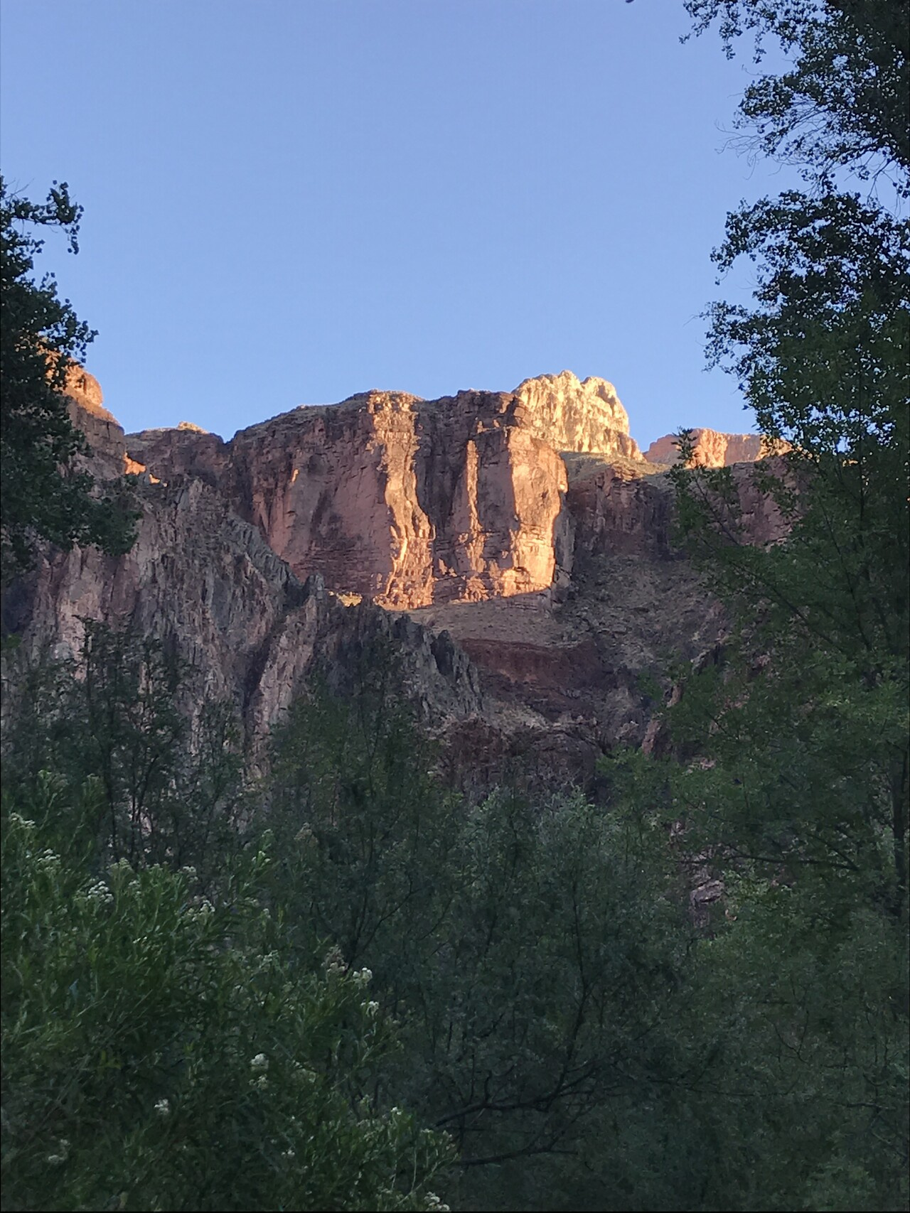
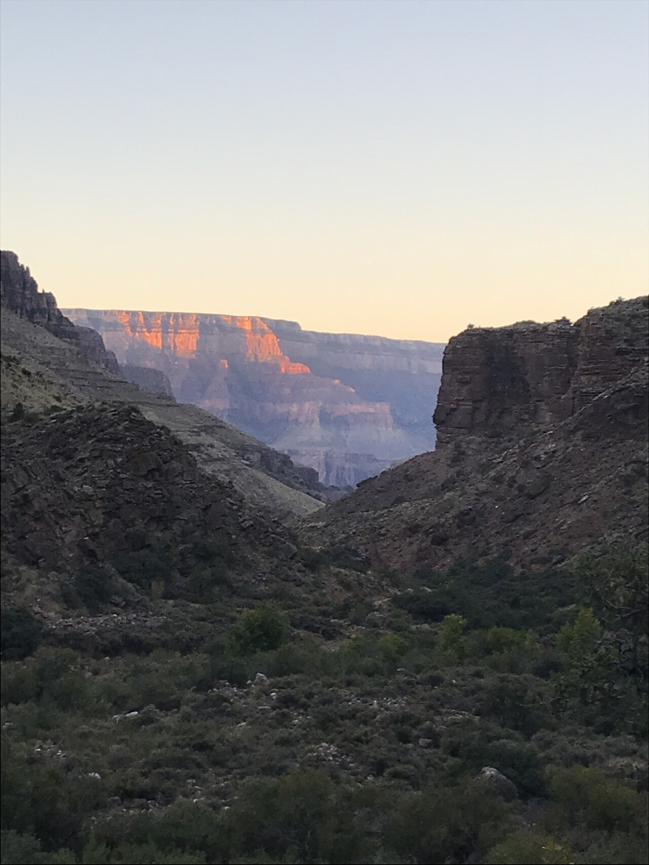
Down there is Phantom Ranch. Our destination for tomorrow.
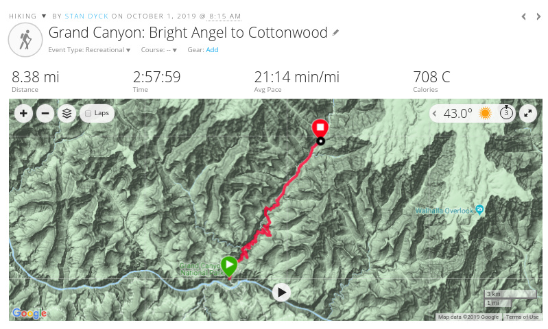
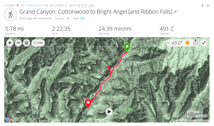
First, some logistics about the trip. It was 5 days and 4 nights of hiking from the South Rim to the North Rim and back. The first day, we went on the South Kaibab trail from the South Rim down to the Colorado River staying in Bright Angel Campground next to Phantom Ranch.
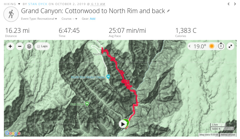
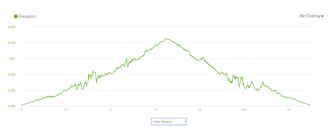
The second day we hiked north about 7 miles to Cottonwood campground, about halfway up to the North Rim. We set up camp there and hiked up to the North Rim and back on day 3 (about 15 miles).
On day four we hiked back down to Bright Angel Camp and spend another night there, and on day five we hiked out to the South Rim on the Bright Angel trail.
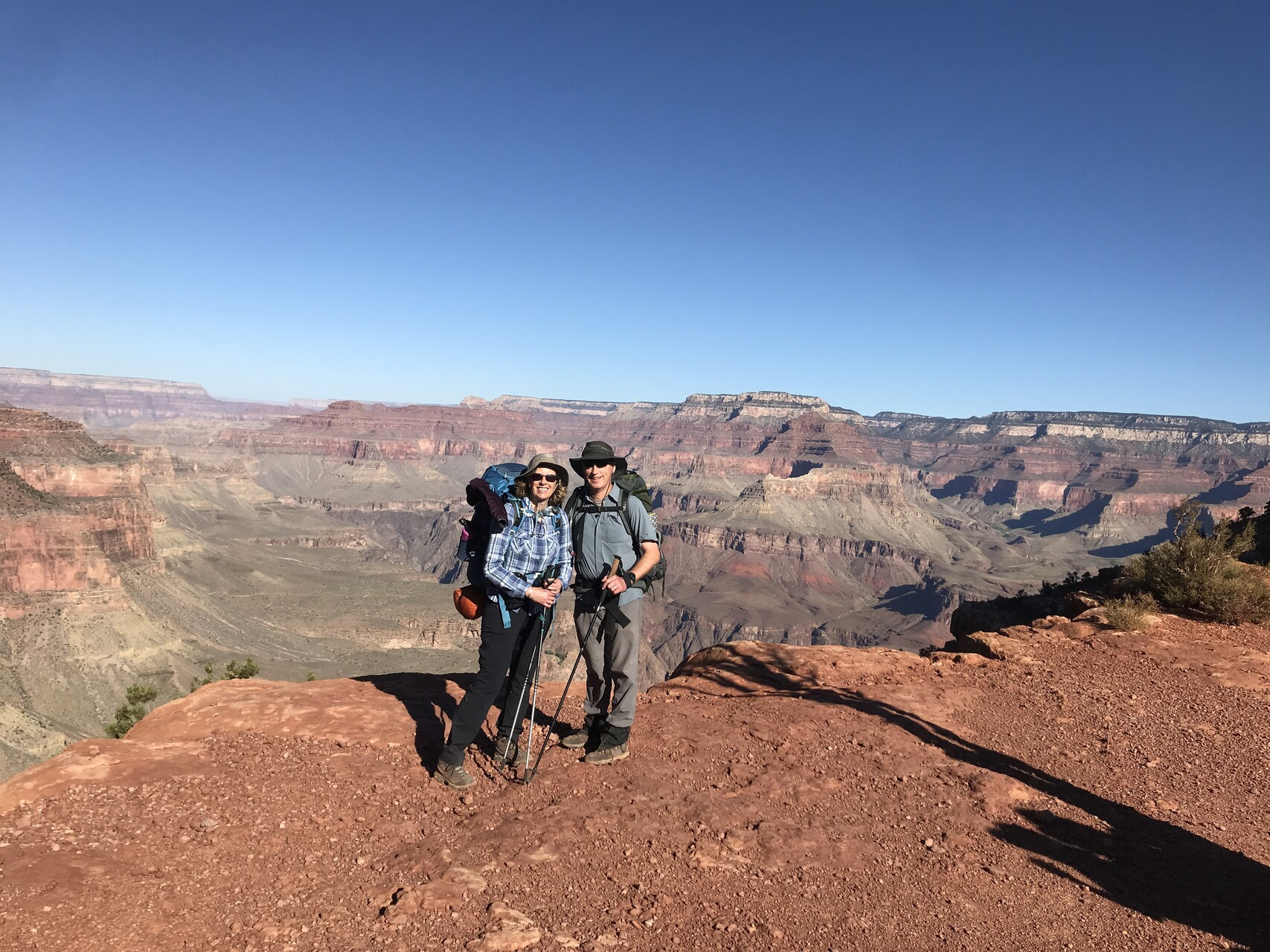
I should mention that we would have done none of this without the super organizational skills of my friend Kelly, our hike leader. She is a veteran of Grand Canyon trips and handled all kinds of things for us from planning the route, securing permits, making hotel reservations, and car rentals (plus driving). I am so happy and thankful for her friendship (and her husband Matt too!).
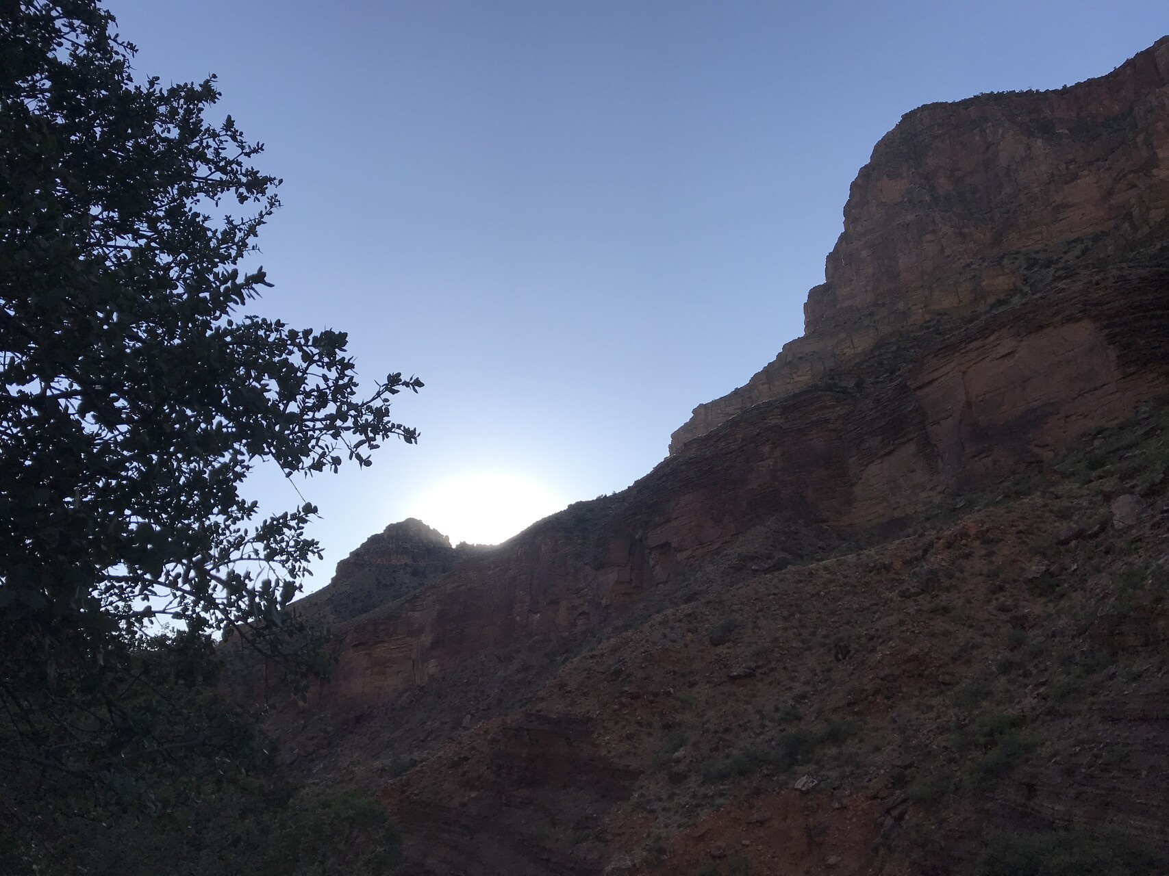
The first day was going to be one of the hardest. It was a lot of down climbing (about 5000 feet) with full packs and no water available along the way. That meant I was carrying about 10 pounds of water in addition to all my gear in my backpack.
The plan is always to start early and finish before it gets hot.
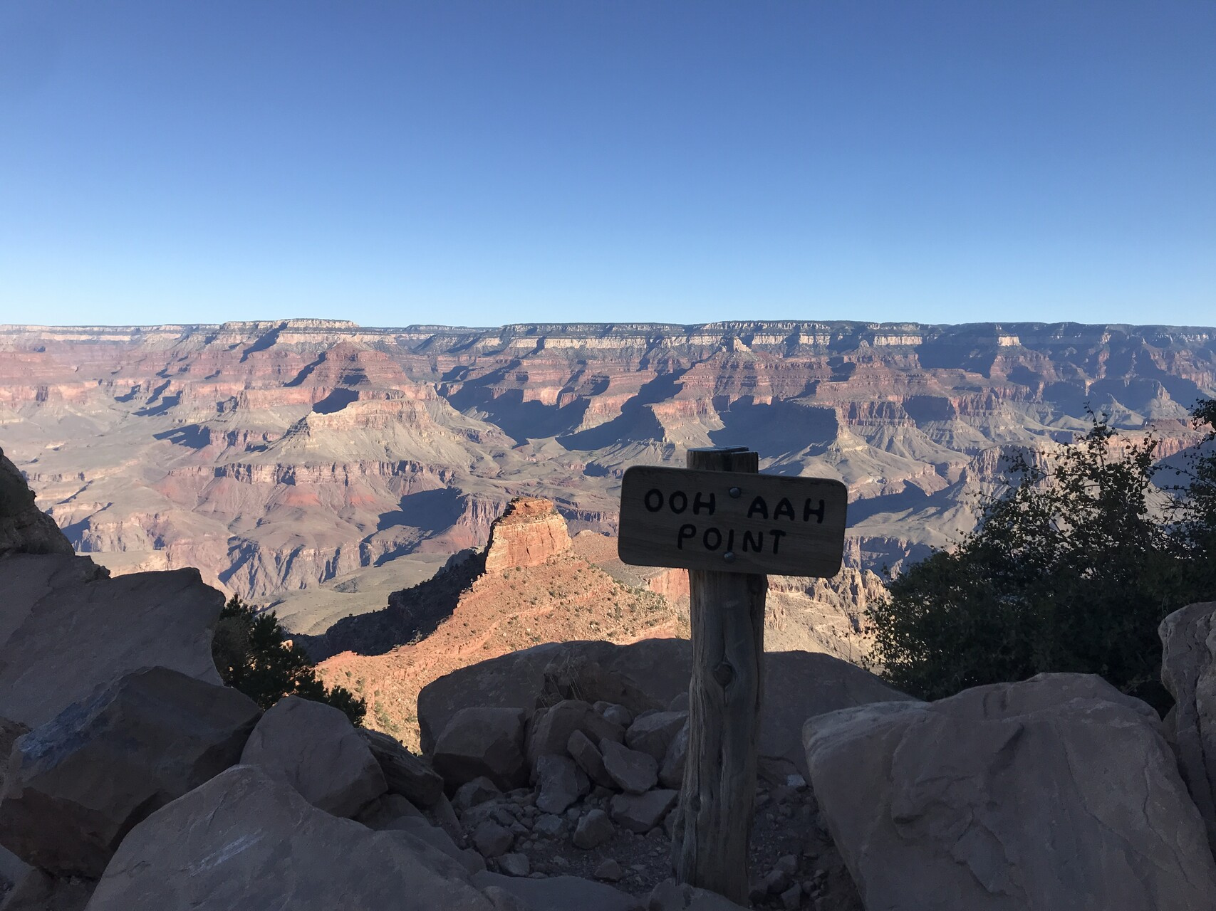
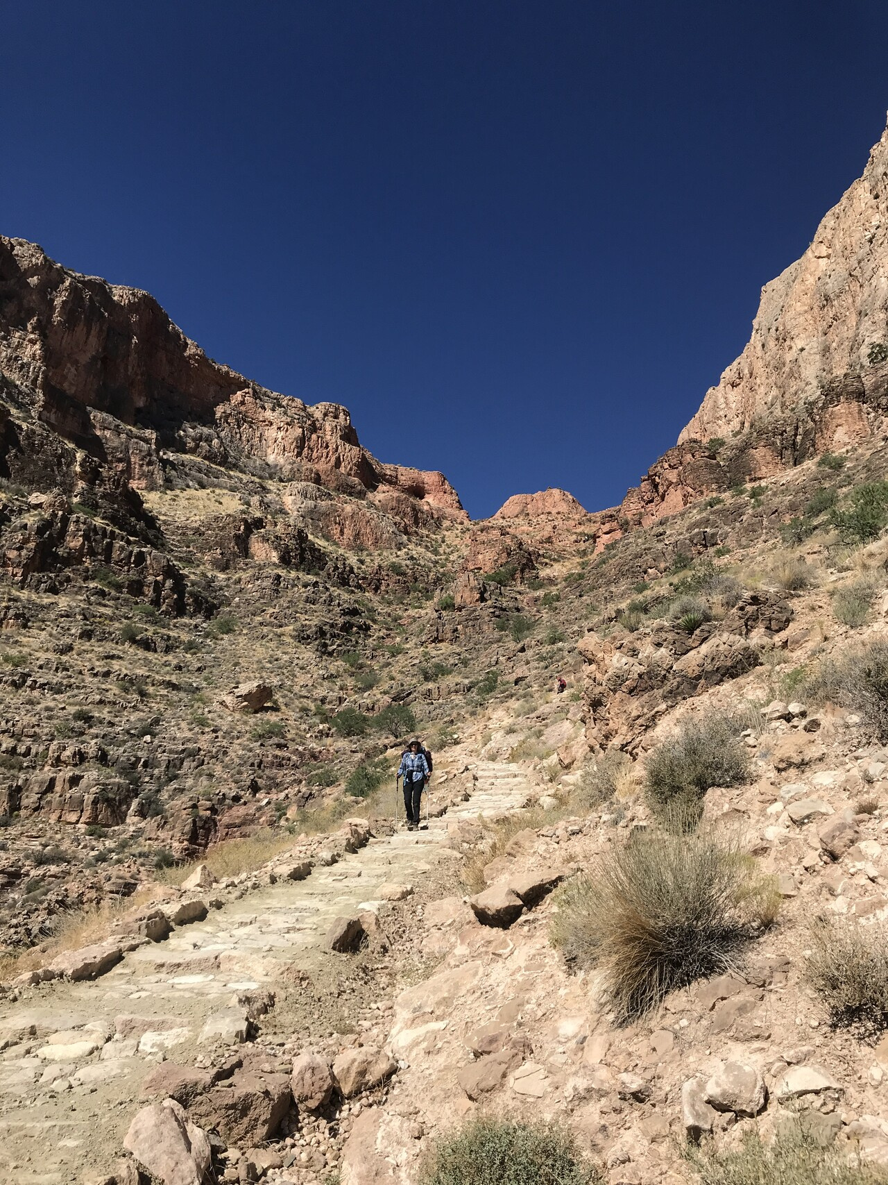
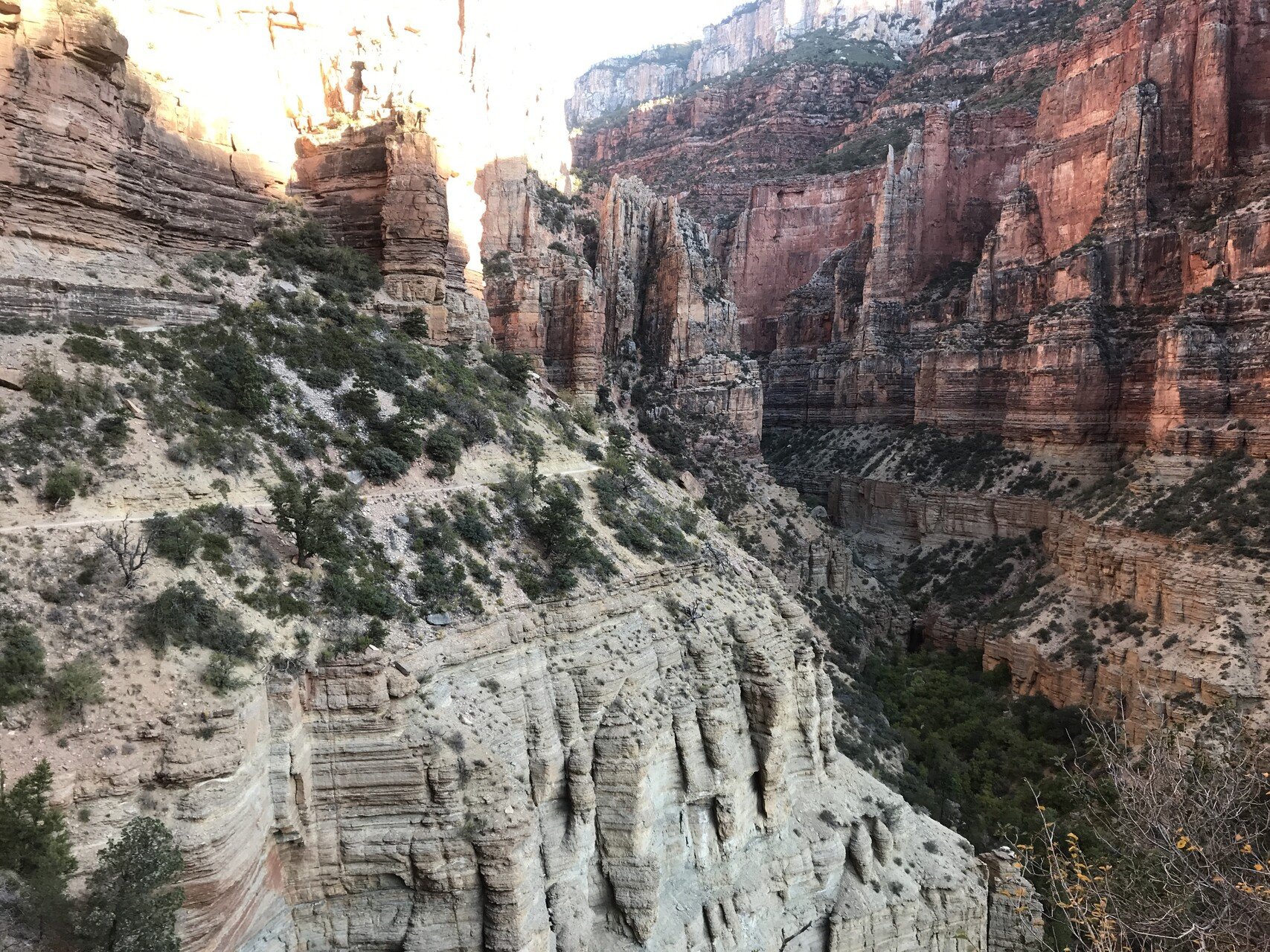
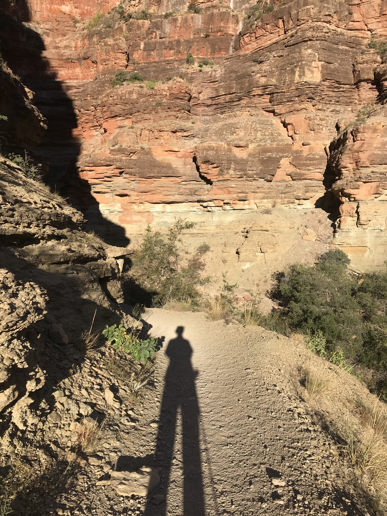
It was quite cool at the Rim in the morning (in the 50s) but as you go down it gets hotter. The trail is wide and clearly marked the whole way.
and of course the views are superb.
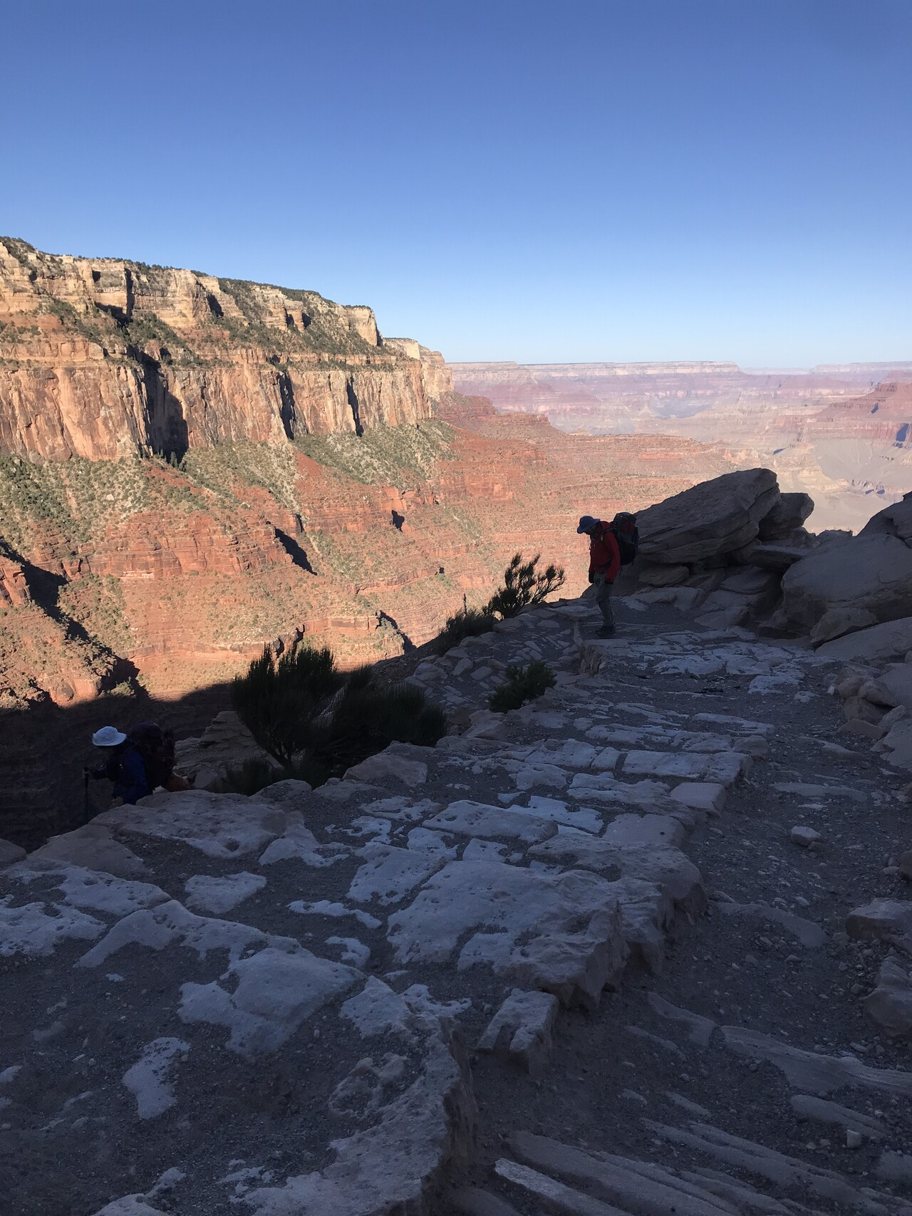
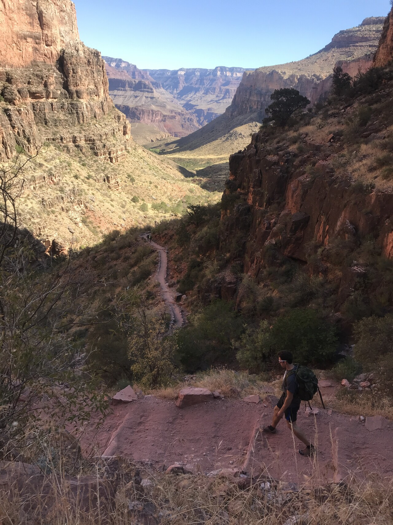
The climbing down is not hard on your lungs or heart but your legs and knees take a beating. When we reached a place called Skeleton Point, Laura had a fall, landing on her knees. Luckily, it was only some scrapes and a bit of bleeding and nothing more serious. A bit of first aid was all that was needed.
Proceeding from Skeleton Point we ran into a group on their way up. I took a photo after they had passed above us
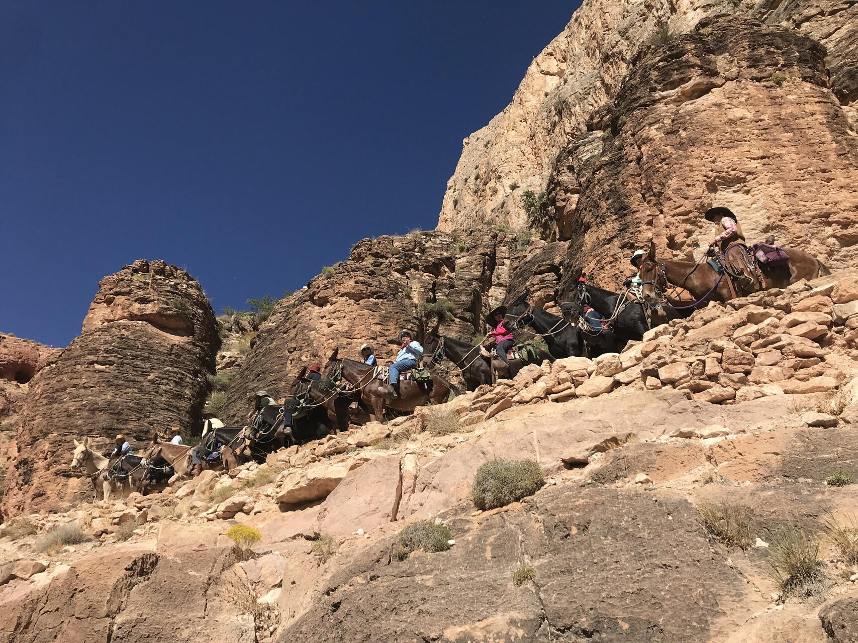
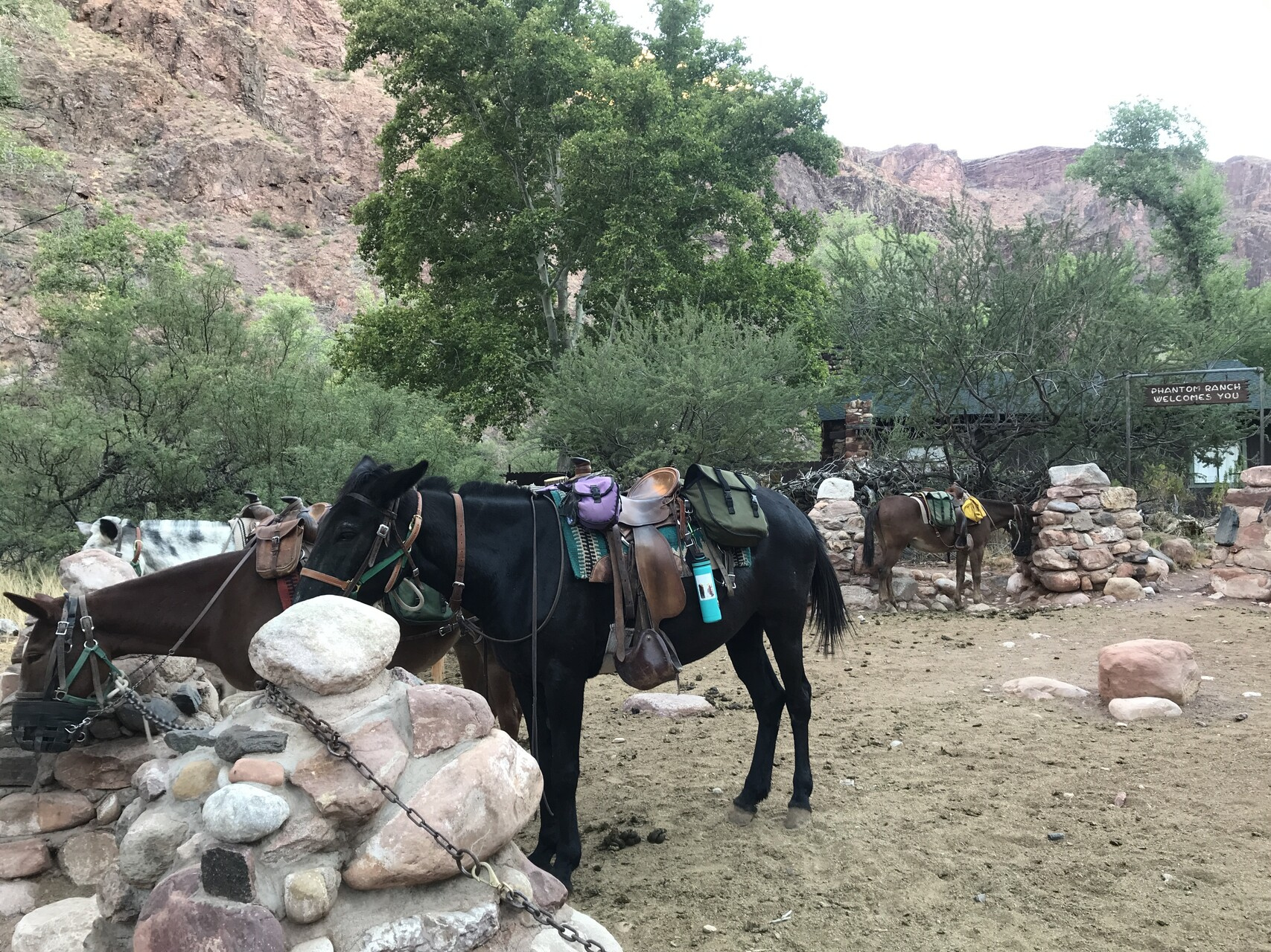
Mules are still one of the best ways to move people and stuff up and down the canyon. I don’t think I’d want to try it though.
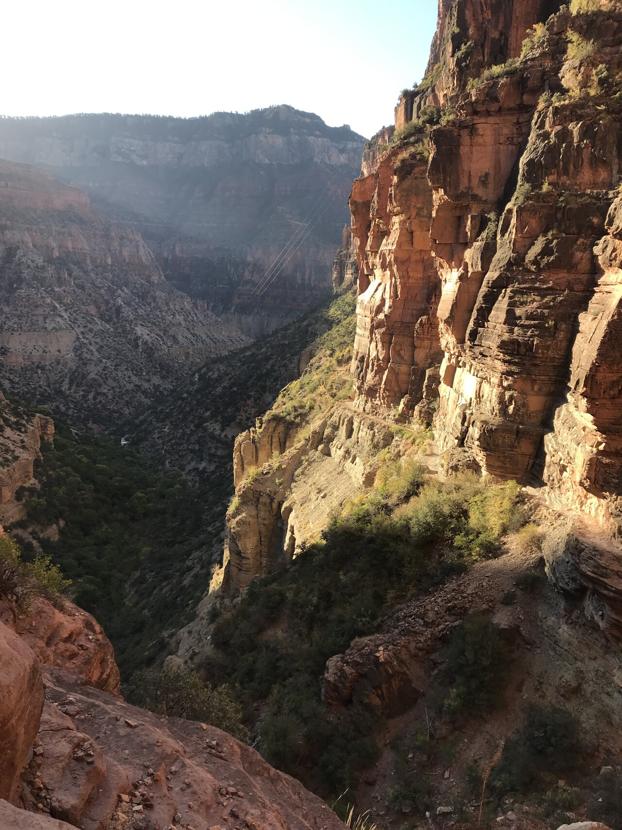
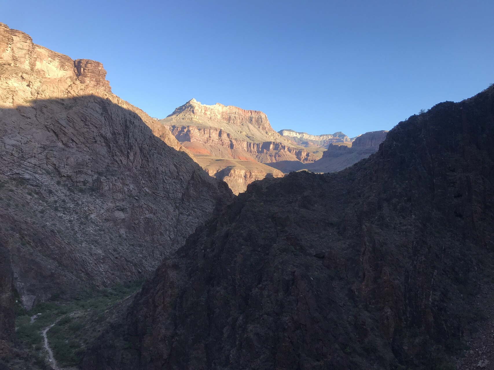
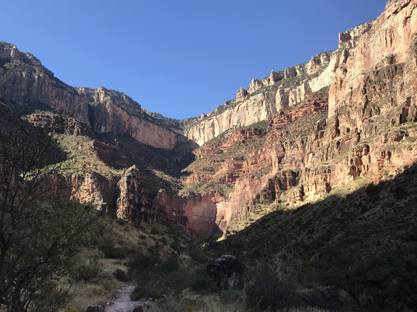
About halfway down you get to a trail crossing called The Tipoff where the South Kaibab intersects the Tonto Trail. There is a bathroom there. From there you start descending to the “inner canyon”.
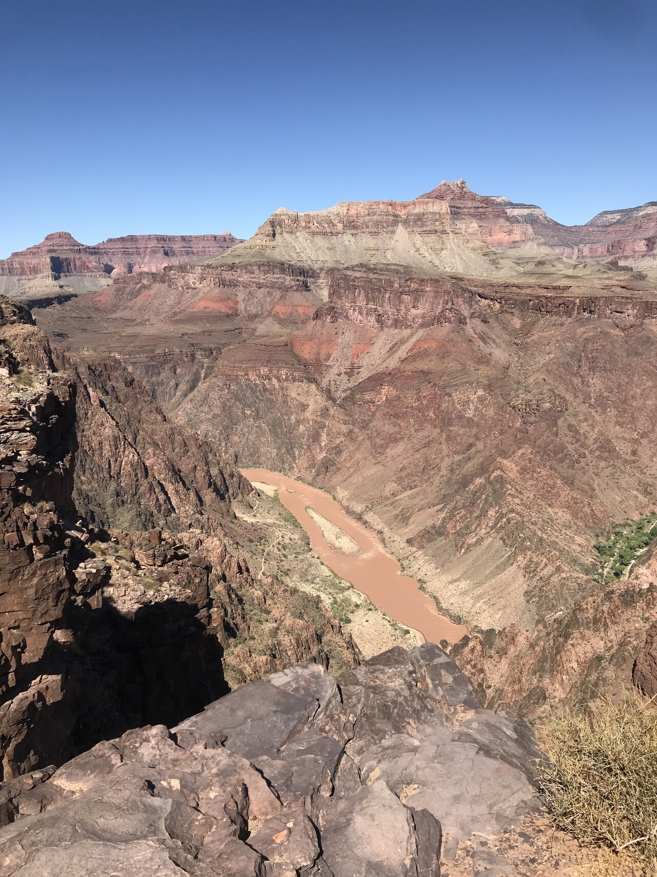
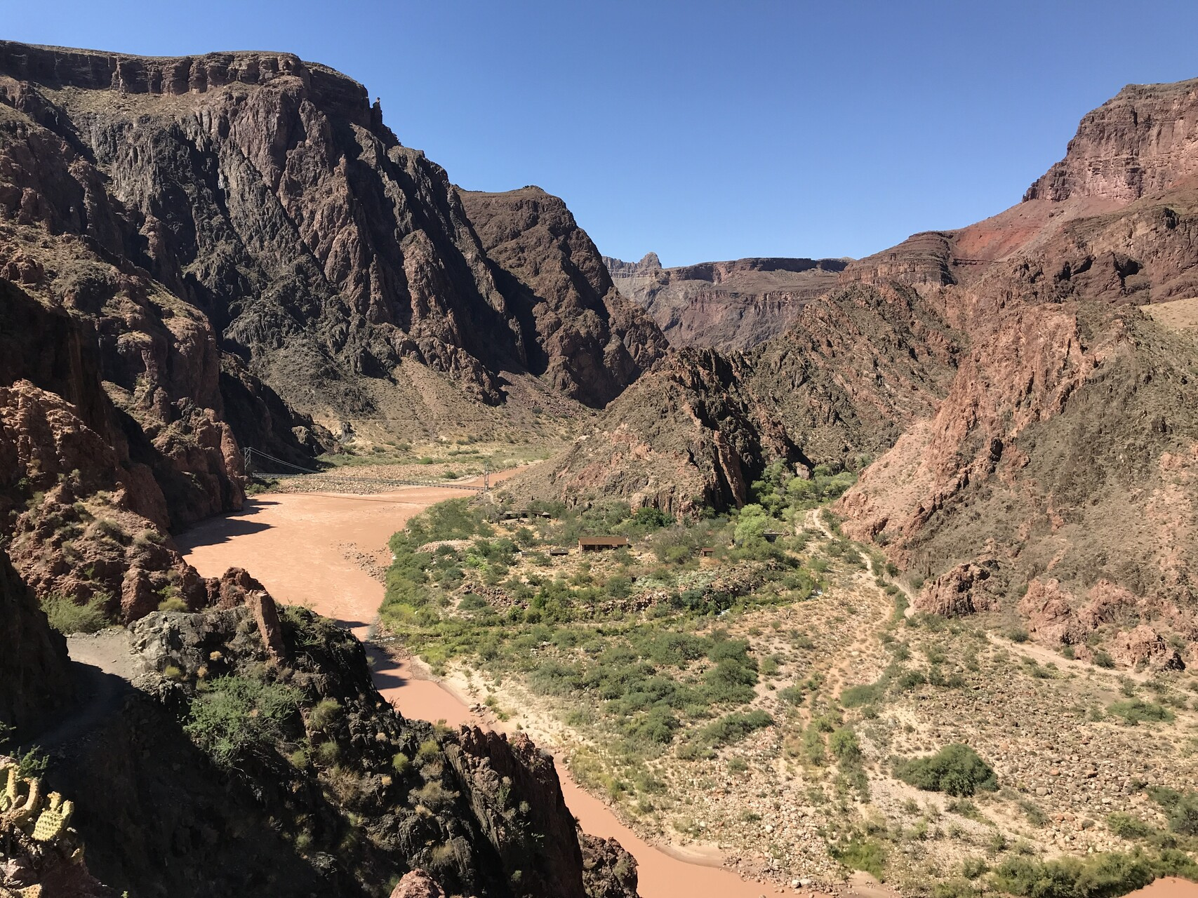
And you get your first glimpses of the Colorado River.
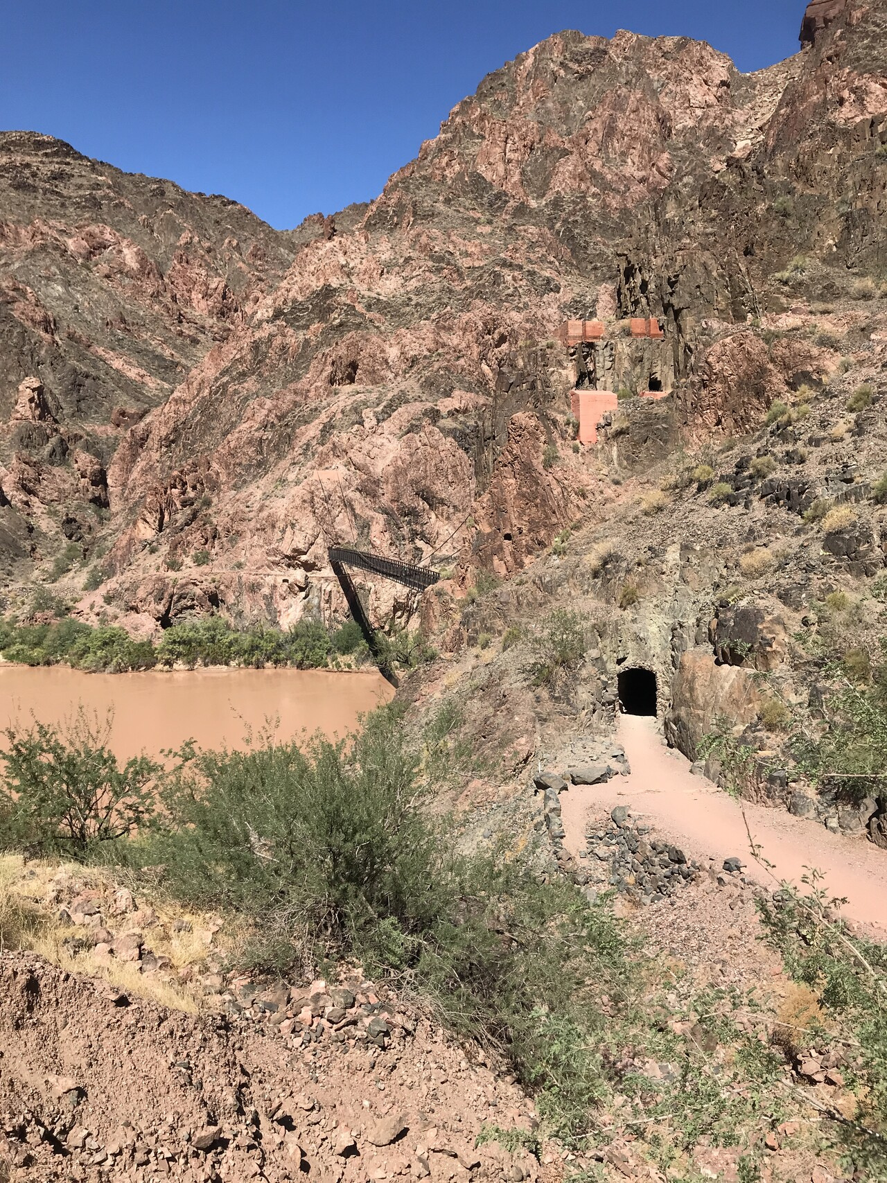
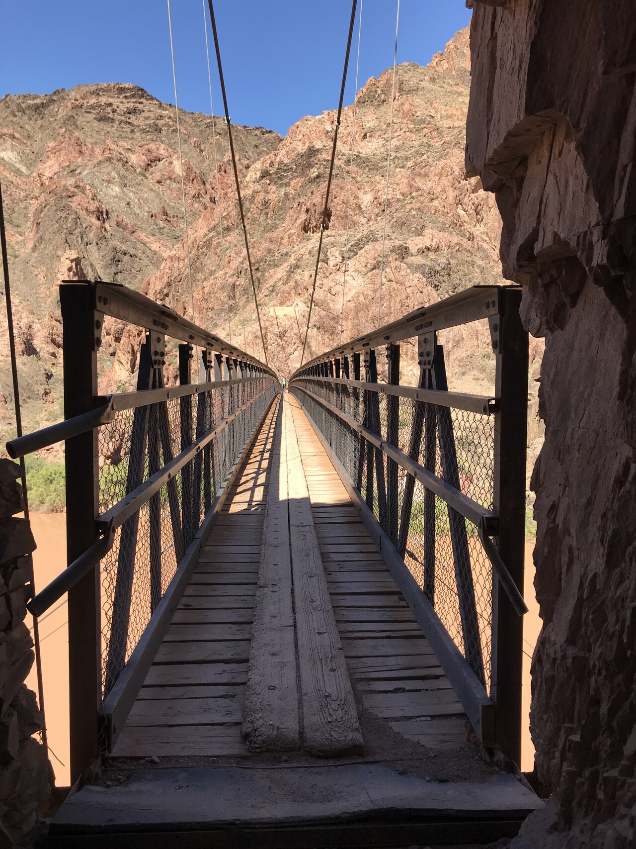
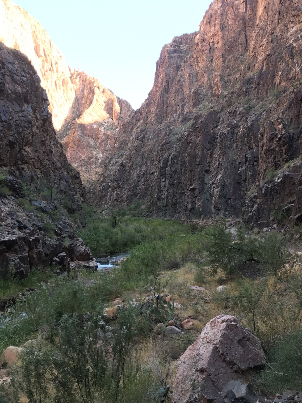
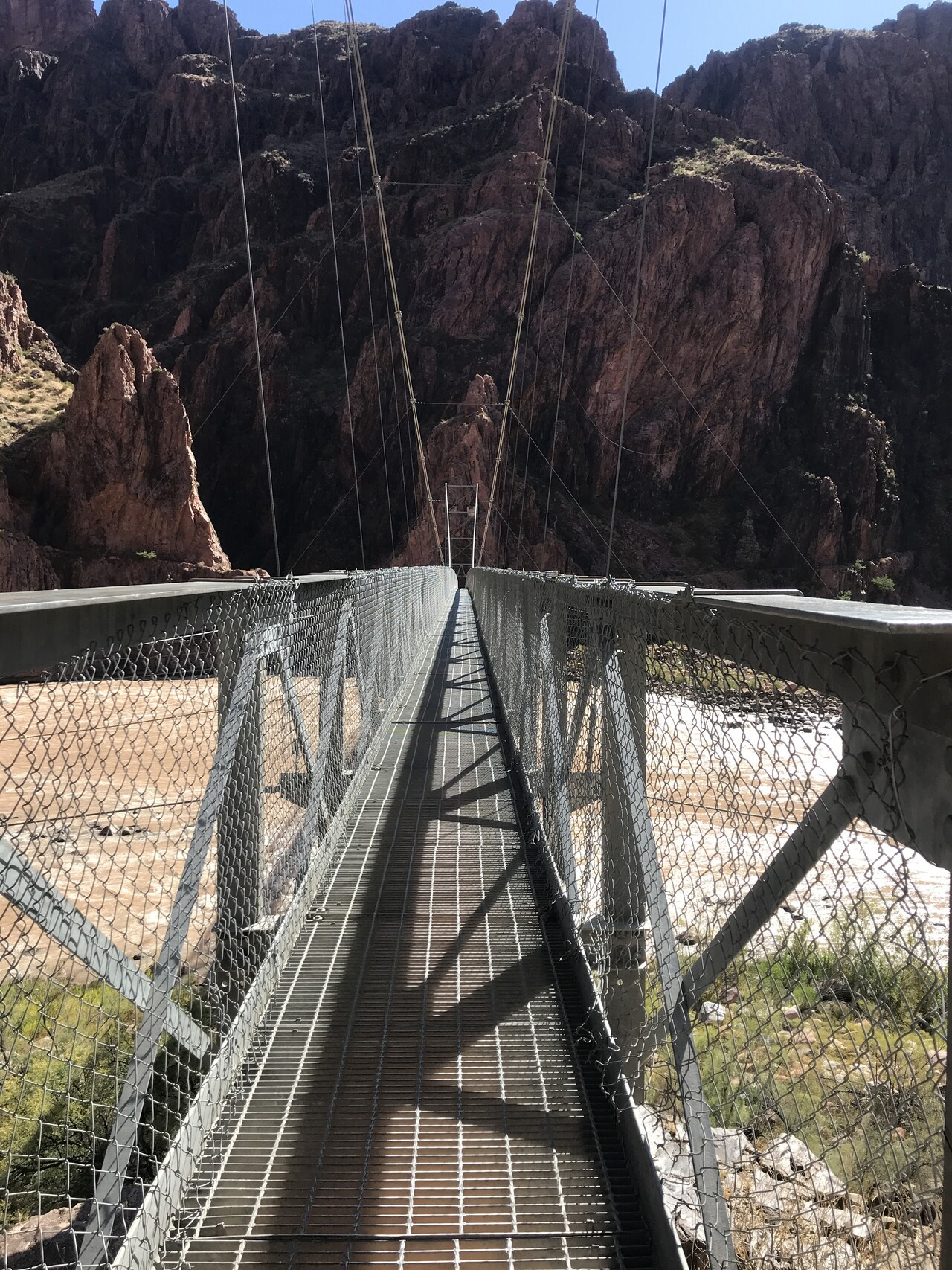
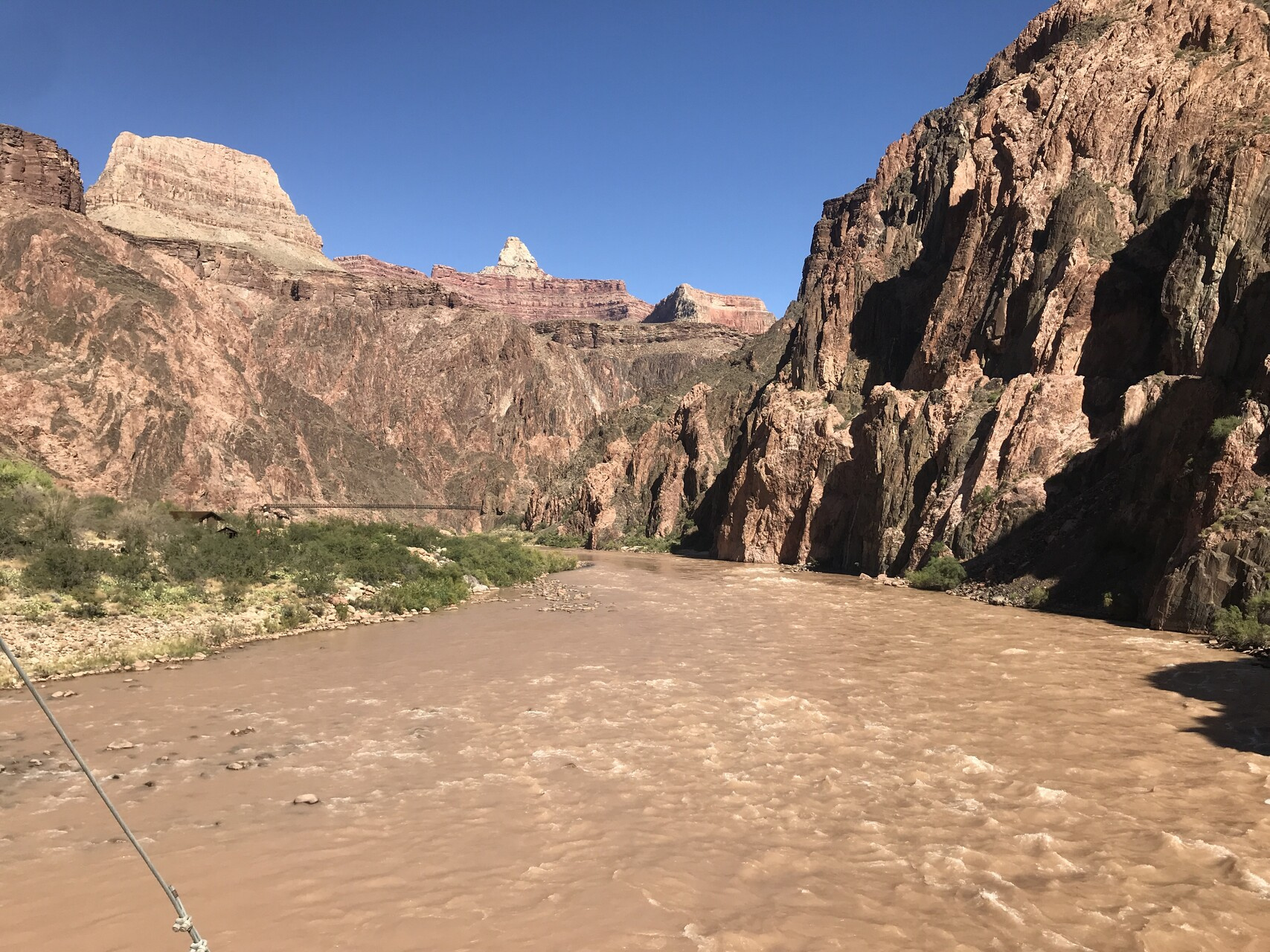
After a few twists and turns (ever downwards), you see the Black Bridge, one of two ways across the river.
By this point, we were reaching the hot time of the day. It got up into the 90s down at the bottom. I was happy to finally get to the bridge.
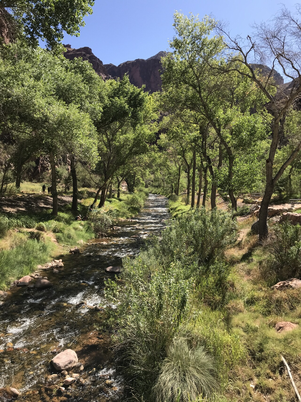
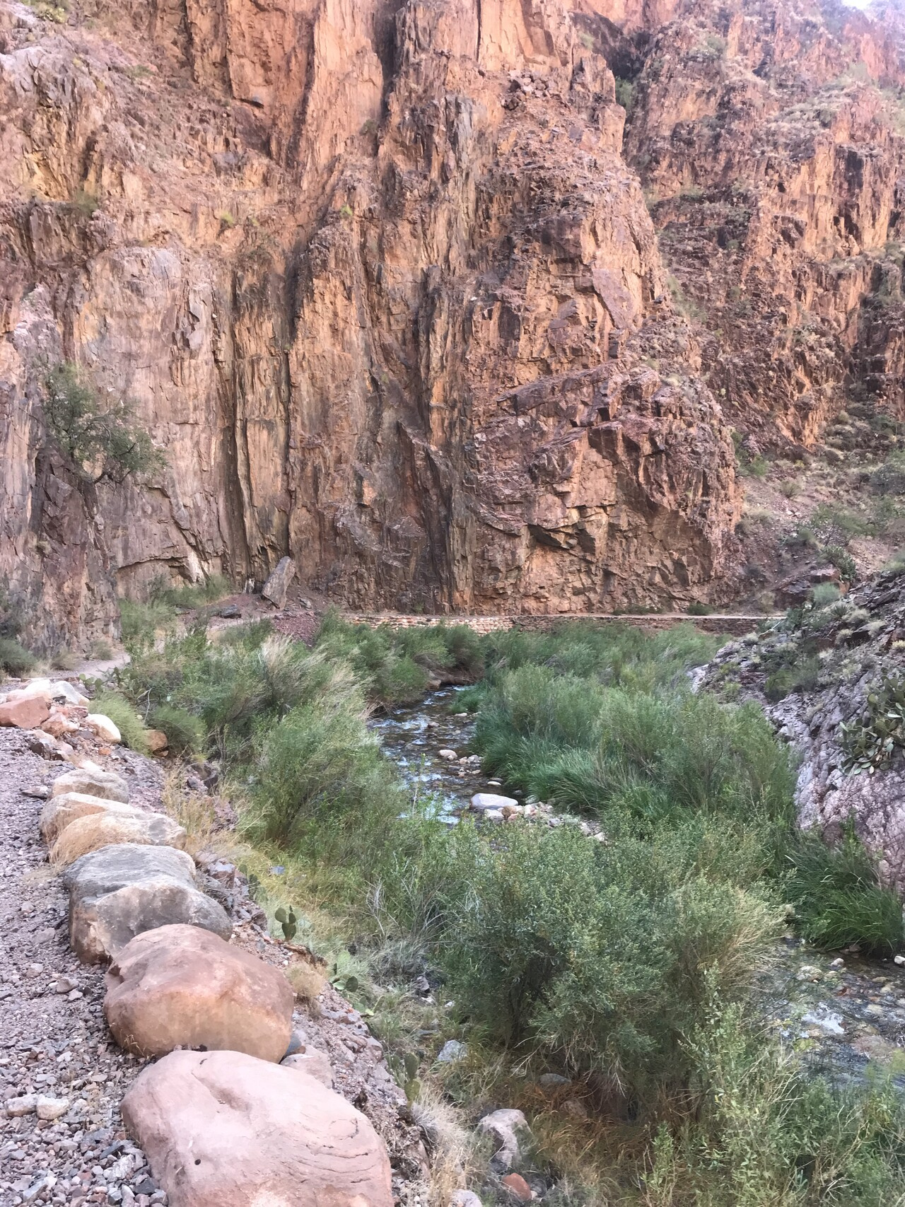
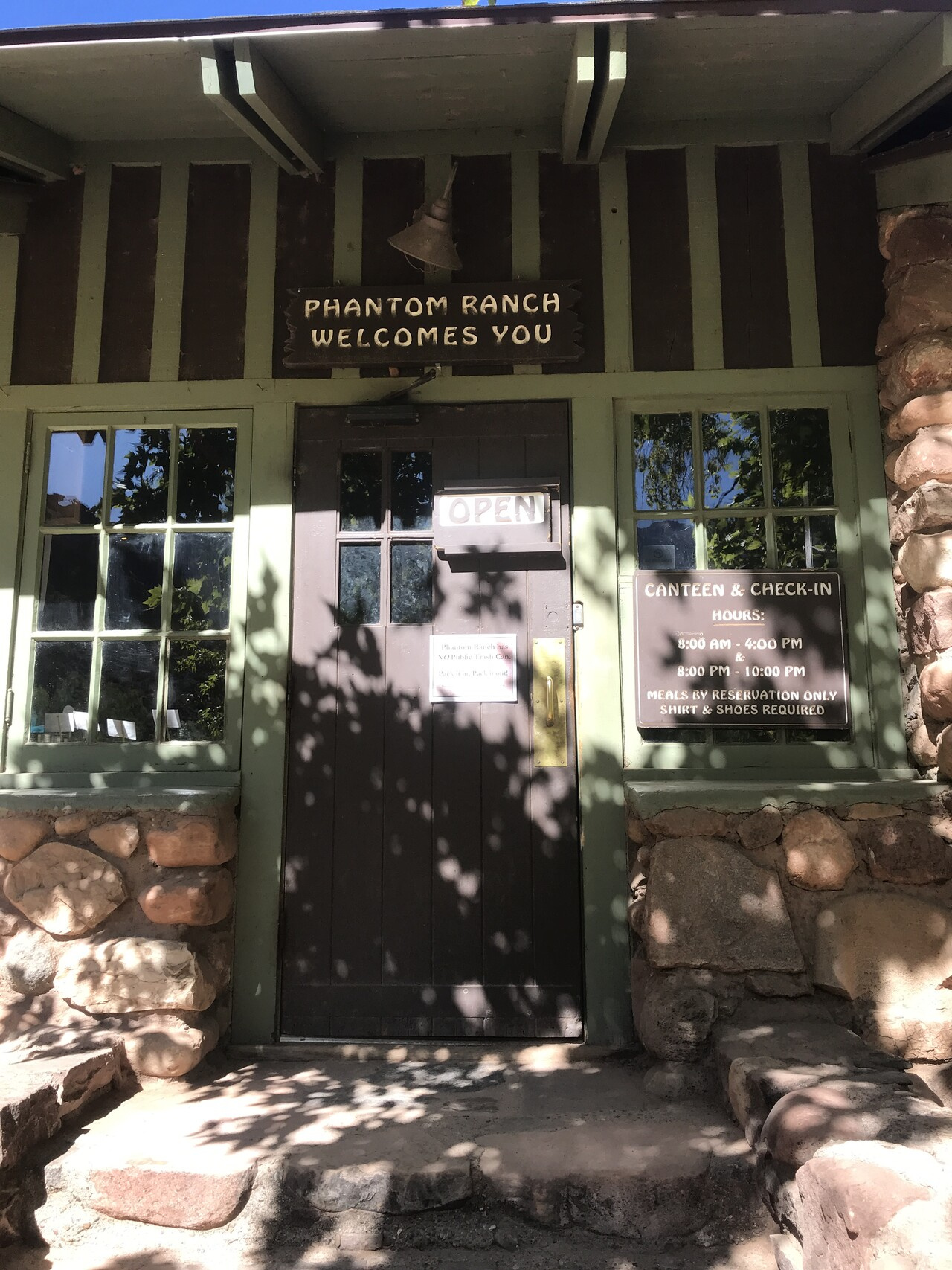
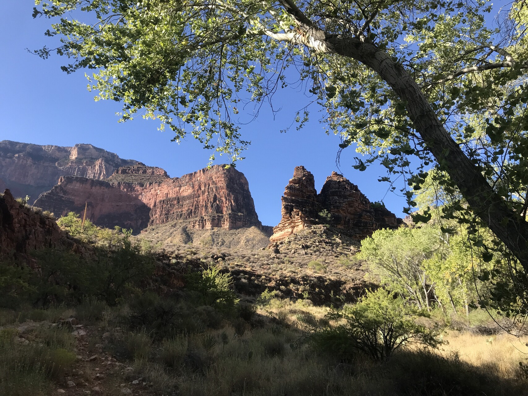
At the bottom is the Bright Angel Campground and Phantom Ranch where the Bright Angel Creek flows down from the north into the Colorado.
The Ranch provides somewhat modern amenities (i.e. Ranch life). We had tents and sleeping bags instead. We took advantage of the canteen for lemonade and other cold drinks though. We also had reservations for dinner that night and breakfast the next morning which was quite welcome after along hot day of hiking clocking in at about 7.5 miles.
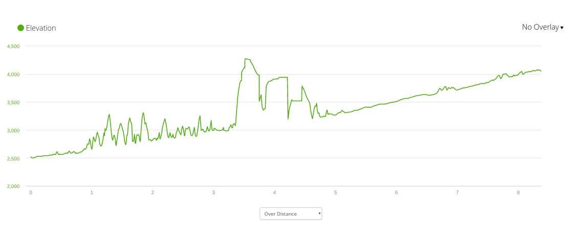
The headline though was the elevation loss
We were lucky to have timed our trip to coincide with the new moon. The Grand Canyon Park was recently certified officially as a dark sky park by the International Dark Skies Association. We didn’t see any clouds for the whole trip so we got some of the best star viewing I’ve had for some time. The Milky Way, in particular, was about as detailed as I can ever remember.
I was also quite happy that there is now signage (and peer pressure) encouraging people to use red light headlamps at night instead of the harsh bright white LED lights. It makes a big difference in preserving your night vision and I found a red light is perfectly fine for getting around in even the darkest conditions.
After a first, warm night at Bright Angel camp we got a breakfast at the ranch and then headed up towards the North Rim
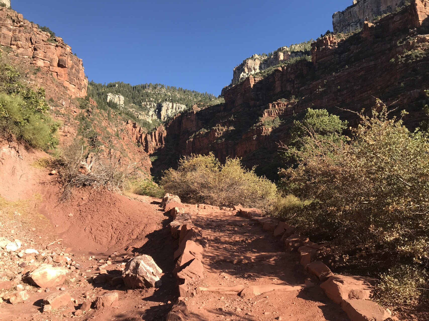
The route was a bit easier on this day. About the same distance and uphill but only about 1500 feet of climbing. We spent the morning shaded by the high walls of the box canyon cut out by Bright Angel Creek.
A consequence of this is that GPS signals are not very reliable. This is reflected in the elevation profile recorded by my watch
I recorded 7200ft of elevation gain and 5600ft of elevation loss. The difference works out to about the right amount. Here’s the track on the map
It was still a nice walk.
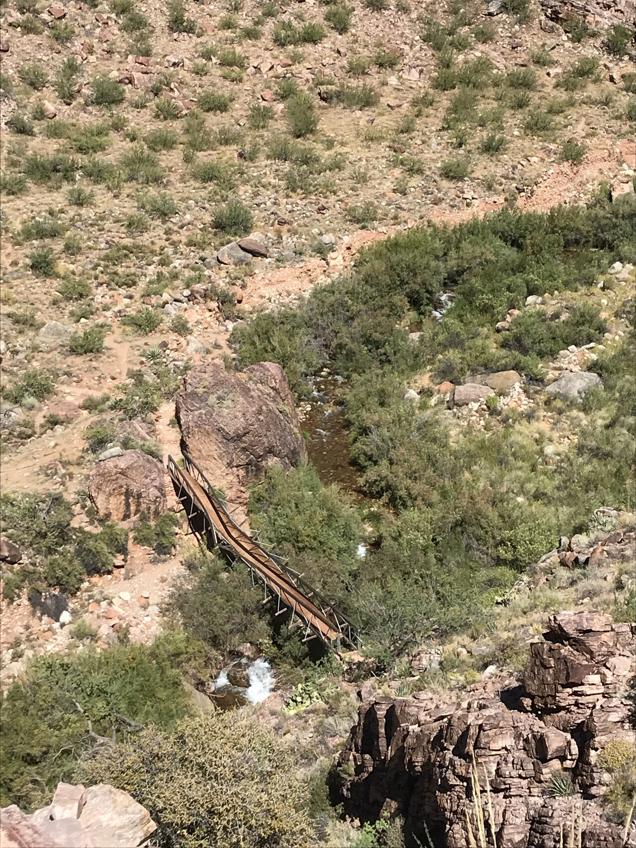
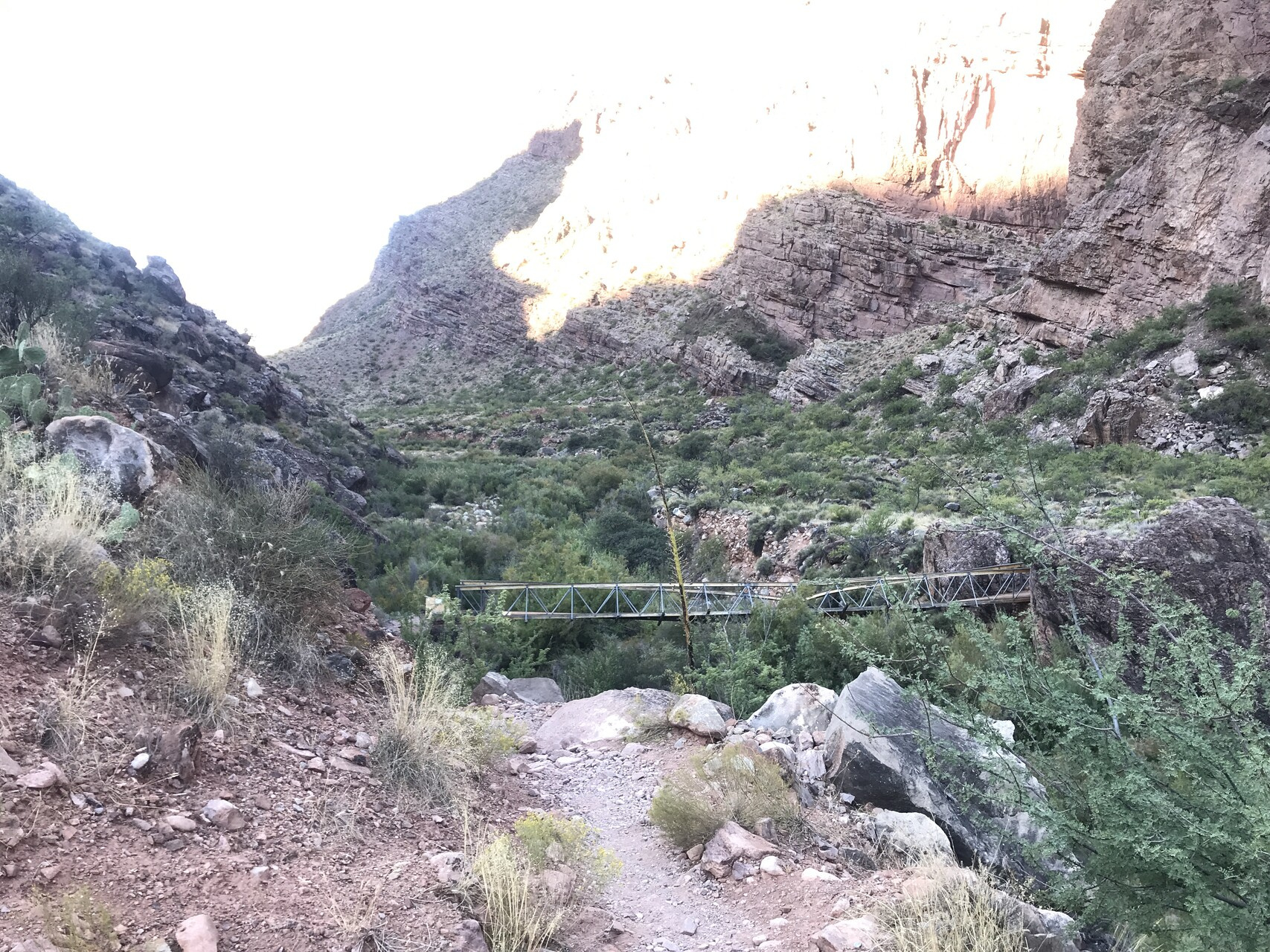
When we got beyond the high walls and out of the shade, it got pretty hot. There is a side trip along the way to Bright Ribbon Falls which is on the other side of the creek from the trail. The bridge across the creek got knocked off its mooring earlier this year.
You can still get across in another location but we decided to do that on the way back. Instead, we went up to Cottonwood Camp.
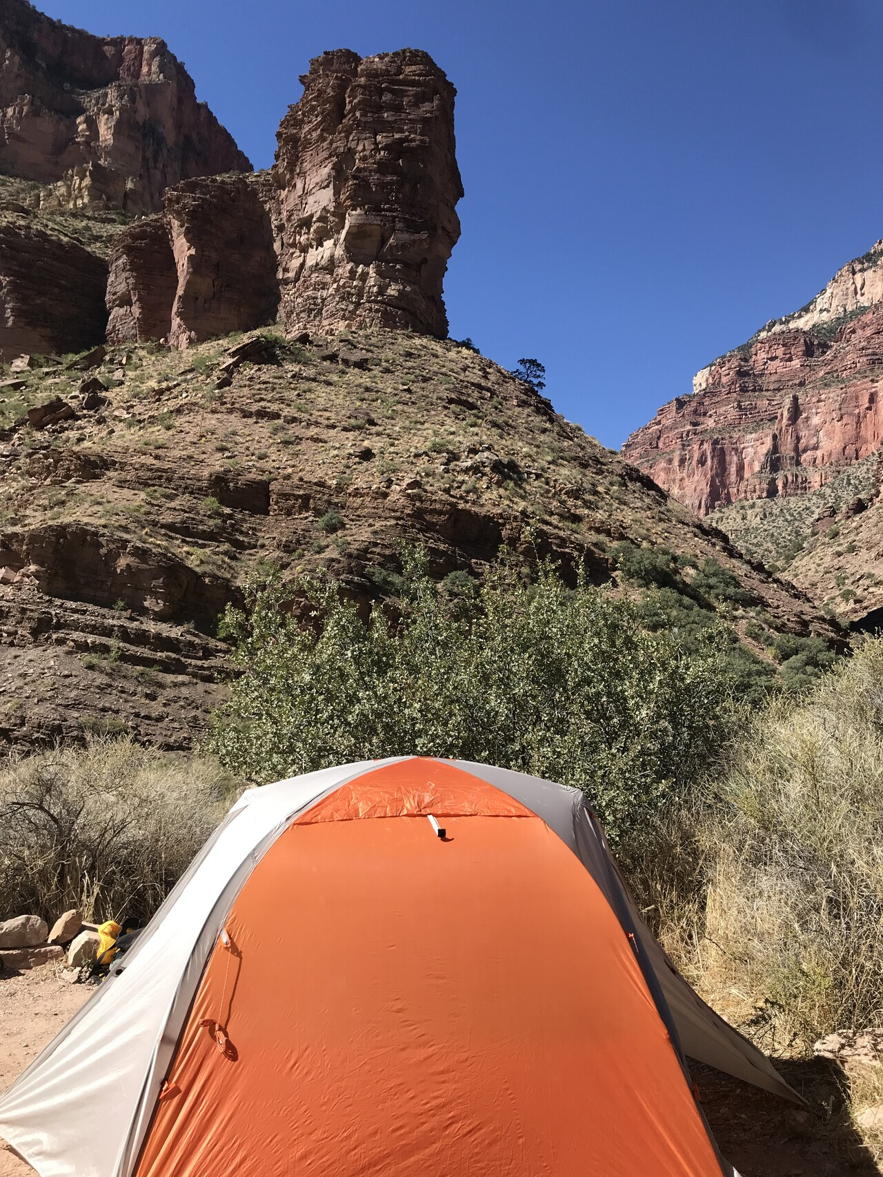
Our campsite didn’t have a lot of shade but we had easy access to a nice spot along the creek.
Plus, the Sun sets pretty early when the walls around you are high.
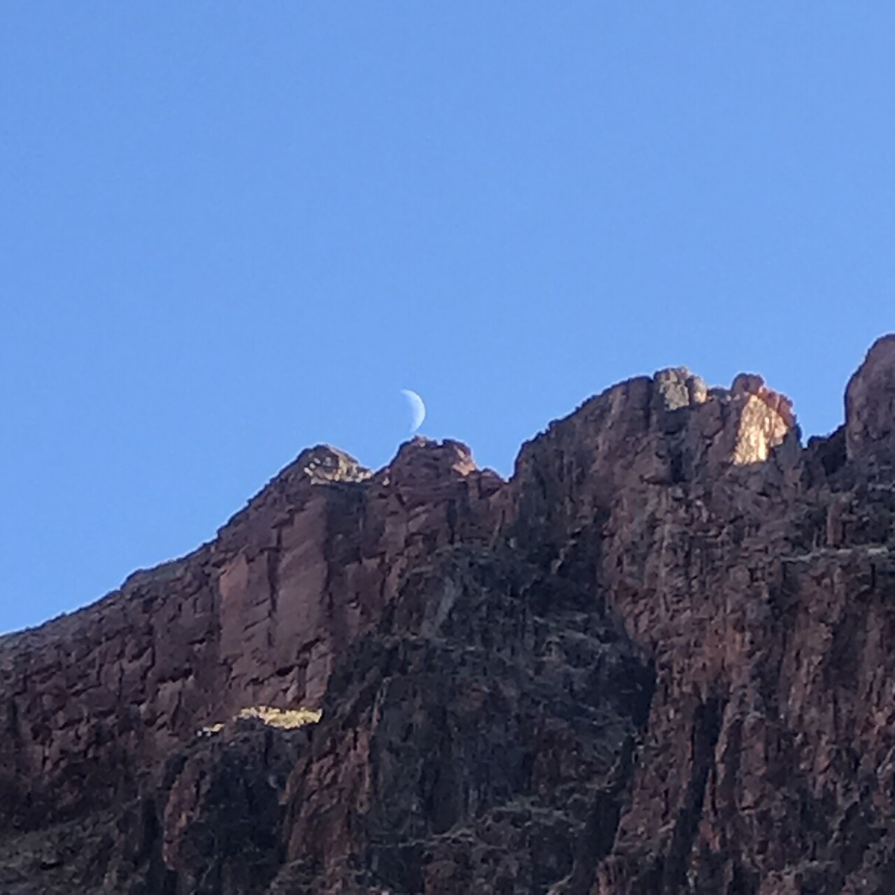
The skies were again clear and dark overnight. We had a brand new Moon which lined up nicely with Jupiter and Saturn. My place in the tent looked out to the North and I found that I could mark the progress of the night by noting the position of the various circumpolar constellations (Ursa Major, Cassiopeia) traveling around the North Star.
I was really looking forward to our next day’s trip to the North Rim.
Having gone halfway up to the North Rim, we left most of our gear behind at Cottonwood camp and headed up the rest of the way.
It is a long hike with lots of climbing (both up and down) but because we ended up where we started, I brought a small pack that held only the essentials. We started out early so as to get the hiking done during the cooler part of the day.
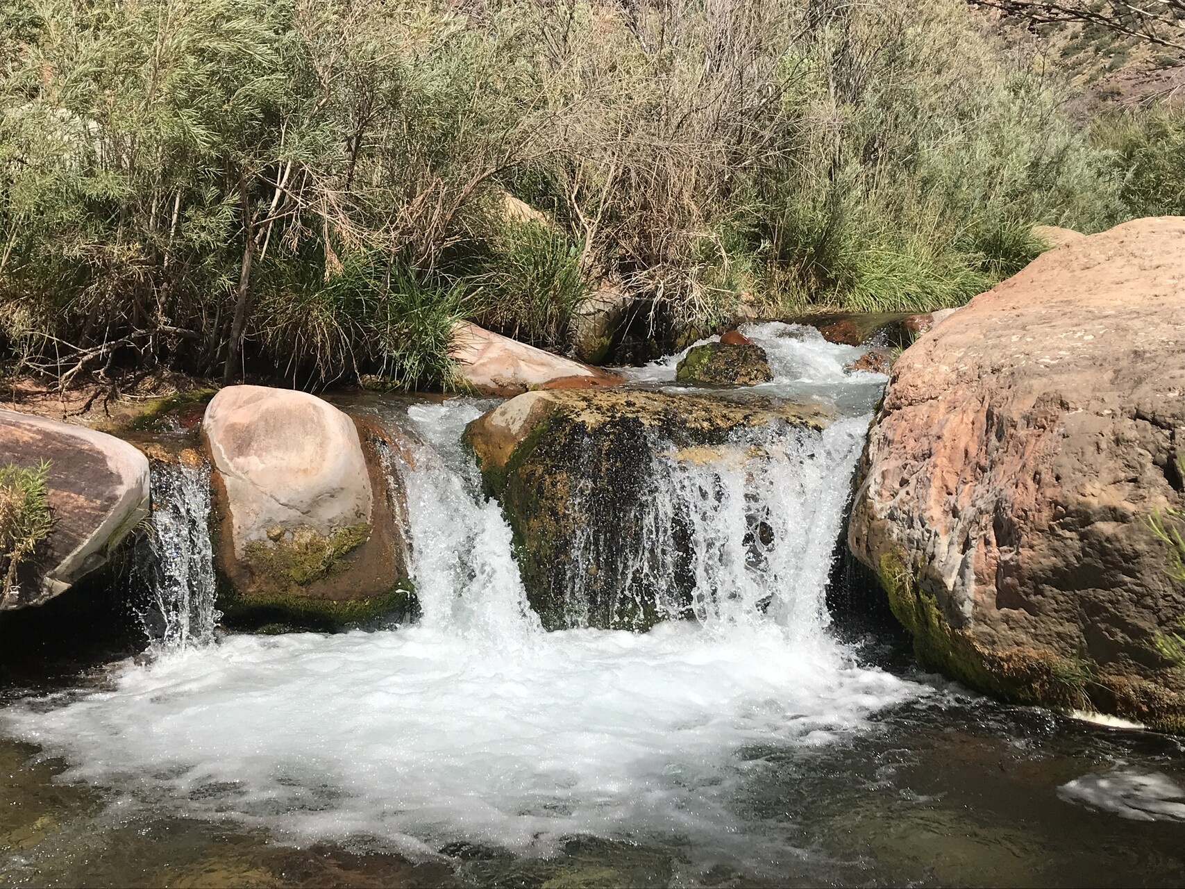
After a couple of miles, we came to the source of the Bright Angel Creek
The water just comes out of the mountain. It is piped down to the Colorado and then back up to the South Rim where it makes up the drinking supply for the whole park.
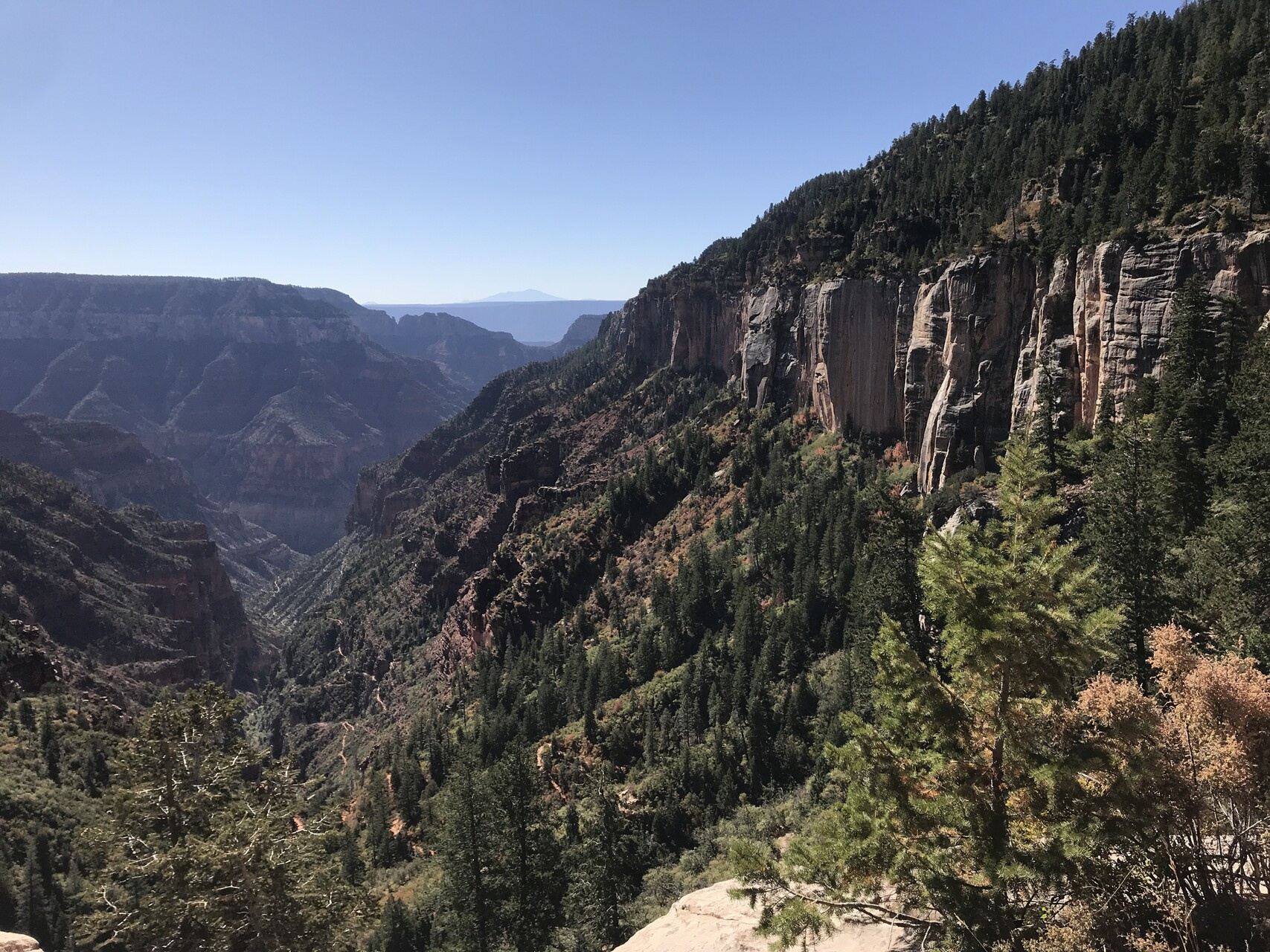
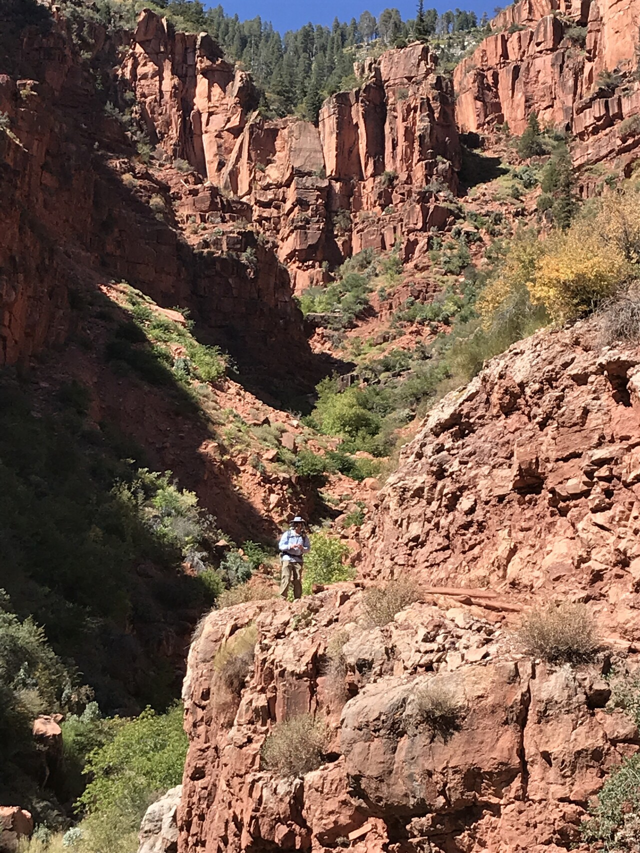
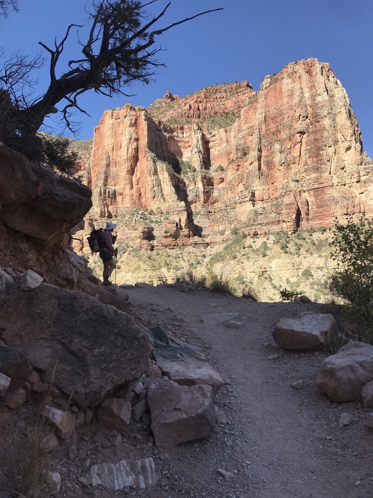
The next few miles were some of the most beautiful I’ve had the privilege to hike.
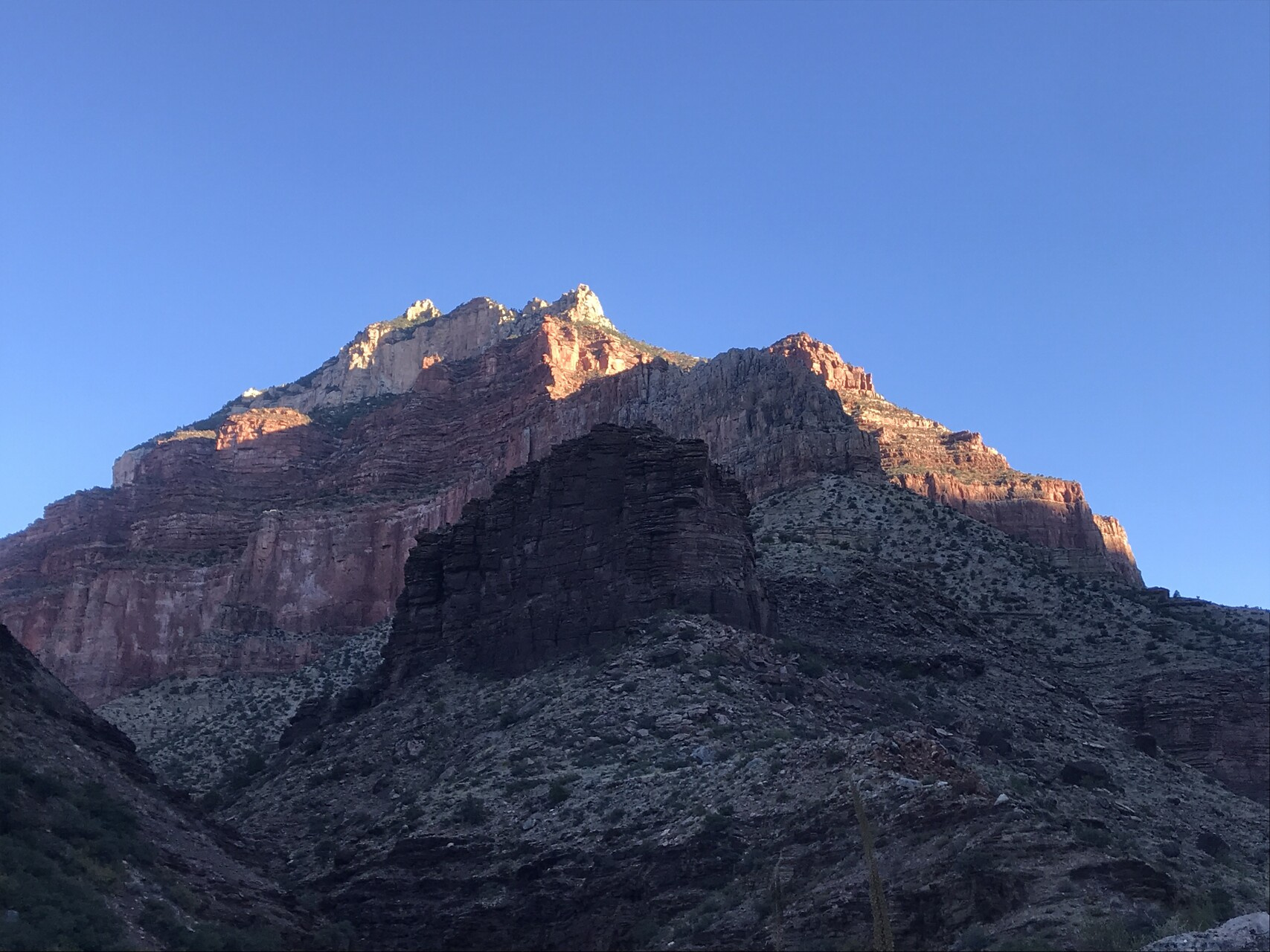
The Sun finally came over the eastern hills and lit up the canyon.
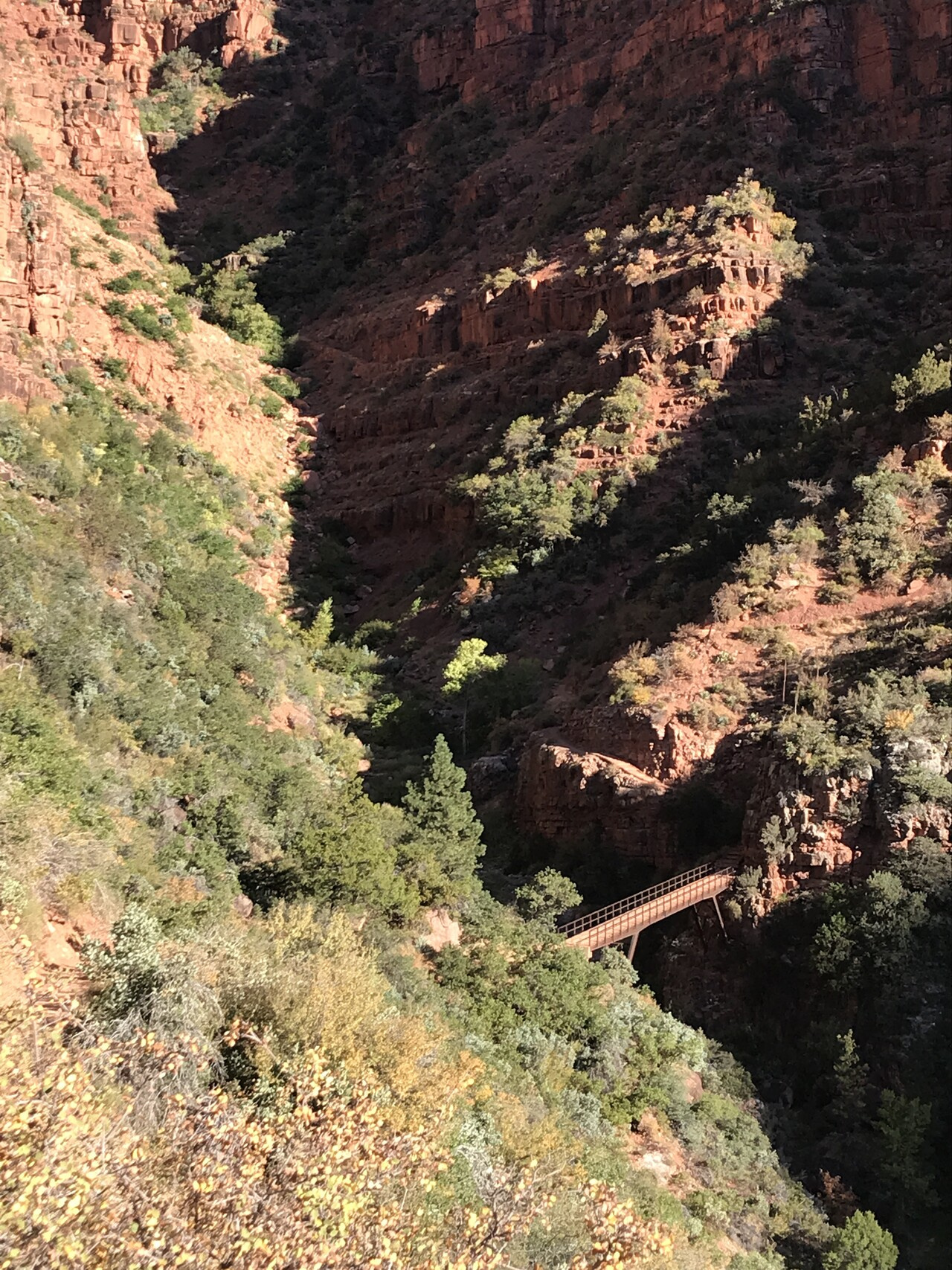
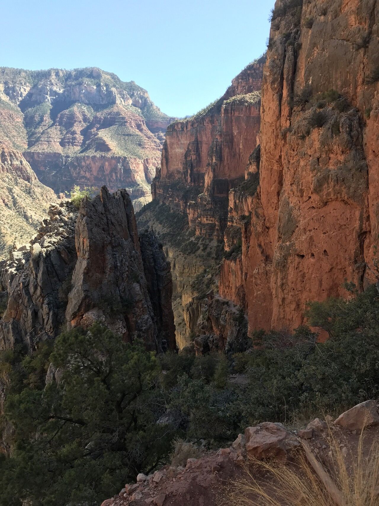
Eventually, we did see our destination.
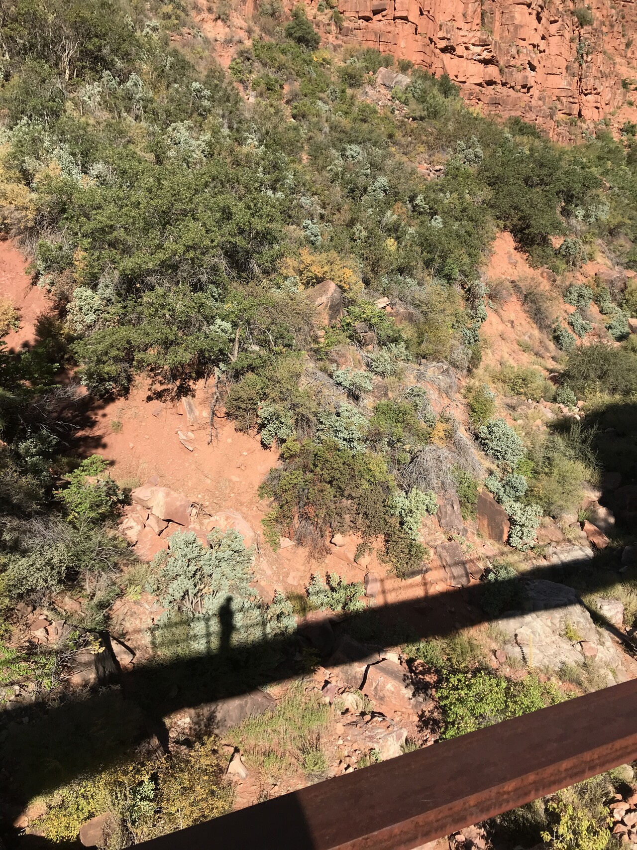
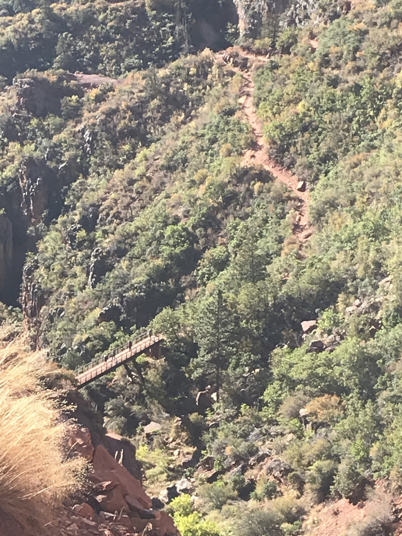
We went up that narrow gap up to the highest point in the distance. That included a large bridge crossing.
I was ahead of my hiking companions but I watched them cross the bridge from above.
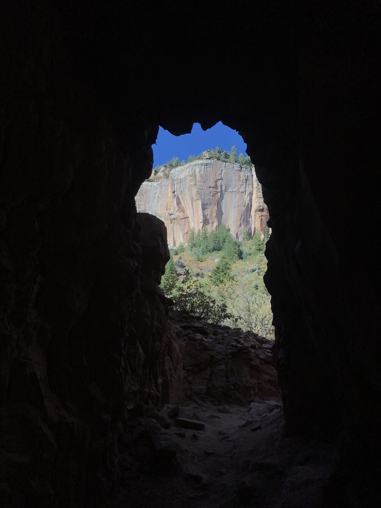
After a lot more climbing we arrived at the Supai Tunnel stop
When I got to Supai, it was quite crowded with hikers and a large mule train group heading up. I left for the top after them but while mule trains go faster than hikers, they stop a lot so I was stuck waiting a couple of times.
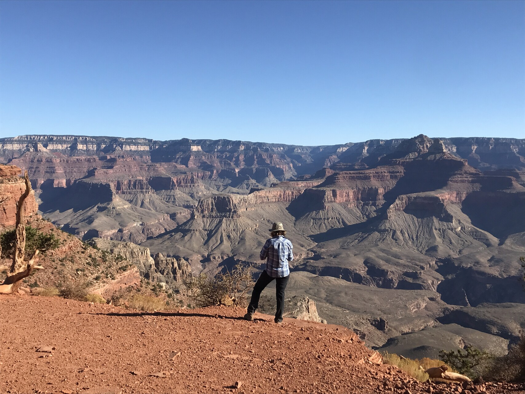
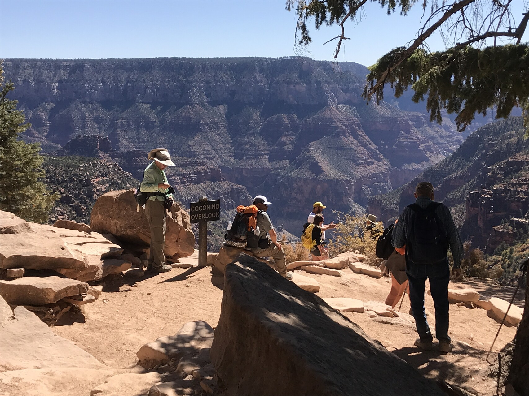
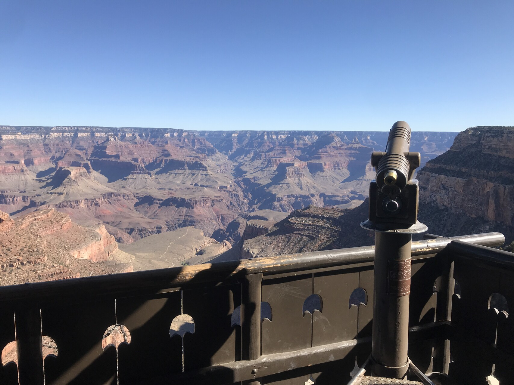
The view from the North Rim trailhead is not much to write about. You can’t actually see the canyon from there. The best views are at a point down the trail a bit named Coconino Overlook
After a lunch at the top, we headed back along the same path, this time with a lot more sunshine.
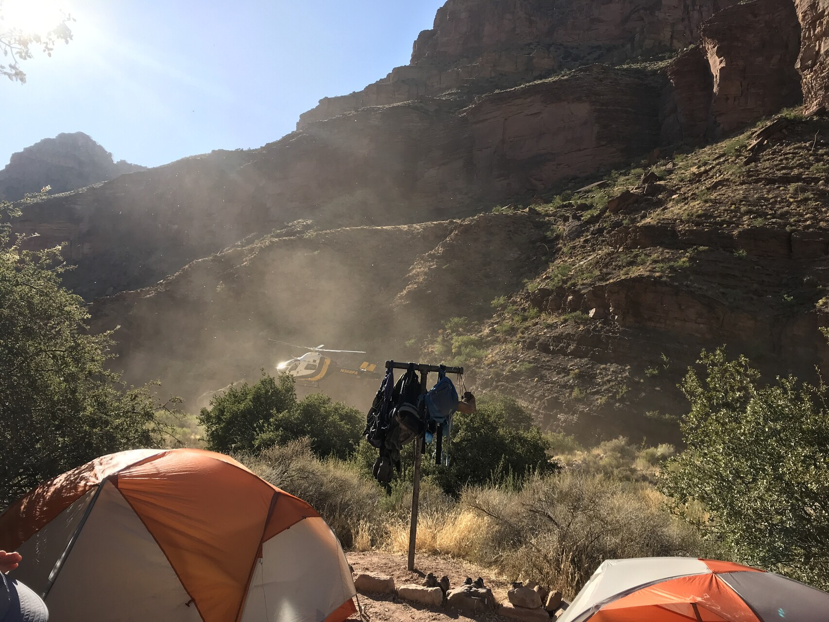
When we got back to the Cottonwood camp, we had some excitement. A helicopter dropped in to deliver some supplies to the horse camp nearby.
One of the horses there wasn’t feeling too well and forced a group to stay there a few extra days.
The GPS signal was again not great
You can also see the back tracking in the elevation profile around miles 3 to 5.
Overnight we had clear skies again and there was a conjunction between the Moon and Jupiter not long after sunset.
Overall, I was really happy with the day. Hiking with a small pack really improved the experience a lot for me.
This day was a mirror image of day two. As such, there isn’t much to say that I didn’t cover there.
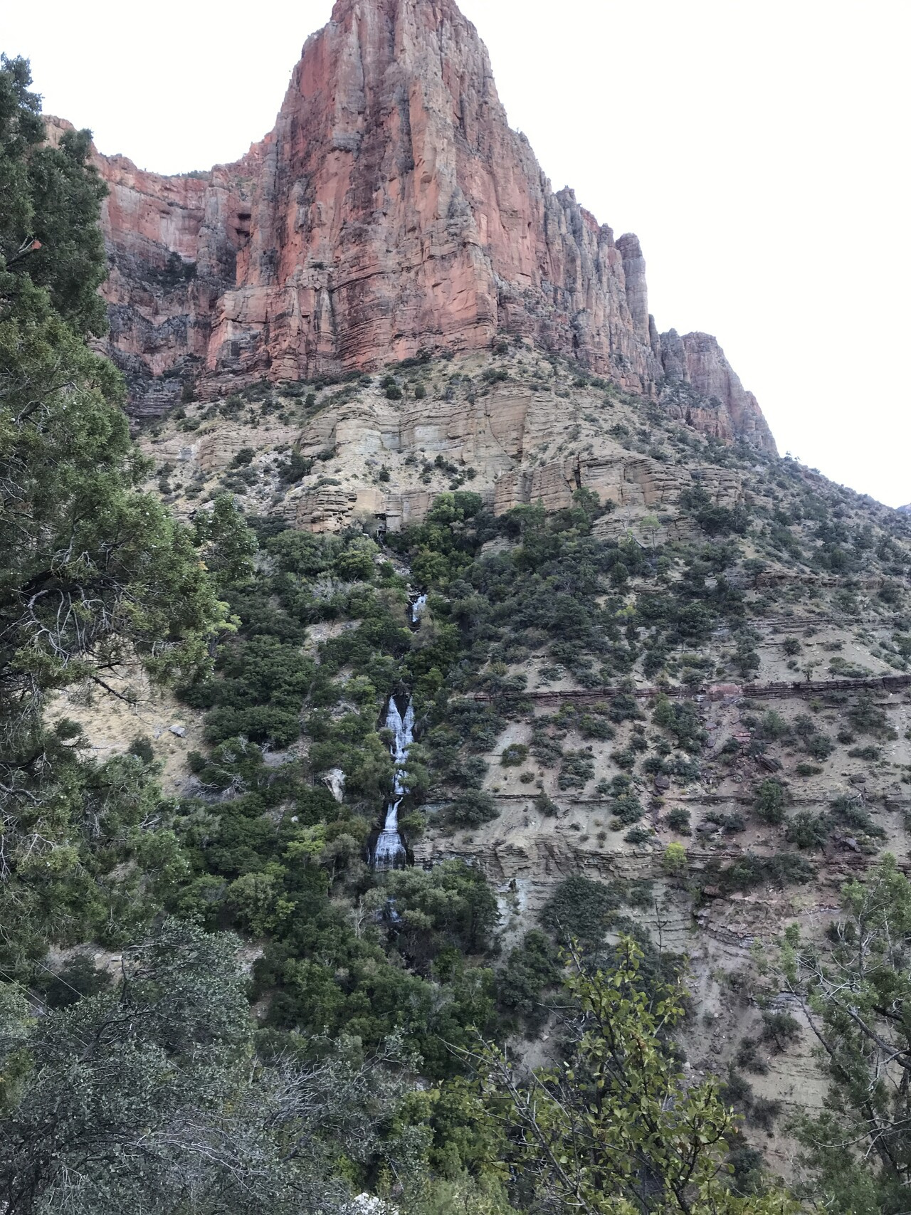
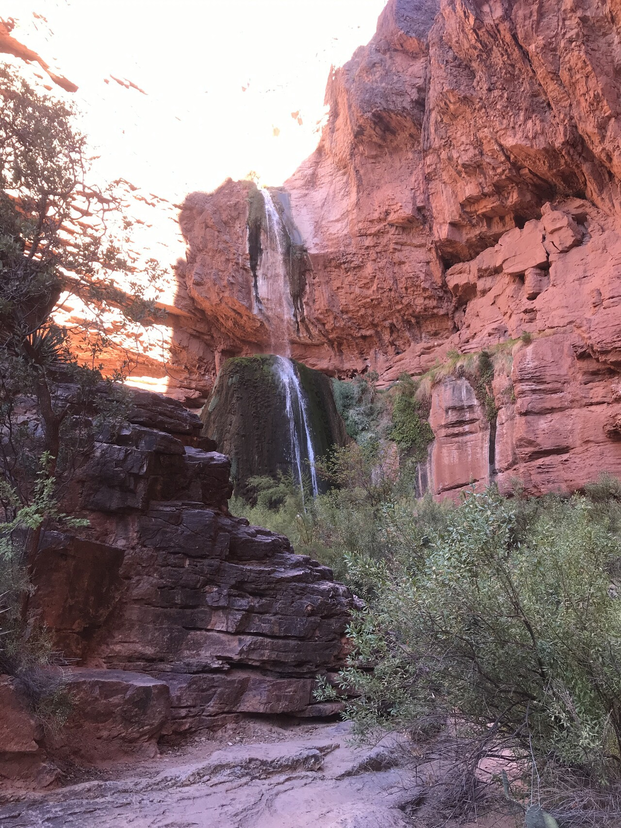
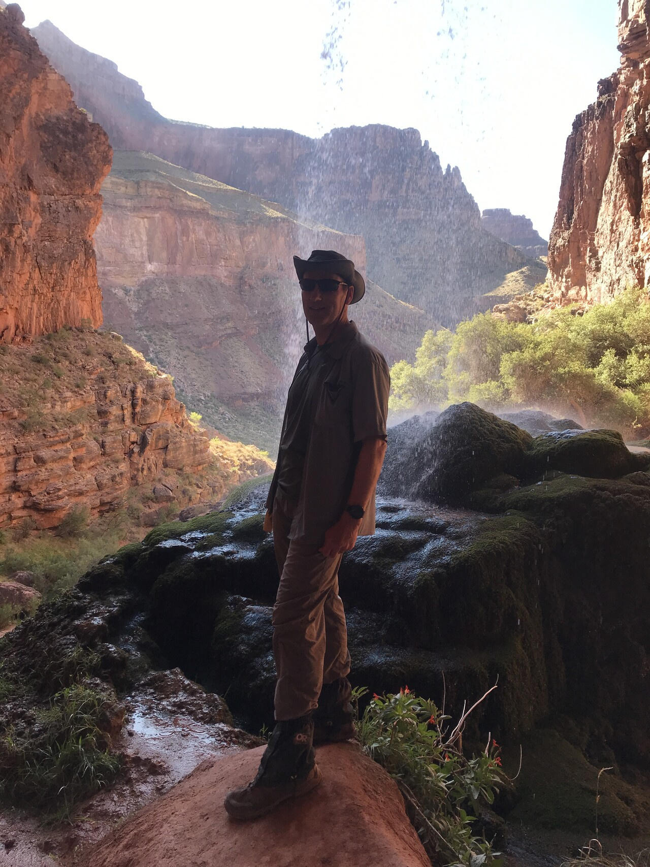
The main difference is that we took a side trip in the morning to Ribbon Falls. As I said earlier, there is a downed bridge that prevented us from getting there the usual way.
There was a side trail further down that gave us a moderately challenging crossing. The trail was a bit winding and not obvious in every place, but we eventually got to the falls.
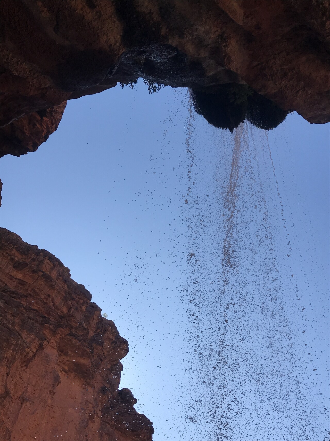
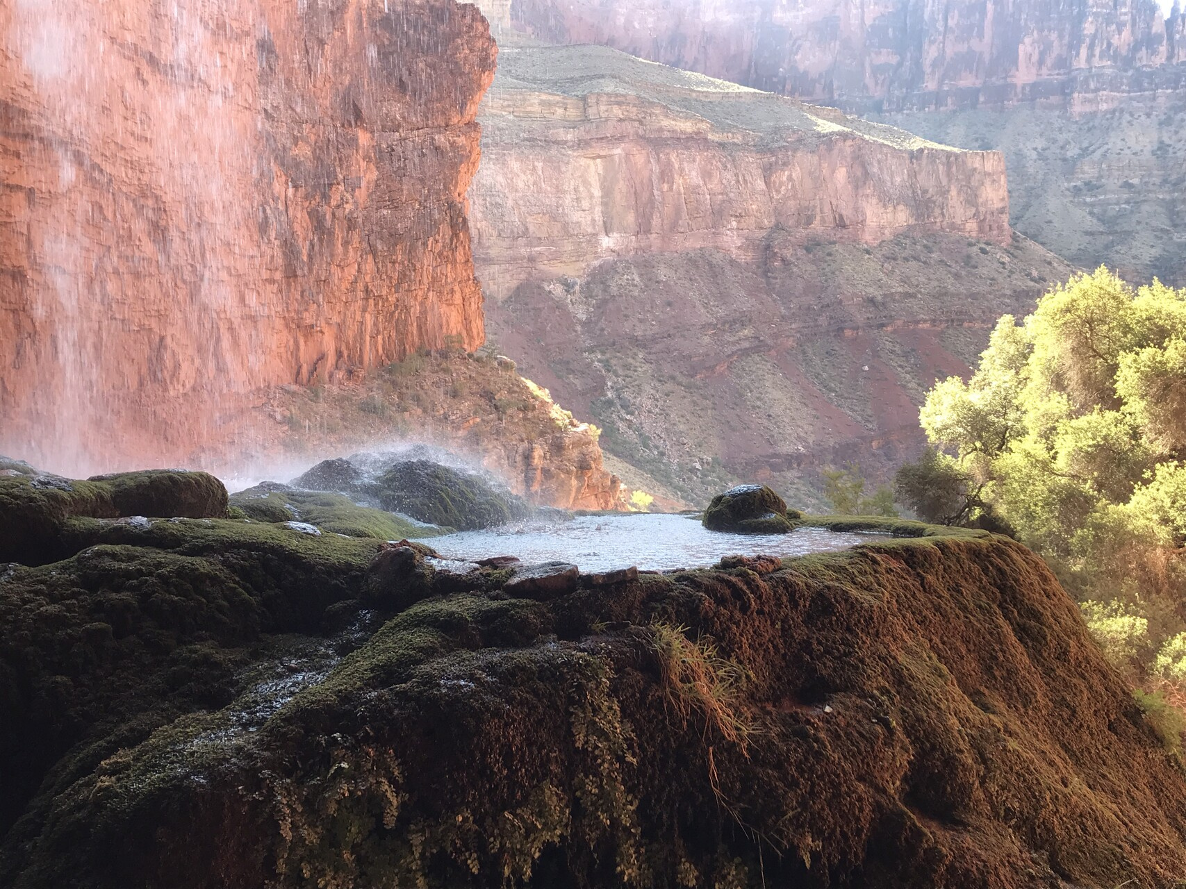
There is a path that allows you to get behind the falls.
With our side trip complete, we headed back down towards Phantom Ranch.
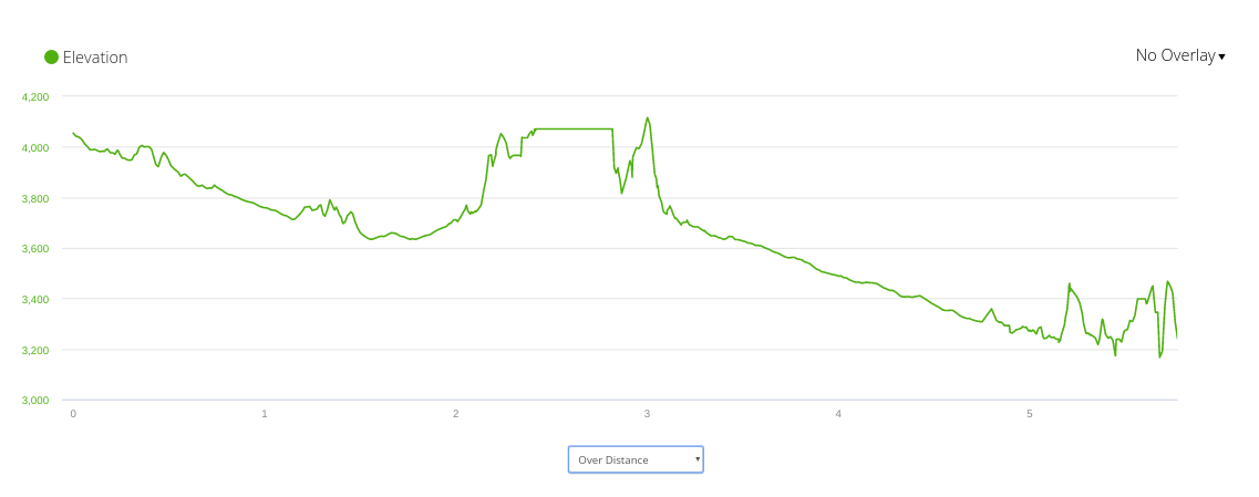
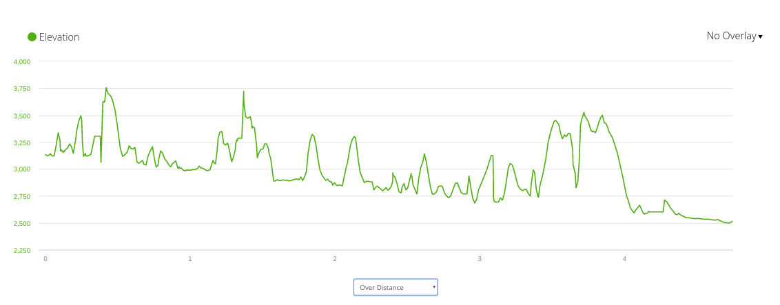
Once again, my GPS tracking was pretty poor. It was so bad in fact that it went out completely at one point and I had to restart it. As a result, I have two maps for that hike.
The elevation profiles are also in two parts:
Neither of those is very accurate but there they are.
The Cottonwood camp was high enough that it was reasonably cool as long as you are in the shade. As we headed down though it got hotter. By the time we got down to Phantom Ranch, it was in the mid-90s.
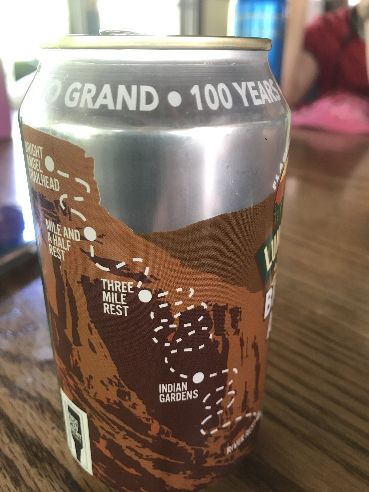
We took advantage of the cold beverages available for purchase.
This one had a convenient map of tomorrow’s route back to the South Rim.
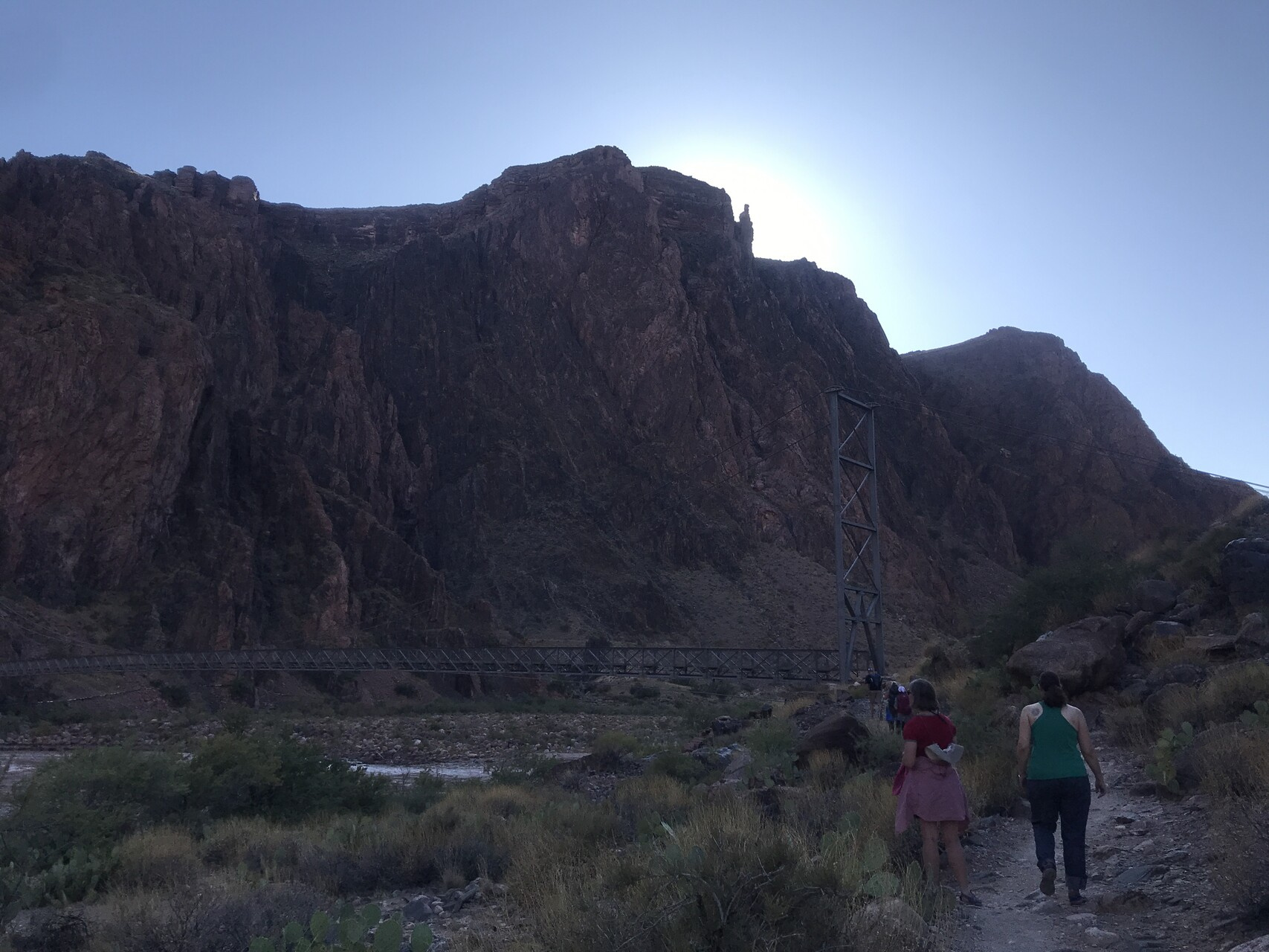
After setting up camp, I walked down to the big river to have a look at the bridge
There are two bridges. We came across the black bridge and left via the silver bridge.
I went back a little later as the sun was setting.
and caught the moonset as well.
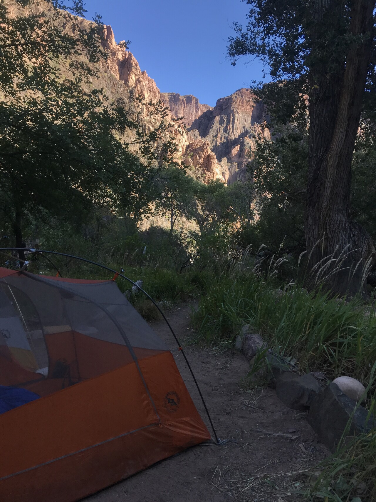
It was hot and dry enough that we didn’t bother putting the fly on the tent.
which meant a great view of the stars all night.
One quick story before I talk about our last day. I got up that night to go to the bathroom. It was very dark of course but my night vision was such that I could see perfectly well, so I left the tent without grabbing my headlamp.
Once I got there a problem presented itself. The bathrooms at Bright Angel camp are really nice. They have flush toilets and running water sinks and electricity. These are much appreciated after many days of pit tolets with no sinks. Since they are wired for electricity, they also are fully lit inside with full-spectrum white lights. When I opened the door I quickly realized that I was in trouble. My night vision was completely ruined. When I finished and stepped back outside into the dark I couldn’t see anything. My tent was not going to be easy to find either. There were a lot of sites and ours required navigating a short side path to get to.
It normally takes 5-15 minutes for your eyes to adjust to the darkness so I was going to have to sit for a while. I was saved, however, by one minor detail that I didn’t mention. For some reason, I don’t really know why, when I left the tent, I decided to count how many steps I took to get to the bathroom. I didn’t think I was doing it for any reason. I just walked and started counting. I still remembered that it took 30 steps to get from the turnoff at the tent to the bathroom. I figured, why not just count my steps going back and hope for the best.
After counting out 30 steps, I still couldn’t see much of anything but I turned and much to my relief found that I had come out exactly where I needed to be. I had the side path that led to our tent. I was starting to get enough night vision so that I could just make out the tent so I was able to get back without invading some stranger’s campsite.
The moral of that story is that you should always count your steps…or always remember where you came from…or something…I don’t know. I guess there’s no moral to that story.
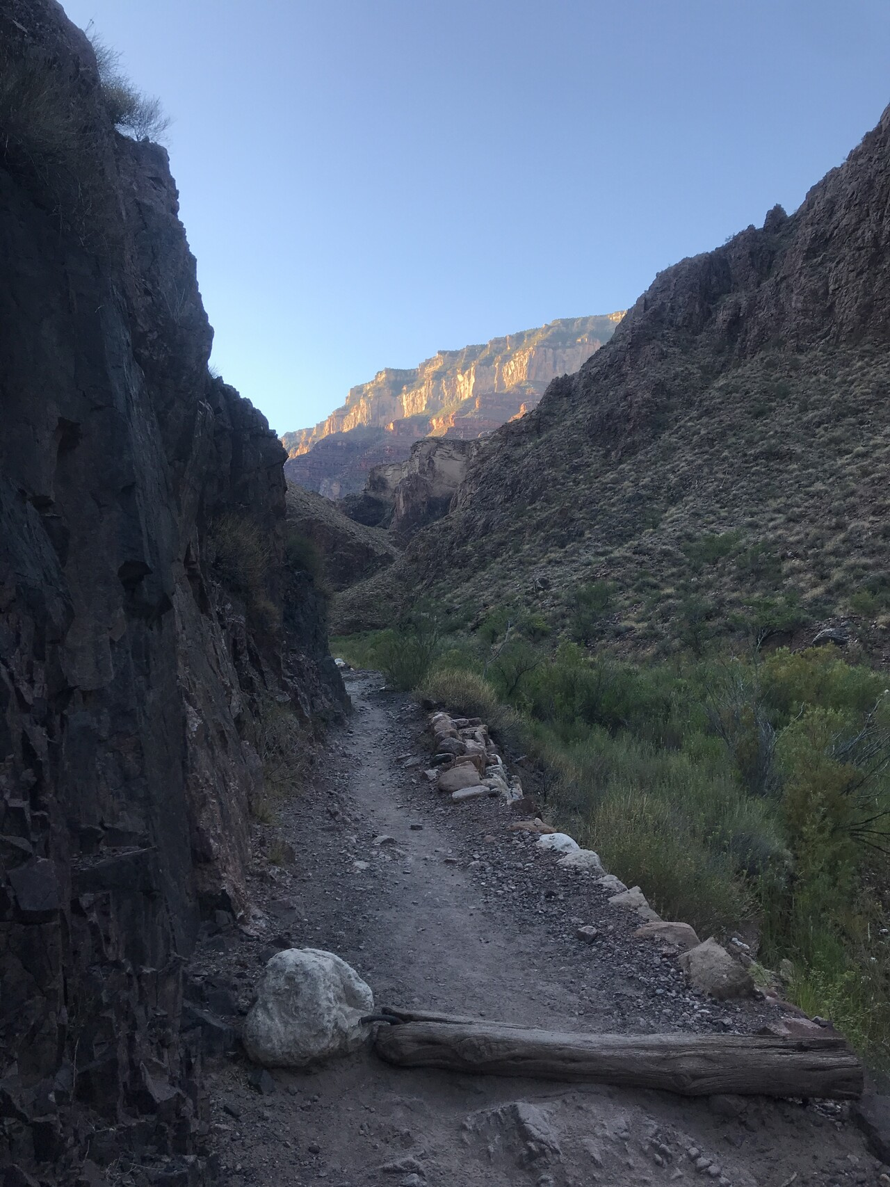
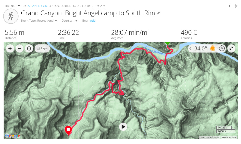
After 4 days and 4 nights of backpacking, it was time to hike out. Another early start and another big climb. We went up the Bright Angel trail instead of the trail we came down. It is a longer distance so it isn’t quite as steep. It also has several water stops along the way so we didn’t need to carry as much weight.
It was another picture-perfect morning.
Once again my GPS watch conked out partway up so I have two maps
I had good tracking up till the Indian Garden camp but the second part was up against the south wall so the signal bounced around a lot.
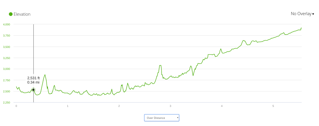
Only a few glitches in the elevation profile on the first track and then a few big ones on the second.
There is one winding steep section before you get to the Indian Garden camp.
From there you can see the destination, still a long way up.
Because of the time we started we were lucky to be hiking in the shade for most of the way up.
There are a couple more water/bathroom stops after Indian Garden. They are conveniently named for the amount of distance remaining. The Three MIle stop and the One-and-a-half Mile stop. It was a lot of climbing.
The higher we got, the more people were on the trail. When we hit the 1.5 mile stop, I decided to kick it into high gear to see how fast I could make it out.
I did the last mile and a half at an 18/19 minute mile pace. Pretty good!
It was pretty cold at the top, somewhere around the 40s. Felt good. And good to be done.
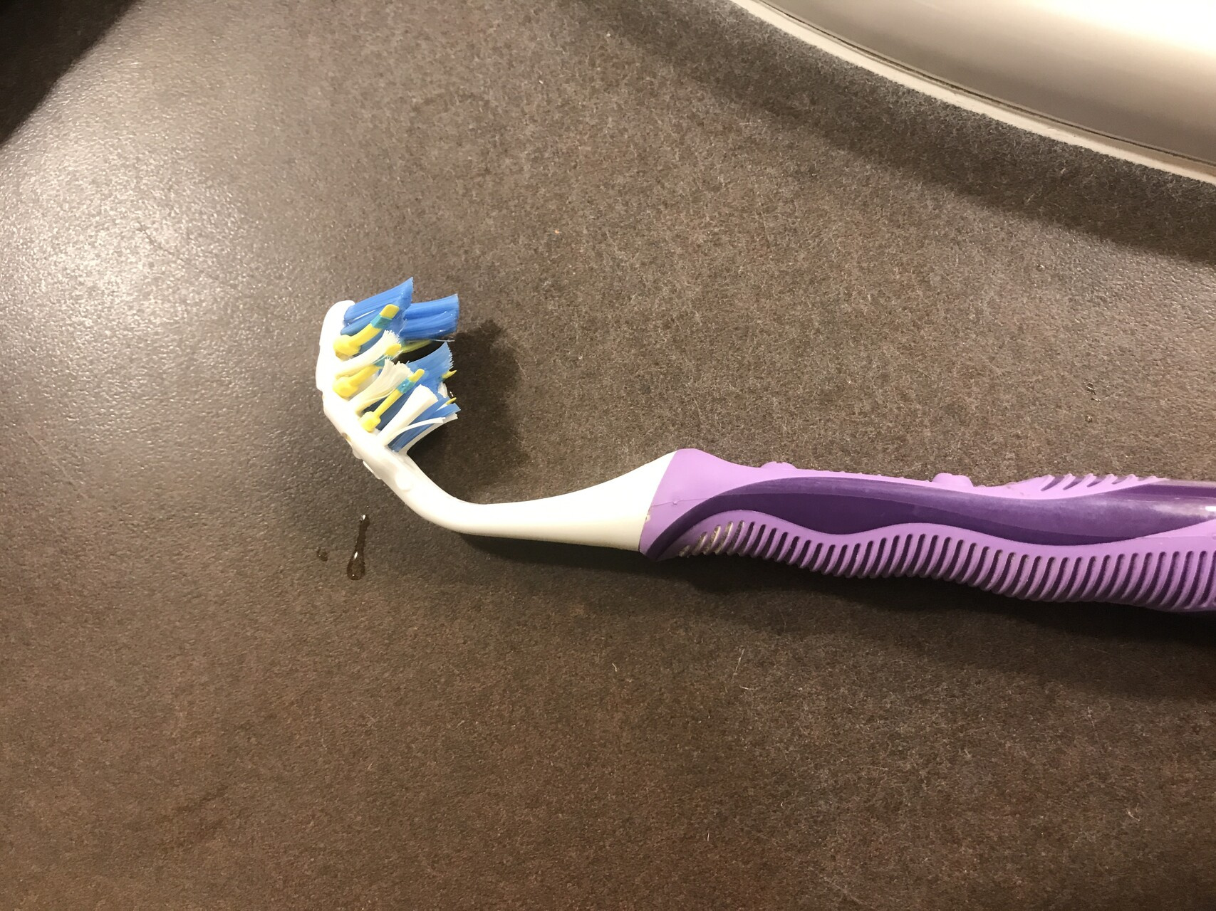
I got a shower and a good meal. While unpacking, I discovered that my poor toothbrush had been packed away a bit too aggressively.
We spent the night at the Maswik Lodge. The next morning I saw, just outside our room what I thought was a dog playing in the yard outside. After looking more closely, it turned out to be a coyote, chasing and catching a squirrel. It grabbed it by the neck and trotted off with its lunch.
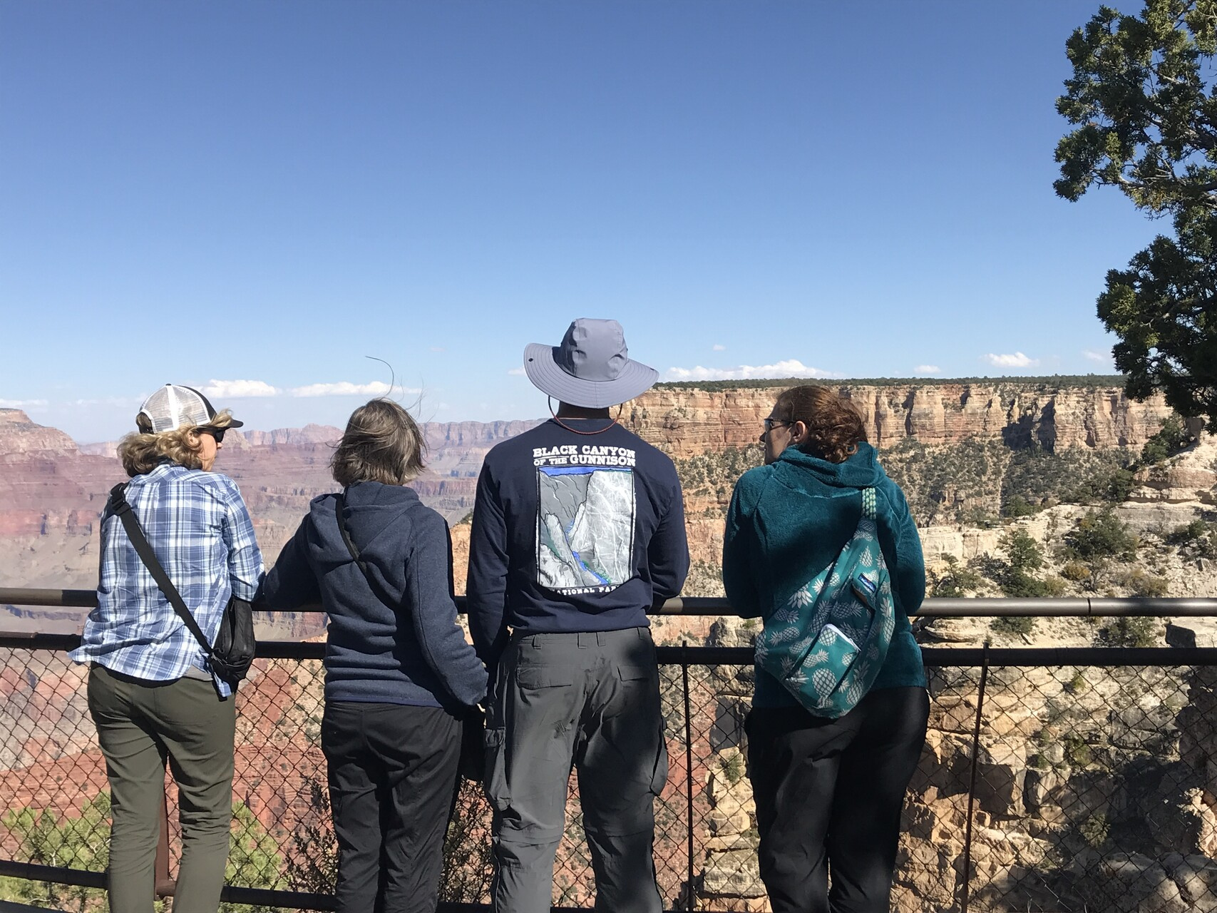
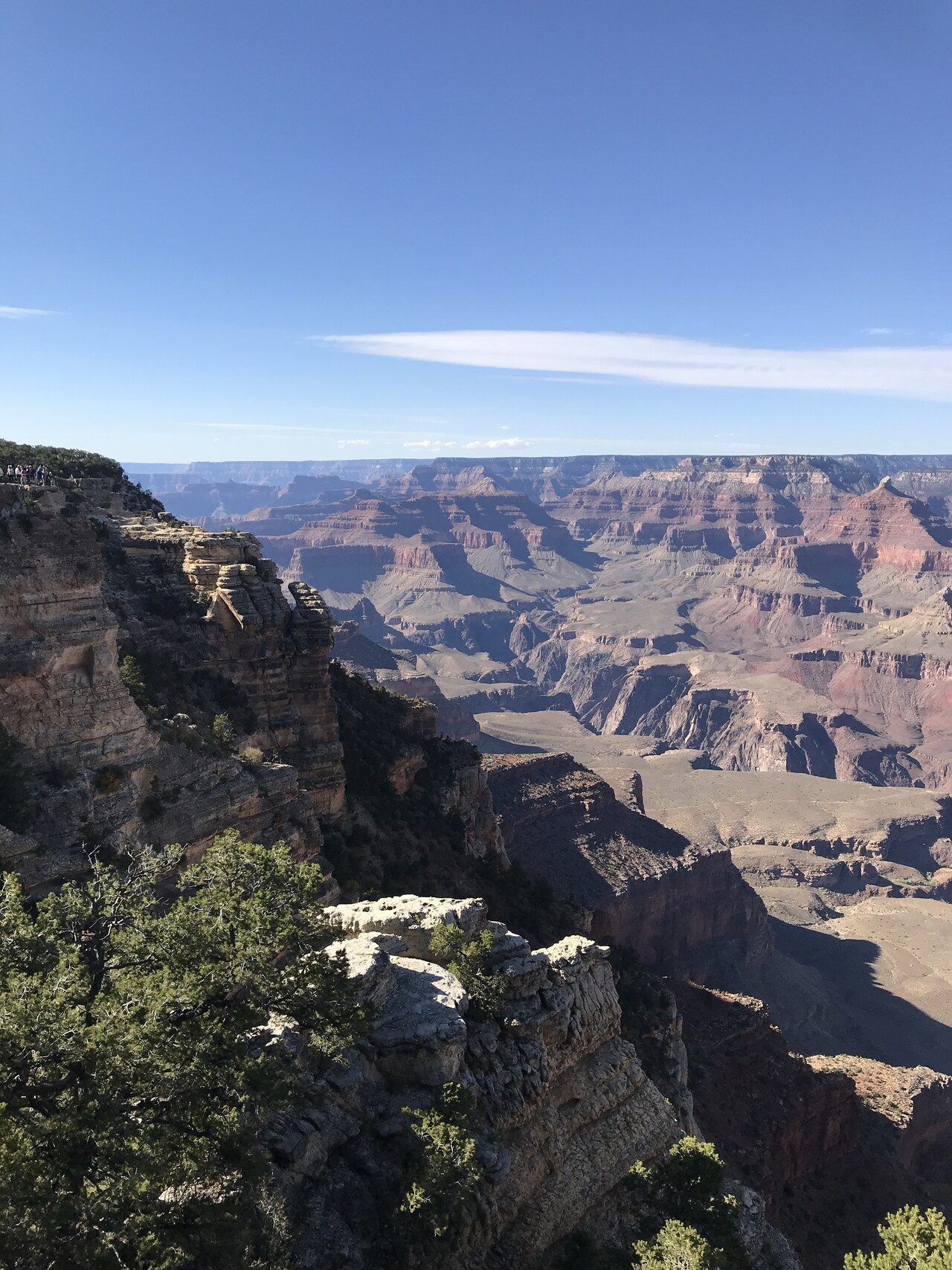
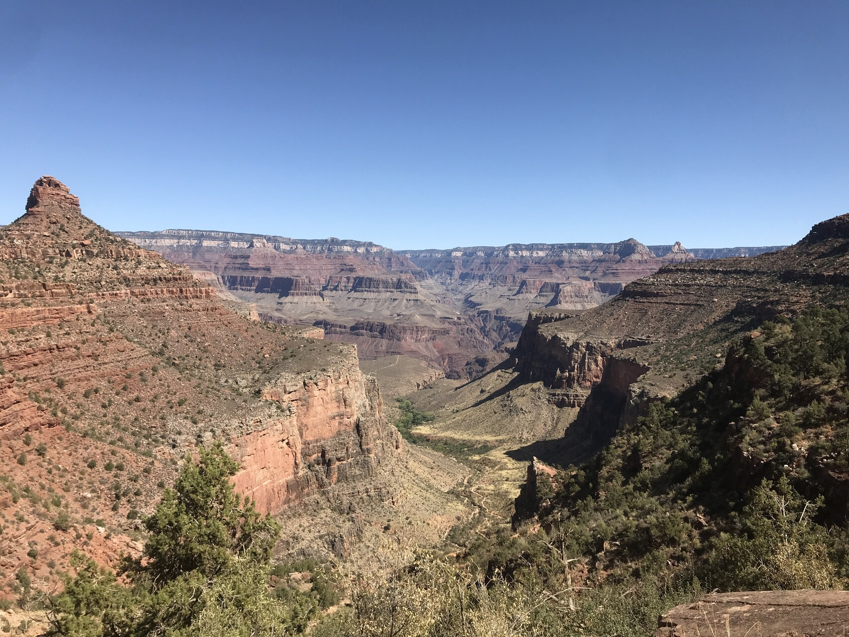
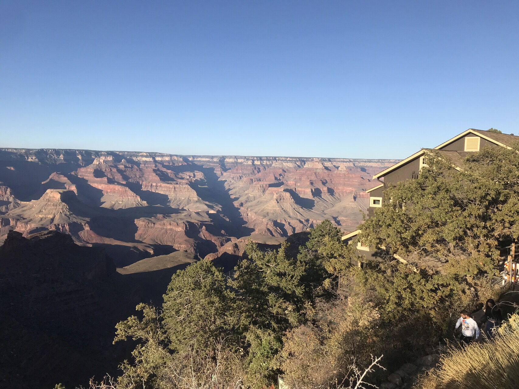
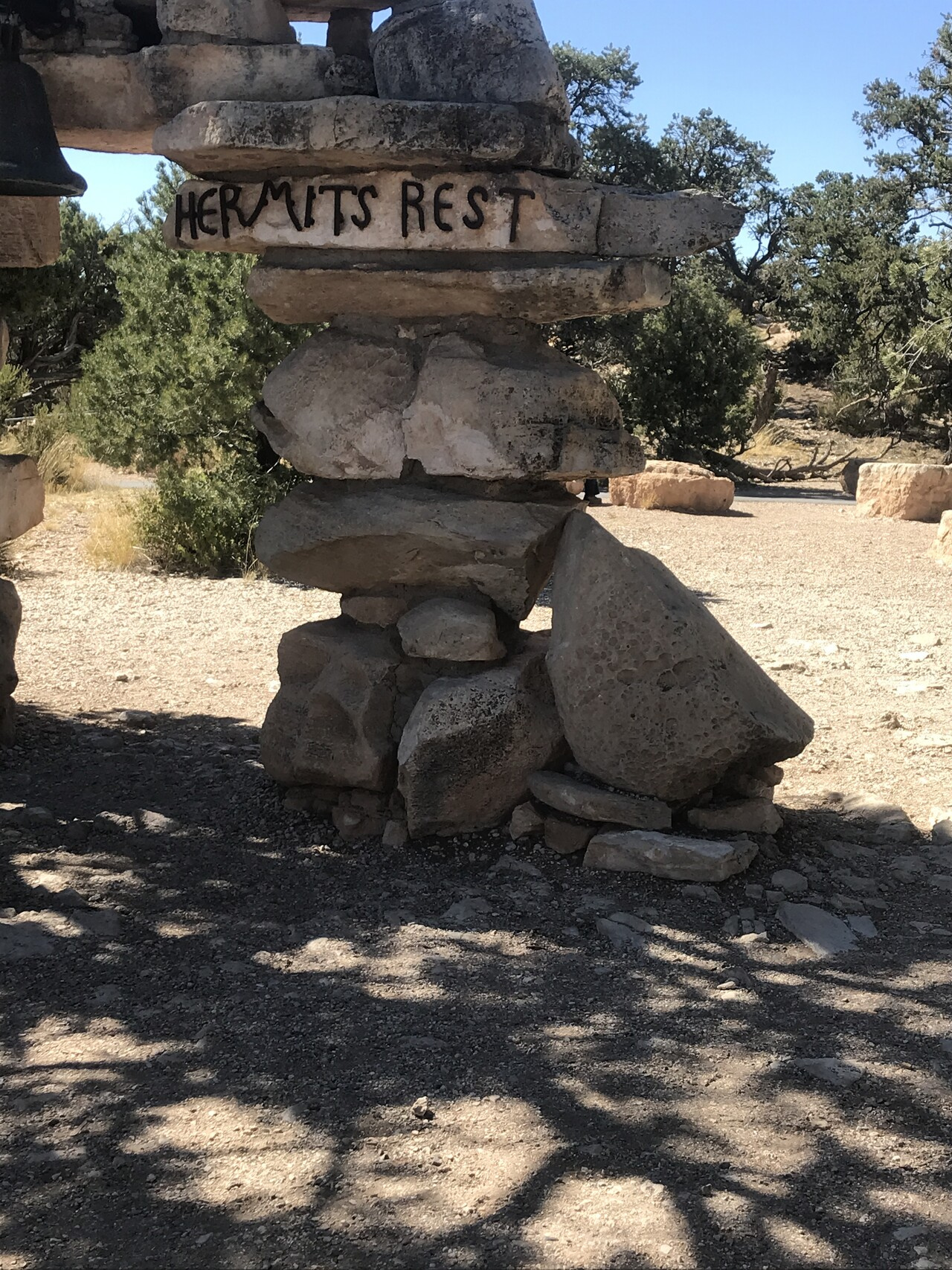
We didn’t need to be at the airport in Phoenix until the evening so we did a bit of touristing on the south rim.
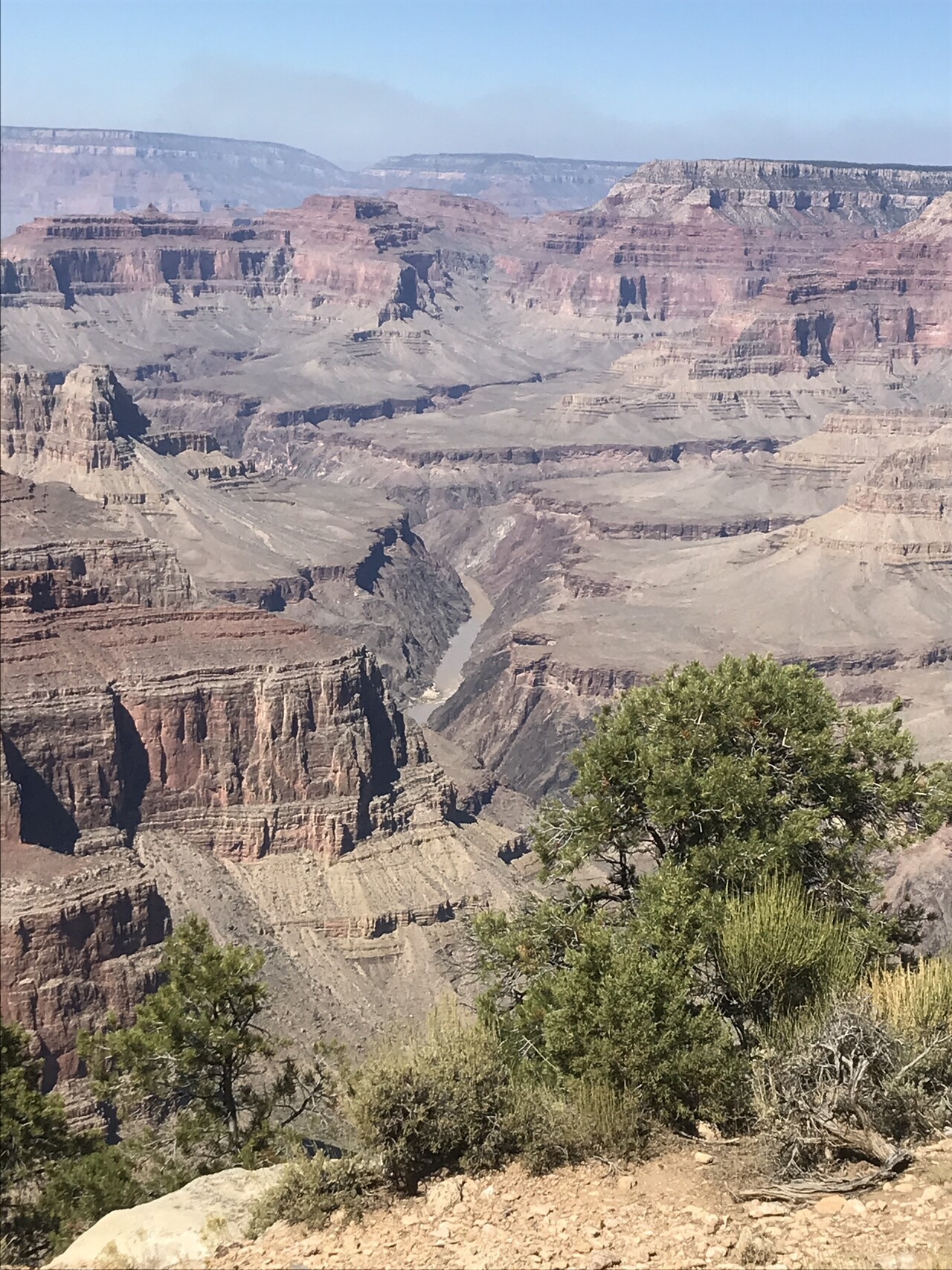
We went to a place called Hermit’s Rest
Got a view of the Colorado River
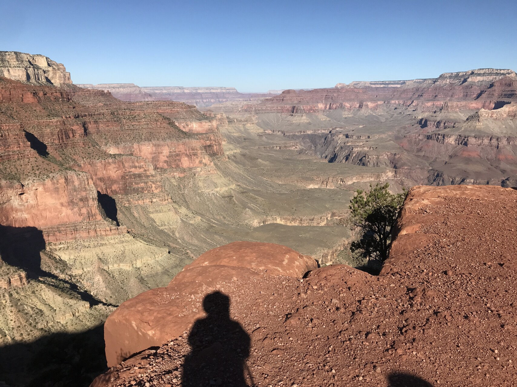
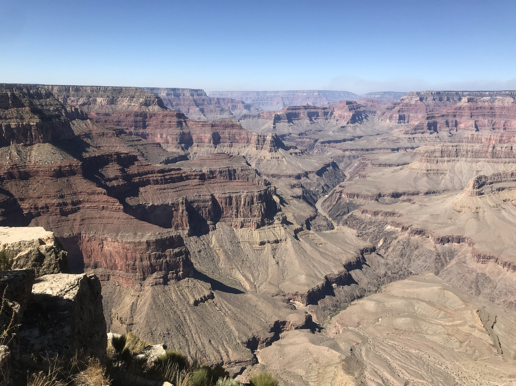
And here is my last picture of the Grand Canyon.
Hopefully not the last picture ever though. I look forward to going back.